Skip to search results
loaded 10000 results
All Products
(10,000 products)Products (10000)
Filter
- Cycling (4798)
- Bike Parts (2670)
- Bike Accessories (1122)
- Cycling Clothing (576)
- Bike Racks and Storage (172)
- Bikes (152)
- Cycling Shoes (132)
- Bike Helmets (123)
- Indoor Cycling (27)
- Camping and Hiking (4140)
- Camp Kitchen (1047)
- Hiking Backpacks (446)
- Tents (439)
- Sleeping Gear (425)
- Health and Safety (396)
- Camp Hydration (327)
- Sunglasses (309)
- Camp Electronics (289)
- Gadgets (273)
- Camp Furniture (179)
- Camp Lighting (120)
- Dog Gear (99)
- Women's Clothing (3789)
- Women's Tops (949)
- Women's Bottoms (769)
- Women's Jackets (737)
- Women's Shirts (668)
- Women's Pants (548)
- Women's Underwear (314)
- Women's Shorts (221)
- Women's Swimwear (177)
- Women's Vests (66)
- Snowsports (3419)
- Skiing (2708)
- Downhill Skiing (2442)
- Snowboarding (2071)
- Snow Clothing (2067)
- Backcountry Skiing (579)
- Cross-Country Skiing (499)
- Snow Gear (372)
- Snowshoeing (192)
- Men's Clothing (3187)
- Men's Tops (814)
- Men's Jackets (680)
- Men's Bottoms (649)
- Men's Shirts (598)
- Men's Pants (394)
- Men's Shorts (255)
- Men's Underwear (165)
- Men's Swimwear (124)
- Men's Vests (51)
- Footwear (2597)
- Shoes (1091)
- Women's Footwear (1022)
- Men's Footwear (941)
- Boots (650)
- Hiking Footwear (595)
- Socks (475)
- Sandals (199)
- Kids' Footwear (121)
- Footwear Accessories (118)
- Slippers (53)
- Fitness (2042)
- Training (1714)
- Swimming (289)
- Yoga (77)
- Triathlon (50)
- Indoor Cycling (27)
- Running (1998)
- Running Clothes (982)
- Running Shoes (502)
- Fitness Electronics (123)
- Running Packs (110)
- Recovery Essentials (108)
- Energy Food and Drinks (102)
- Running Safety (22)
- Watersports (1489)
- Paddling Clothing (210)
- Paddling Accessories (182)
- Kayaking (71)
- PFDs (47)
- Paddle Boarding (30)
- Paddling Footwear (17)
- Canoeing (10)
- Packrafts (4)
- Rafts and Tubes (3)
- Packs and Bags (1416)
- Packs (930)
- Bags (455)
- Luggage (207)
- Packing Organizers (86)
- Cases (46)
- Stuff Sacks (19)
- Climbing (801)
- Climbing Hardware (230)
- Mountaineering Gear (154)
- Climbing Shoes (128)
- Climbing Harnesses (73)
- Chalk and Chalk Bags (71)
- Climbing Essentials (54)
- Webbing and Cords (54)
- Climbing Ropes (52)
- Climbing Training (26)
- Climbing Packs (24)
- Climbing Helmets (22)
- Big Wall Gear (3)
- Travel Gear (750)
- Day Bags and Packs (333)
- Luggage (207)
- Laptop Bags (130)
- Travel Accessories (106)
- Packing Organizers (86)
- Photography (21)
- Books and Maps (712)
- Maps (407)
- Guidebooks (249)
- Adventure Books (27)
- Kids' Books (14)
- Kids' Clothing (581)
- Kids' Jackets (248)
- Kids' Pants (79)
- Kids' Shirts (50)
- Kids' Underwear (30)
- Kids' Swimwear (24)
- Kids' Shorts (15)
- Kids' Vests (6)
- Electronics (528)
- Fitness Electronics (123)
- GPS (73)
- Portable Power (73)
- Watches (60)
- Action Cameras (58)
- Music Devices (48)
- Photography (21)
- Radios (17)
- Car Racks (494)
- Car Rack Accessories (144)
- Bike Racks (97)
- Watercraft Racks (78)
- Base Roof Racks (75)
- Garage Storage (70)
- Lifestyle and Gifts (249)
- Games and Toys (65)
- Stickers (63)
- Keychains (51)
- Home and Cabin Decor (28)
- Park Passes (16)
- Picnicking (14)
- Journals and Pens (10)
- Holiday (4)
- Patches and Pins (2)
- Black Diamond (383)
- Helly Hansen (317)
- Outdoor Research (307)
- Patagonia (432)
- REI Co-op (623)
- SRAM (411)
- The North Face (609)
- 686 (37)
- 8BPLUS (15)
- adidas (38)
- Adler German Axes (6)
- Adventure Medical Kits (15)
- Adventure Ready (19)
- AeroPress (8)
- ALES GREY (1)
- Alpina (6)
- AlpineAire Foods (28)
- ALPS Mountaineering (63)
- Altra (74)
- ALWRLD (32)
- Amphipod (35)
- Andie (4)
- Apply Stickers (15)
- Aquamira (1)
- Aquatabs (2)
- Arc'teryx (248)
- Arcade Belts (16)
- Arms of Andes (12)
- ASICS (25)
- Asolo (44)
- Astral (19)
- Atlas (8)
- Atomic (63)
- Atomicchild (16)
- Backpacker's Pantry (22)
- Badger (18)
- Baffin (27)
- Baggu (2)
- Balega (7)
- BANDITS (4)
- BearVault (4)
- Bedrock Sandals (5)
- Ben's (7)
- Benchmade (55)
- Bending Branches (7)
- Bern (1)
- Beyond Yoga (65)
- BGDB (1)
- Big Agnes (109)
- BioLite (22)
- Birkenstock (61)
- Bison Designs (8)
- Bivo (4)
- black crows (18)
- Black Diamond (383)
- BlackStrap (5)
- Blizzard (15)
- BLUE ICE (19)
- Blue Orange (3)
- Blundstone (12)
- Bobo's Oat Bars (7)
- Bodyglide (5)
- Bogg Bag (3)
- Bogs (53)
- Bontrager (53)
- Boody Eco Wear (6)
- BOTE (15)
- Boulder Gear (74)
- Brooks (155)
- Buff (22)
- Burton (90)
- Butora (5)
- C.A.M.P. (51)
- Caddis (6)
- CamelBak (63)
- CAMP Eyewear (16)
- Camp Snap (1)
- Campsuds (2)
- Canari (11)
- Cannondale (64)
- Carve Designs (28)
- Casio (5)
- CEP (8)
- CGear Multimats (3)
- Chaco (23)
- Chaos (21)
- Chrome (13)
- Chubbies (15)
- Chums (26)
- Cleanwaste (5)
- Clif (5)
- Club Ride (7)
- Co-op Cycles (39)
- Coal (8)
- Coast (23)
- COCOON (8)
- Coghlan's (29)
- Coleman (49)
- Columbia (235)
- Conscious Step (5)
- Continental (74)
- COROS (9)
- Cotopaxi (108)
- Counter Assault (7)
- Crab Grab (10)
- Craft (61)
- crankbrothers (37)
- Crazy Creek (9)
- Croakies (11)
- Cross Point Gear (2)
- CTR (49)
- Cure Hydration (3)
- CURREX (11)
- Cycle Dog (2)
- Cygolite (12)
- Cypher (2)
- DAKINE (86)
- Danner (51)
- Dansko (17)
- Darn Tough (101)
- Deuter (21)
- Dimension (4)
- DMM (13)
- Dometic (17)
- Dorfman Hat Co. (2)
- DPS Skis (3)
- Dr. Bronner's (7)
- DryGuy (5)
- DUER (16)
- Dynafit (19)
- Eagle Creek (27)
- EcoFlow (8)
- Edelrid (34)
- Electra (17)
- Electric (14)
- Endura (42)
- ENO (31)
- Ergon (74)
- evolv (20)
- ExOfficio (10)
- Exped (65)
- Fair Harbor (11)
- Farm to Feet (5)
- FEND (1)
- Fenix (11)
- Fischer (28)
- Five Ten (17)
- Fix Manufacturing (5)
- Fjallraven (136)
- FLEXTAIL (8)
- FlipBelt (2)
- Flylow (47)
- Forsake (14)
- Fox (93)
- Fox River (17)
- FP Movement (50)
- Free Country (161)
- Free Fly (68)
- Freshette (1)
- FrictionLabs (6)
- FRONTIERSMAN (1)
- Full Windsor (4)
- G-Form (4)
- Garmin (82)
- Gazelle (8)
- Gear Aid (31)
- Gerber (35)
- Giro (80)
- GivePet (3)
- Glyder (28)
- Goal Zero (19)
- goodr (36)
- GoPro (39)
- Gordini (15)
- GOREWEAR (15)
- Gramicci (6)
- Grangers (7)
- Grass Sticks (1)
- Grayl (9)
- Green Guru (1)
- Greenfield (3)
- Gregory (150)
- Gripmaster (3)
- Grivel (5)
- GSI Outdoors (54)
- GU (12)
- GUPPYFRIEND (1)
- Guyot Designs (1)
- Halfdays (17)
- HART Outdoor (10)
- Helinox (23)
- Helly Hansen (317)
- HEROCLIP (4)
- Herschel Supply Co. (35)
- HEST (13)
- Hestra Gloves (27)
- HiBAR (5)
- Hiker Coffee (1)
- Hillsound (5)
- Hilly (1)
- Hilma Running (1)
- HOKA (88)
- Honey Stinger (13)
- Hot Chillys (17)
- Hults Bruk (4)
- humangear (24)
- Hurley (3)
- HydraPak (28)
- Hydro Flask (44)
- Hyggelight- The Growing Candle (6)
- Icebreaker (103)
- ICEBUG (11)
- Igloo (3)
- Ignik (27)
- Injinji (15)
- INNO (6)
- Janji (51)
- JBL (12)
- Jelly Belly (9)
- Jetboil (21)
- JOLYN (5)
- Jones (27)
- JOYRIDE (9)
- Julbo (11)
- Kahtoola (12)
- Kamik (42)
- Kammok (16)
- Kari Traa (80)
- Katadyn (14)
- KAVU (9)
- KEEN (141)
- Kelty (35)
- Kids Ride Shotgun (8)
- Klean Kanteen (11)
- Knockaround (15)
- Knog (3)
- Kombi (1)
- Komperdell (7)
- Kovea (1)
- Kuat (62)
- KUHL (83)
- Kula Cloth (1)
- La Sportiva (133)
- Lantern Press (11)
- LE BENT (9)
- Leatherman (16)
- Leki (30)
- Liberty Mountain (2)
- LifeSaver (1)
- LifeStraw (23)
- Lightning Nugget (1)
- Lodge (18)
- Look (34)
- Loucks (4)
- Lowa (22)
- LuminAID (6)
- Mammut (106)
- Manzella (4)
- Marker (15)
- Marmot (152)
- Matador (21)
- Maui Jim (47)
- Maxtrax (6)
- melin (25)
- Merrell (140)
- Metolius (61)
- Midland (6)
- Midnight Lightning (4)
- Mountain Hardwear (208)
- Mountain House (28)
- Mountain Summit Gear (10)
- mountainFLOW eco-wax (17)
- MSR (90)
- Muc-Off (23)
- Mudpuppy (1)
- Muir Energy (1)
- Mustang Survival (11)
- Nalgene (7)
- Nani Swimwear (13)
- Nathan (54)
- NEMO (99)
- New Balance (17)
- Nidecker (18)
- Nike (44)
- Nikon (17)
- Nikwax (21)
- Nite Ize (115)
- Nocs Provisions (17)
- Nomadix (14)
- norda (8)
- Nordica (22)
- Noshinku (1)
- NRS (173)
- NUUN (9)
- O'Neill (39)
- Oakley (26)
- Obermeyer (88)
- Oboz (63)
- Ocean Bottle (6)
- Oiselle (23)
- OluKai (57)
- On (117)
- OneUp Components (24)
- OOFOS (19)
- Ooni Pizza Ovens (5)
- Opinel (10)
- Opolis (4)
- Orange Seal (6)
- ORGANIC Climbing (5)
- Ortlieb (40)
- Ortovox (18)
- Osprey (228)
- Ostroy (10)
- outdoor element (9)
- Outdoor Products (3)
- Outdoor Research (307)
- Outside Inside (8)
- Owala (4)
- OXO (23)
- PackTowl (4)
- Pacsafe (19)
- PACT Outdoors (7)
- Panache Sport (4)
- Panaracer (19)
- Park Tool (100)
- Parks Project (4)
- Patagonia (432)
- Peak Design (42)
- PEAK REFUEL (27)
- PEARL iZUMi (103)
- Petzl (101)
- Picture Organic Clothing (20)
- Pistil (3)
- Planet Bike (15)
- Platypus (16)
- Pocket Guides Publishing (4)
- Polar (5)
- Pomoca (11)
- Portland Design Works (27)
- prAna (173)
- Prism Designs (5)
- Pro-Tec Athletics (24)
- PROBAR (3)
- Purist (2)
- PYNRS (10)
- Quantum Energy Squares (1)
- Rab (45)
- rabbit (48)
- Race Face (86)
- Rapha (33)
- Reef (18)
- REI Co-op (623)
- Reliance (10)
- Reserve Wheels (3)
- REVEL GEAR (1)
- Rex Specs (3)
- Rhino Skin Solutions (6)
- RHONE (31)
- Roark (55)
- Rossignol (86)
- RotopaX (4)
- Rottefella (11)
- Roxy (22)
- Royal Robbins (65)
- Ruffwear (45)
- Rumpl (9)
- Salewa (17)
- Salomon (224)
- Salsa (69)
- SaltStick (4)
- SAOLA (15)
- Saucony (42)
- Sawyer (13)
- Saxx (16)
- Scala (6)
- Scarpa (49)
- Scepter (4)
- Schwalbe (81)
- Sea to Summit (159)
- Sealskinz (32)
- Seirus (28)
- Selle Royal (14)
- Sherpa Adventure Gear (22)
- Sherpani (21)
- Shimano (300)
- Shoe Goo (1)
- Shokz (9)
- Showers Pass (6)
- SHREDLY (9)
- Silca (16)
- SILKY (10)
- Ski Bones (1)
- Skratch Labs (7)
- SKS (8)
- Skullcandy (15)
- Slime (8)
- Smartwool (266)
- Smith (173)
- Snow Peak (62)
- Sockwell (33)
- SOL (20)
- SOLE (3)
- SOLELY (5)
- Solo Stove (2)
- Sorel (31)
- Soto (8)
- Speedy Stitcher (3)
- Sperry Top-Sider (1)
- Sprayway (7)
- Spring Energy (3)
- Spurcycle (7)
- Spy (3)
- Squirrels Nut Butter (6)
- SRAM (411)
- Stance (85)
- Stanley (23)
- STATIC (6)
- Sterling (18)
- Stickers Northwest (16)
- Stio (83)
- STRIDER (1)
- Suncloud (23)
- Sunday Afternoons (26)
- Sunski (20)
- Superfeet (10)
- Suunto (21)
- Sweaty Betty (8)
- Sweet Turns (5)
- Swift Industries (8)
- Swiss Army (11)
- Swix (87)
- Tailwind Nutrition (8)
- tasc Performance (14)
- Ten Thousand (5)
- Teravail (61)
- Terramar (10)
- Terry (55)
- Teva (58)
- The Landmark Project (21)
- The North Face (609)
- the TICK PATROL (1)
- The Woobles (3)
- Therm-a-Rest (20)
- Therm-ic (6)
- TheTentLab (2)
- Thinksport (2)
- Thousand (9)
- Thread Wallets (7)
- Threads 4 Thought (45)
- Thule (200)
- TIEM (4)
- Tifosi (23)
- Tilley (4)
- Timberland (23)
- Tiny Tents (1)
- Toad&Co (51)
- TOAKS (29)
- Tony's Chocolonely (4)
- Topeak (64)
- Topo Athletic (41)
- Topo Designs (34)
- ToughCutie (1)
- Trango (16)
- Trek (29)
- Tubbs (20)
- Turtle Fur (27)
- TYR (30)
- UCO (18)
- Under Armour (10)
- Urban Native Era (2)
- Ursack (5)
- Vans (31)
- Varlo (12)
- Vasque (7)
- Veer (46)
- VEJA (15)
- Verve (1)
- VISSLA (37)
- Vittoria (22)
- Vivobarefoot (35)
- Voile (6)
- Vuori (164)
- Wahoo Fitness (21)
- Whistles for LIFE (1)
- WhitePaws RunMitts (2)
- Wide Open (9)
- Wild Country (20)
- Wild One (5)
- Wild Rye (34)
- Wild Zora (3)
- Wildway (1)
- Wolfgang (5)
- Woolrich (9)
- woom (22)
- WRIGHTSOCK (7)
- Xero Shoes (69)
- XTRATUF (29)
- Yakima (211)
- Yaktrax (8)
- Yellowbird (2)
- YETI (106)
- Zamberlan (24)
- Zempire (51)
- Zensah (3)
- Zippo (15)
- Zoic (32)
- ZOLEO (2)
- 0 to 0.49 (3789)
- 0.5 to 0.99 (2601)
- 1 to 1.49 (1950)
- 1.50 to 2.99 (2153)
- 3 to 4.99 (831)
- 5 to 7.99 (486)
- 8 to 11.99 (299)
- 12 to 19.99 (166)
- 20 to 29.99 (136)
- 30 to 49.99 (120)
- 50 to 74.99 (56)
- 75 to 99.99 (12)
- 100 to 1000 (8)
- Solid (3145)
- Colorblock (507)
- Novelty (213)
- Graphic (98)
- Print (92)
- Striped (88)
- Plaid (67)
- Floral (63)
- Camouflage (63)
- Tie Dye (5)
- Men's (4124)
- Women's (5033)
- Unisex (3251)
- Boys' (737)
- Girls' (743)
- Kids' (671)
- Toddler Boys' (120)
- Toddler Girls' (119)
- Toddlers' (119)
- Infant Boys' (38)
- Infant Girls' (38)
- Infants' (37)
- Deals (5159)
- Casual (2902)
- Hiking (2682)
- Multisport (2240)
- Cycling (1890)
- Mountain Biking (1713)
- Snowsports (1711)
- Camping (1478)
- Running (1338)
- Backpacking (1229)
- Fitness (1197)
- Travel (1083)
- Downhill Skiing (1043)
- Snowboarding (743)
- Road Cycling (661)
- Climbing (550)
- Trail Running (502)
- Backcountry Skiing (384)
- Watersports (350)
- Gravel Cycling (325)
- Rock Climbing (240)
- Paddling (229)
- Mountaineering (225)
- Cross-country Skiing (216)
- Swimming (153)
- Recreational Cycling (142)
- Walking (129)
- Bikepacking (121)
- Emergency Preparedness (92)
- Bike Commuting (84)
- Yoga (77)
- Kayaking (77)
- Fishing (76)
- Snowshoeing (72)
- Splitboarding (62)
- Fitness Recovery (60)
- Bike Touring (51)
- Paddle Boarding (49)
- Ice Climbing (49)
- Wildlife Viewing (43)
- Urban Cycling (43)
- Supply & Repair (42)
- Photography (34)
- Birding (32)
- Indoor Cycling (31)
- Canoeing (27)
- Cyclocross (20)
- Working (19)
- Navigating (18)
- Bouldering (17)
- Rafting (15)
- Flatwater Kayaking (12)
- BMX (10)
- Surfing (6)
- Caving (6)
- Triathlon (6)
- Scuba Diving (4)
- Whitewater Kayaking (2)
- Horseback Riding (2)
- Slacklining (1)
- Stewardship (1)
- XXS (250)
- XS (2931)
- Small (5463)
- Medium (5388)
- Large (5264)
- XL (4900)
- 00 (6)
- 0 (52)
- 1 (80)
- 1.5 (10)
- 2 (217)
- 2.5 (8)
- 3 (100)
- 3.5 (15)
- 4 (275)
- 4.5 (27)
- 5 (408)
- 5.5 (230)
- 6 (1174)
- 6.5 (808)
- 7 (1288)
- 7.125 (2)
- 7.25 (2)
- 7.375 (2)
- 7.5 (1028)
- 7.625 (2)
- 7.75 (2)
- 7.875 (2)
- 8 (1958)
- 8.5 (1465)
- 9 (1832)
- 9.5 (1370)
- 10 (1935)
- 10.5 (1029)
- 11 (1554)
- 11.5 (704)
- 12 (1196)
- 12.5 (345)
- 13 (735)
- 13.5 (28)
- 14 (529)
- 14.5 (18)
- 15 (144)
- 15.5 (11)
- 16 (139)
- 17 (1)
- 18 (16)
- 20 (4)
- 22 (6)
- 24 (6)
- 32 (3)
- 36 (3)
- 38 (2)
- 40 (2)
- 186003 (1)
- 186007 (1)
- 186008 (1)
- 186009 (1)
- 186010 (1)
- 186013 (1)
- 186014 (1)
- 186015 (1)
- 186016 (1)
- 186017 (1)
- 186019 (1)
- 186020 (1)
- 186025 (1)
- 186026 (1)
- 186028 (1)
- 186029 (1)
- 186031 (1)
- 186032 (1)
- 186039 (1)
- 186044 (1)
- 186045 (1)
- 186046 (1)
- 186047 (1)
- 186049 (1)
- 186050 (1)
- 186056 (1)
- 186059 (1)
- 186066 (1)
- 186070 (1)
- 186074 (1)
- 186075 (1)
- 186076 (1)
- 186077 (1)
- 186082 (1)
- 186084 (1)
- 186086 (1)
- 186089 (1)
- 186091 (1)
- 186093 (1)
- 186095 (1)
- 186101 (1)
- 186112 (1)
- 186113 (1)
- 186115 (1)
- 186116 (1)
- 186117 (1)
- 186120 (1)
- 186122 (1)
- 186124 (1)
- 186125 (1)
- 186126 (1)
- 186130 (1)
- 186133 (1)
- 186137 (1)
- 186140 (1)
- 186141 (1)
- 186142 (1)
- 186144 (1)
- 186146 (1)
- 186147 (1)
- 186151 (1)
- 186152 (1)
- 186153 (1)
- 186154 (1)
- 186157 (1)
- 186158 (1)
- 186159 (1)
- 186160 (1)
- 186167 (1)
- 186171 (1)
- 186174 (1)
- 186175 (1)
- 186178 (1)
- 186184 (1)
- 187002 (1)
- 187003 (1)
- 187004 (1)
- 187005 (1)
- 187006 (1)
- 187013 (1)
- 187019 (1)
- 187026 (1)
- 187029 (1)
- 187032 (1)
- 187041 (1)
- 187047 (1)
- 187048 (1)
- 187055 (1)
- 187100 (1)
- 187109 (1)
- 187121 (1)
- 187122 (1)
- 187129 (1)
- 187133 (1)
- 187138 (1)
- 187139 (1)
- 187140 (1)
- 187141 (1)
- 187150 (1)
- 187152 (1)
- 187159 (1)
- 187164 (1)
- 187166 (1)
- 187175 (1)
- 187176 (1)
- 187179 (1)
- 187191 (1)
- 1 Person (6)
- 1.5 IN (1)
- 1.75 IN (2)
- 10 X-Wide (3)
- 10.5 X-Wide (2)
- 100 CM (5)
- 105 CM (7)
- 11 X-Wide (3)
- 110 CM (22)
- 115 CM (25)
- 12 Inch Wheel (4)
- 12 Months (29)
- 12 X-Wide (3)
- 120 CM (25)
- 125 CM (23)
- 13-15 IN (1)
- 130 CM (29)
- 135 CM (18)
- 140 CM (18)
- 145 CM (17)
- 15-17.5 IN (1)
- 150 CM (18)
- 155 CM (19)
- 16 Inch Wheel (4)
- 160 CM (14)
- 165 CM (11)
- 170 CM (7)
- 175 CM (3)
- 18 Months (21)
- 18.5 Mondo (4)
- 18W (45)
- 19.5 Mondo (4)
- 1X (186)
- 2 IN (2)
- 2 Person (3)
- 2.25 IN (2)
- 2.5 IN (2)
- 2.75 IN (2)
- 20 Inch Wheel (9)
- 20.5 Mondo (4)
- 205 MM (1)
- 20W (28)
- 21.5 Mondo (4)
- 22.5 Mondo (28)
- 225 MM (1)
- 22W (19)
- 23.5 Mondo (72)
- 24 Inch Wheel (7)
- 24.5 Mondo (83)
- 24W (11)
- 25.5 Mondo (106)
- 26.5 Mondo (123)
- 26W (16)
- 27.5 Mondo (76)
- 28 Waist (70)
- 28.5 Mondo (72)
- 29 Waist (22)
- 29.5 Mondo (47)
- 2T (90)
- 2X (209)
- 2X/3X (1)
- 2XL (2502)
- 3 IN (2)
- 3 Months (21)
- 30 Waist (148)
- 30.5 Mondo (6)
- 31 Waist (35)
- 32 B (2)
- 32 C (4)
- 32 D (6)
- 32 DD (6)
- 32 DD/E (1)
- 32 E (4)
- 32 F (5)
- 32 FF (3)
- 32 G (3)
- 32 GG (2)
- 32 H (2)
- 32 Waist (143)
- 33 Waist (35)
- 34 B (2)
- 34 C (4)
- 34 D (4)
- 34 DD (5)
- 34 DD/E (1)
- 34 E (4)
- 34 F (4)
- 34 FF (3)
- 34 G (1)
- 34 GG (2)
- 34 H (2)
- 34 Waist (137)
- 35 Waist (15)
- 36 B (2)
- 36 C (5)
- 36 D (5)
- 36 DD (7)
- 36 DD/E (1)
- 36 E (4)
- 36 F (5)
- 36 FF (3)
- 36 G (2)
- 36 GG (3)
- 36 H (2)
- 36 Waist (136)
- 38 A/B (1)
- 38 B (2)
- 38 C (4)
- 38 D (7)
- 38 DD (8)
- 38 DD/E (1)
- 38 E (6)
- 38 F (6)
- 38 FF (3)
- 38 G (3)
- 38 GG (2)
- 38 H (3)
- 38 Waist (131)
- 3T (79)
- 3X (182)
- 3XL (286)
- 40 A/B (1)
- 40 B (2)
- 40 C (4)
- 40 C/D (1)
- 40 D (5)
- 40 DD (5)
- 40 DD/E (1)
- 40 E (5)
- 40 F (6)
- 40 FF (4)
- 40 G (3)
- 40 Waist (97)
- 42 Waist (51)
- 42-44 EU (2)
- 44 Waist (12)
- 46 Waist (4)
- 48 Waist (4)
- 49-53cm (10)
- 4T (74)
- 4X (28)
- 4XL (19)
- 5 X-Wide (2)
- 5.5 - 7 FT (1)
- 5.5 X-Wide (2)
- 50 ML (1)
- 50 Waist (4)
- 52 CM (2)
- 54-57cm (15)
- 58-60cm (14)
- 59 CM (1)
- 5T (40)
- 5XL (11)
- 6 Months (24)
- 6 T (6)
- 6 X-Wide (2)
- 6.5 X-Wide (2)
- 60 CM (9)
- 65 CM (5)
- 66 CM (1)
- 7 T (10)
- 7 UK (1)
- 7 X-Wide (2)
- 7.3 - 11 FT (1)
- 7.5 X-Wide (3)
- 70 CM (6)
- 75 CM (4)
- 8 T (7)
- 8 X-Wide (3)
- 8.5 X-Wide (3)
- 85 CM (4)
- 9 T (6)
- 9 X-Wide (3)
- 9.5 X-Wide (3)
- 90 CM (6)
- 95 CM (5)
- Adjustable (22)
- BC102 (1)
- BC105 (1)
- BC109 (1)
- BC110 (1)
- BC111 (1)
- BC112 (1)
- BC116 (1)
- BC117 (1)
- BC118 (1)
- BC119 (1)
- BC120 (1)
- BC121 (1)
- BC122 (1)
- BC123 (1)
- BC124 (1)
- BC125 (1)
- BC126 (1)
- BC127 (1)
- BC128 (1)
- BC129 (1)
- BC130 (1)
- BC131 (1)
- BC132 (1)
- BC133 (1)
- BC134 (1)
- BC135 (1)
- BC136 (1)
- BC137 (1)
- BC138 (1)
- BC139 (1)
- BC142 (1)
- BC143 (1)
- BC144 (1)
- BC145 (1)
- BC146 (1)
- BC148 (1)
- BC150 (1)
- BC151 (1)
- BC152 (1)
- BC153 (1)
- BC154 (1)
- BC156 (1)
- BC159 (1)
- BC160 (1)
- BC161 (1)
- BC162 (1)
- BC163 (1)
- BC165 (1)
- BC166 (1)
- BC167 (1)
- BC168 (1)
- BC169 (1)
- BC170 (1)
- BC171 (1)
- BC173 (1)
- BC174 (1)
- BC175 (1)
- BC176 (1)
- BC177 (1)
- BC178 (1)
- BC179 (1)
- BC180 (1)
- BC181 (1)
- BC182 (1)
- BC183 (1)
- BC184 (1)
- BC185 (1)
- BC186 (1)
- BC187 (1)
- BC188 (1)
- BC189 (1)
- BC190 (1)
- BC191 (1)
- BC193 (1)
- BC194 (1)
- BC195 (1)
- BC196 (1)
- BC197 (1)
- BC198 (1)
- BC200 (1)
- BC203 (1)
- BC204 (1)
- BC205 (1)
- BC206 (1)
- CLASSIC (4)
- Double (7)
- Double Wide (1)
- Kids (7)
- L Round Contour (5)
- Large Mummy (9)
- Long (142)
- Long Wide (20)
- Long Wide-Plus Duo (1)
- Long X-Wide (6)
- M - XL (2)
- M Round Contour (4)
- Medium Double (1)
- Medium Duo (2)
- Medium Wide (11)
- Narrow (3)
- One Size (418)
- Petite (2)
- Queen (3)
- Regular (160)
- Regular Double (1)
- Regular Mummy (9)
- Regular Wide (25)
- Regular Wide Mummy (1)
- S Round Contour (5)
- SC10 (1)
- SC13 (1)
- SC15 (1)
- SC16 (1)
- SC17 (1)
- SC19 (1)
- SC20 (1)
- SC21 (1)
- SC22 (1)
- SC23 (1)
- SC25 (1)
- SC27 (1)
- SC28 (1)
- SC29 (1)
- SC30 (1)
- SC31 (1)
- SC32 (1)
- SC33 (1)
- SC34 (1)
- SC35 (1)
- SC36 (1)
- SC37 (1)
- SC38 (1)
- SC39 (1)
- SC40 (1)
- SC41 (1)
- SC42 (1)
- SC43 (1)
- SC44 (1)
- SC45 (1)
- SC46 (1)
- SC47 (1)
- SC48 (1)
- SC5 (1)
- SC50 (1)
- SC51 (1)
- SC52 (1)
- SC55 (1)
- SC6 (1)
- SC66 (1)
- SC7 (1)
- SC8 (1)
- SC81 (1)
- SC82 (1)
- SC83 (1)
- SC9 (1)
- Short (35)
- Short Mummy (1)
- Single (4)
- Standard (1)
- Wide (39)
- XXL Slim (3)
- XXL/XXXL (1)
- $0.00 to $9.99 (800)
- $10.00 to $19.99 (1786)
- $20.00 to $49.99 (4694)
- $50.00 to $99.99 (5318)
- $100.00 to $199.99 (5298)
- $200.00 to $499.99 (3325)
- $500.00 to $749.99 (648)
- $750.00 to $999.99 (342)
- $1000.00 to $1999.99 (213)
- $2000.00 to $5000.00 (60)
- $5000 and above (14)
- Bluetooth (215)
- Boa (177)
- GORE-TEX (514)
- PrimaLoft (307)
- RECCO (228)
- Vibram (488)
- Vibram Megagrip (222)
- Android (5)
- ANT (69)
- Anti-Gravity (4)
- Blendr (14)
- bluesign (2)
- Bluetooth (215)
- Boa (177)
- Camalot (1)
- ChromaPop (87)
- COOLMAX (41)
- Dri-FIT (15)
- DriClime (5)
- Dry.Q Active (1)
- Dry.Q Core (7)
- DryVent (109)
- Dyneema (42)
- Dyneema Composite Fabric (5)
- eVent (6)
- FlashDry (97)
- FUTURELIGHT (13)
- GoPro (15)
- GORE WINDSTOPPER (19)
- GORE-TEX (514)
- GORE-TEX INFINIUM (1)
- GORE-TEX Pro (11)
- GORE-TEX SURROUND (4)
- Heatseeker (80)
- HubCheck (3)
- HydroWall (30)
- Indestructawool (47)
- Insect Shield (15)
- Intuition Liners (20)
- iPad (1)
- iPhone (19)
- Jungle Juice (1)
- Kevlar (31)
- KinetiCore (8)
- LanzaTech (7)
- MFI (8)
- Mips (133)
- mtnGLO (3)
- Mylar (2)
- Omni-Freeze (6)
- Omni-Grip (20)
- Omni-Heat (58)
- Omni-Shade (40)
- Omni-Shield (41)
- Omni-Tech (76)
- Omni-Wick (35)
- OutDry (4)
- OutDry Extreme (4)
- Pertex (121)
- Polartec (114)
- Polartec Alpha (7)
- Polartec Power Dry (9)
- Polartec Power Grid (23)
- Polartec Power Stretch (14)
- Polartec Power Wool (3)
- Polartec Thermal Pro (1)
- Polartec Wind Pro (6)
- PreCip (3)
- PrimaLoft (307)
- Prizm (12)
- RECCO (228)
- Schoeller (7)
- Spectra (15)
- Step On (22)
- Teflon (4)
- ThermoBall (39)
- Thermogreen (20)
- Thermolite (16)
- Thinsulate (67)
- Titanium (16)
- Traxion (3)
- VELCRO (15)
- Vibram (488)
- Vibram Arctic Grip (14)
- Vibram Megagrip (222)
- WaveCel (6)
- WindWall (56)
- Top Rated (4634)
- Made in USA (2719)
- Moisture Wicking (2541)
- Waterproof (2498)
- Quick Drying (2172)
- Insulated (1852)
- Sun-Protective Fabric (1199)
- Merino Wool (817)
- Vegan (638)
- New Arrivals (528)
- Thumbholes (502)
- BPA Free (439)
- Packable (437)
- Reservoir Compatible (433)
- Tubeless (342)
- Powder Skirt (338)
- 2-Way Zipper (306)
- Hipbelt Pockets (291)
- Carry-On (272)
- Can Be Resoled (272)
- Gluten Free (234)
- Ultralight (233)
- RECCO Reflector (221)
- Laptop Compartment (221)
- Adjustable Torso Length (218)
- Polarized (208)
- Touch-Screen Compatible (198)
- Vegetarian (189)
- Tubeless Compatible (180)
- Reflective (164)
- Water-Resistant Down (161)
- Side Cargo Pockets (160)
- Interchangeable Lenses (157)
- Designed for E-Bikes (152)
- Non-GMO (151)
- Bibs (148)
- Rotational Impact Protection (146)
- Bite Valve Shut-off Switch (127)
- Glove Leash (120)
- 1x Drivetrain (119)
- Suspended Mesh Back Panel (117)
- SPD Compatible (112)
- Backpack Straps (107)
- Fits In Cup Holder (103)
- Raincover Included (103)
- Locking Blade (96)
- Sleeping Bag Compartment (96)
- Cant Adjustment (95)
- Cuff Adjustment (92)
- iPad / Tablet Compartment (88)
- Traction Tread (84)
- Crankbrothers Compatible (83)
- Collapsible (82)
- Compression (82)
- Cutout Seat (82)
- Repair Kit Included (81)
- Eyewear Compatible (81)
- Look Mountain Compatible (78)
- One-Handed Opening (77)
- Puffy (74)
- Wheeled (71)
- Compass (68)
- Belay Loop (67)
- Time Mountain Compatible (65)
- Smart Device Notifications (63)
- HRM Included/Integrated (63)
- Flex Adjustment (63)
- Wireless Sync (61)
- Wireless (58)
- Padded Waist (58)
- Padded Leg Loops (58)
- Tracks Steps (57)
- Swimming Functions (57)
- Sleep Tracking (56)
- Goggles Wipe (56)
- Biodegradable (56)
- Heel Lift (55)
- Tracks Distance (54)
- Tracks Calories Burned (54)
- Cycling Functions (53)
- Tracks Speed (52)
- Droppable Leg Loops (50)
- 3-in-1 Jacket (49)
- Pulse Oximeter (48)
- VO2 Max Estimate (47)
- Dropper Post (47)
- Field Cleanable (46)
- Adjustable Leg Loops (44)
- Programmable Routes (43)
- Wide (43)
- Regulated Output (42)
- Removable Liner (41)
- Toe Crampon (41)
- Adjustable Straps (41)
- Warmer Pockets (40)
- Integrated Lock (40)
- Organic (39)
- Integrated Gauge (36)
- RFID Blocking (34)
- Photochromic (34)
- Red Light Mode (33)
- Look Road Compatible (33)
- Armrests (32)
- Compression Straps (32)
- Side Traction (31)
- SPD-SL Compatible (31)
- Auto Ignition (30)
- Inflatable (29)
- Volume Control (29)
- Removable Cups (29)
- Cup Holder (28)
- Wearable (27)
- Speedplay Compatible (27)
- Solar Compatible (27)
- Weather Resistant (26)
- Fogproof (26)
- Footprint Included (25)
- Foldable (23)
- Heel Crampon (23)
- Solar-Powered (22)
- Wide-Mouth Opening (22)
- Time Road Compatible (22)
- Award Winner (21)
- Battery Removable (21)
- Adjustable Handle (20)
- Removable Daypack (19)
- Cadence (19)
- Battery Included (19)
- Quick Disconnect Tubing (18)
- Reclining (17)
- Safety Release (17)
- Back Closure (17)
- Multiple Burials (17)
- Suitable for Belaying (16)
- Padded (16)
- Insect Repellent (16)
- Earflaps (16)
- Fenders Included (16)
- Step-Through (16)
- Parking Brake (16)
- Marking Function (16)
- Studded (16)
- Convertible (15)
- Suitable for Rappelling (14)
- Extension Compatible (14)
- Integrated System (13)
- Rack(s) Included (13)
- Avalanche Airbag (13)
- Color Screen (12)
- Hanging (12)
- Tensioned Deck Stay (12)
- Checkpoint-Friendly (11)
- RV Compatible (11)
- Image Stabilization (11)
- High Definition (11)
- Lap Timer (9)
- GPS Tracking (9)
- Exercise Log (9)
- Wireless Communication (8)
- Still Mode (8)
- Speed Comparator (8)
- Hands Free (8)
- Transparent (8)
- Remote Control (8)
- Weather Forecast (7)
- Paddle Included (7)
- Declination Scale (7)
- Running Brake (7)
- Expandable Memory (6)
- Software Controlled (6)
- Touch Screen (6)
- User Replaceable Battery (6)
- Declination Adjustment (6)
- Optional Conversion (6)
- Deck Pocket(s) (6)
- Removable Sleeves (5)
- Preloaded Geocaches (4)
- Sighting Mirror (4)
- Internally Geared (4)
- Temperature (4)
- Nose Guard (4)
- Clinometer (3)
- Fishing Features (3)
- Ascent/Descent Rate (3)
- Underwire (2)
- Elevation Gain/Loss (2)
- Altimeter/Barometer Lock (2)
- Interchangeable Soles (2)
- Belt Drive (2)
- Traffic (2)
- Lifetime Traffic (2)
- Lane Assist (2)
- Custom Points of Interest (2)
- Tandem (2)
- Rocking (1)
- Camera (1)
- Camera Mount (1)
- Electric (1)
- Tires Included (1)
- Emergency Siren (1)
- Shock Absorbing (1)
- Buckle (32)
- Bungee Lace (78)
- Cable Lace (1)
- Dial Lace (69)
- Lace-up (1380)
- Single-pull Lace (75)
- Slip-on (361)
- Strap (189)
- Zipper (23)
- Wool (74)
- Wool / Wool Blend (849)
- Acrylic / Acrylic Blend (59)
- Cotton / Cotton Blend (581)
- Hemp / Linen / Blend (23)
- Leather (34)
- Neoprene / Neoprene Blend (29)
- Nylon / Nylon Blend (1854)
- Paper / Straw / Blend (19)
- Polyester / Polyester Blend (3579)
- Polypropylene / Polypropylene Blend (8)
- Rayon / Rayon Blend (106)
- Silk / Silk Blend (1)
- Synthetic Blend (26)
- 105 (12)
- 650 Down (9)
- Abisko (15)
- Actik (1)
- Activator (7)
- Active Pursuits (30)
- ActiveIce (6)
- Adamas (1)
- Adapt Run (2)
- Adrenaline (7)
- Adventure Meals (21)
- Aeffect (9)
- Aeros (1)
- Aether (5)
- AFO (3)
- Ahnya (2)
- Aion (7)
- Aircontact (4)
- Airflo (2)
- Alivio (4)
- Allpa (16)
- AlpenGlow (3)
- Alpenglow (4)
- Alpha (3)
- Alpha Breeze (2)
- Alpine (23)
- Anacapa (6)
- Apex (8)
- Aphrodite (5)
- Arahi (4)
- Arcane (11)
- Ariel (5)
- Arizona (13)
- Astoria West (1)
- Astro (2)
- Atlas (9)
- Atmos (4)
- Atom (14)
- Aura (4)
- Baggies (5)
- Baltoro (10)
- Base Camp (32)
- Beargrease (2)
- BeFree (7)
- Best Easy Day Hikes (14)
- Beta (12)
- Beta AR (2)
- Better Sweater (12)
- Big Haul (7)
- Bishop Pass (10)
- Black Hole (16)
- Blackthorn (4)
- Bloks (2)
- Bondi (4)
- Bonfire (1)
- Borealis (6)
- Boreas (3)
- Boston (11)
- Bridger (9)
- Brion (3)
- Bugaboo (15)
- Bugout (11)
- BugsAway (6)
- Bull Run (6)
- Burr (3)
- Bushido (5)
- Caldera (2)
- Camalot (4)
- Camp Dreamer (2)
- Campwell (36)
- Capa (3)
- Capilene (33)
- Cascade (4)
- Cascadia (5)
- Catalyst (1)
- Catamount (3)
- Cerium (7)
- Chair Zero (4)
- Challenger (4)
- Chase (5)
- Chaser (12)
- Chester (4)
- Class V (5)
- Classic All Season (8)
- Classic Thermal Merino (21)
- Clementine (1)
- Clifton (7)
- Cloud (10)
- Cloudflyer (2)
- Cloudhorizon (4)
- Cloudrock (8)
- Cloudsurfer (13)
- Cloudswift (4)
- Coefficient (2)
- Colster (1)
- Comfort (6)
- CoolNet (6)
- Copper Spur (24)
- Core (19)
- Cormac (8)
- Cosmic (1)
- Cosmo (2)
- Cottonwood (5)
- Crater Lake (9)
- Crooked River (3)
- Cross Trail (1)
- Cruiser (14)
- Crux (5)
- CTY (9)
- Cutthroat (3)
- Dagger (4)
- Dare (1)
- Daredevil (1)
- Daylite (17)
- Daytrip (3)
- DeepSleep (6)
- Del Dia (17)
- Delta (9)
- Denali (10)
- Deore (20)
- Deore XT (18)
- Deva (8)
- Di2 (33)
- Dirt (13)
- Disco (4)
- Discovery (5)
- Distance (21)
- Do Good (2)
- DoubleNest (3)
- Down Sweater (17)
- Downdrift (4)
- Dragonfly (9)
- DRT (4)
- Dura-Ace (7)
- Durand (2)
- Dynama (7)
- Eagle (89)
- ECO (7)
- Eddy (1)
- Edge (6)
- Eja (3)
- Elixir (4)
- Ember (5)
- Escalante (4)
- Ether (4)
- Everyday (21)
- Evo (15)
- EXO (14)
- Exos (3)
- Experience (6)
- EZ (12)
- Fairview (7)
- Farpoint (7)
- Fenix (5)
- Ferrosi (16)
- Fillo (3)
- First Chair (4)
- First Light (2)
- Fitz Roy (2)
- Fjord (6)
- Flak (1)
- Flash (35)
- Flex (6)
- Flexlite (6)
- Flight Deck (4)
- Fly Creek (9)
- Force (43)
- Forerunner (4)
- Forte (2)
- Free Hiker (4)
- Freedom (18)
- Freeflex (3)
- Freerider (7)
- Front Range (3)
- Fuego (11)
- Fusion (2)
- Gamma (20)
- Gaviota (2)
- Gear Tie (12)
- GEL-Cumulus (2)
- GEL-Nimbus (4)
- Genesis (2)
- Ghost (20)
- GigaPower (2)
- Glycerin (8)
- GO (3)
- Go Series (9)
- GoBites (5)
- Gossamer (4)
- GravelKing (13)
- GravityWorks (3)
- Griptilian (1)
- Grom (2)
- Groundwork (1)
- GRX (40)
- GX Eagle (20)
- H2.0 (2)
- Habit (8)
- Half Dome (8)
- Halle (3)
- Halo (12)
- Halulite (8)
- Headlamp (2)
- HeatGear (3)
- Hedgehog (6)
- Helium (12)
- Hero (6)
- Hex 2.0 (3)
- High Coast (8)
- Hiker (16)
- Hopara (2)
- Hopper (7)
- Hornet (8)
- Horsethief (2)
- HotForge (12)
- Houdini (5)
- Hubba (4)
- Hurricane (4)
- Hydraulics (10)
- Hydro Moc (1)
- Hydropeak (5)
- HydroSkin (12)
- Hyperfreak (8)
- I/O (16)
- IceFlow (6)
- Incendo (4)
- inReach (7)
- Instinct (2)
- Interceptr (3)
- Intraknit (34)
- IsoPro (2)
- Jackal (2)
- Jade (5)
- Jag (2)
- Jester (4)
- Journeyer (4)
- Junction (9)
- Jungle (7)
- Kaha (8)
- Kalmia (4)
- Kanken (12)
- Katmai (2)
- Kestrel (3)
- KICKR (8)
- Kid Comfort (2)
- Kinetic (2)
- Klash (2)
- Kyanite (8)
- Kyte (3)
- Launch (4)
- Lighthouse (1)
- Lightning (6)
- Limelight (3)
- Link (2)
- Loft (1)
- Lone Peak (15)
- Los Gatos (1)
- Lowdown (4)
- Lowlands (1)
- Luci (6)
- M Series (3)
- Macai (1)
- Mach (6)
- Maddsen (5)
- Mafate (6)
- MAG (34)
- Magma (7)
- Maipo (9)
- Mantis (4)
- Maven (6)
- Maya (3)
- Mayari (1)
- MegaMat (7)
- Merino 185 (14)
- Merino Sport (7)
- Meta (4)
- Micro D (7)
- Miko (2)
- Mini (1)
- MiniMo (1)
- Miura (4)
- Moab (50)
- Mogami (5)
- Moji (2)
- Momentum (12)
- Monarch (5)
- Moonlite (2)
- Moterra (4)
- Motion (3)
- Mountain (3)
- Mountain Series (5)
- Nano (7)
- Nano Puff (11)
- Nano-Air (5)
- NeoAir NXT (4)
- Nepal (4)
- Newport (7)
- Norvan (18)
- Nucleo (2)
- Nuptse (19)
- NV (5)
- NX Eagle (7)
- Opt Outside (7)
- Ora (3)
- Orbiter (2)
- Original (4)
- Original Chair (2)
- Original Universal (6)
- Osborne (3)
- Osito (4)
- Outdoor (17)
- Ovik (6)
- Own The Run (1)
- P-6 (5)
- Pack & Carry (1)
- Pack-It (8)
- PackLite (1)
- Paragon (6)
- Passage (2)
- Peak Series (7)
- Peregrine (5)
- Performance (25)
- PFG (11)
- PocketRocket (5)
- Poco (9)
- Podium (9)
- Ponto (7)
- Porter (3)
- Powder Town (20)
- Powderbound (20)
- Prostaff (6)
- Proton (2)
- Pursuit (5)
- Quandary (9)
- Quencher (4)
- Quest (2)
- Quick (12)
- R1 (26)
- Radiant (10)
- Rainier (10)
- Rainrunner (2)
- Rambler (42)
- Rangefinder (3)
- Raven (6)
- RC (9)
- Recon (4)
- RemiDemi (2)
- Renegade (9)
- Renew (6)
- Retro (10)
- Rev (7)
- Revo (7)
- Ridge Flex (1)
- Riff (4)
- Rincon (4)
- Roadie (5)
- Roadtripper (6)
- Roctane (2)
- Rothe (6)
- Roundtrip (9)
- Ruckpack (7)
- RunOff (7)
- Rustler (1)
- S-Biner (19)
- Sahara (33)
- Sandlite (1)
- Sawtooth (8)
- Scout (4)
- Scrambler (2)
- Seacamp (1)
- SEG (2)
- Sherpa (4)
- Shift (10)
- Sidekick (1)
- Siesta (2)
- Siren (2)
- Sirrus (5)
- Skarab (3)
- Skeletool (1)
- Skimmer (3)
- SkyBox (2)
- Skyline (2)
- SkyRise (3)
- SLX (12)
- Spacedye (39)
- Speed Lite (5)
- Speed Solo (4)
- Speedcross (6)
- Speedgoat (9)
- Speedplay (5)
- Sphere (8)
- Spot (2)
- Sprocket (1)
- Spyfire (3)
- Squad (15)
- Squeeze (4)
- Stargaze (1)
- Stinson (2)
- Storm (3)
- Stormbreak (4)
- Stormhenge (4)
- Stratos (4)
- Stretch Zion (7)
- StretchDown (9)
- Strider (4)
- Stuff (6)
- Subterra (7)
- Summit Series (67)
- Superior (4)
- Supply (5)
- Sustain (15)
- Swank (4)
- Swiftland (49)
- Synchilla (6)
- Sypes (3)
- T2 (2)
- Tacx (4)
- Take Your Time (1)
- Talon (10)
- Tarantulace (2)
- Targhee (22)
- Tarn (5)
- Teca (11)
- Tempest (11)
- Tensor (4)
- Terradora (1)
- Terrebonne (4)
- Terreno (6)
- Terrex (23)
- Thermo (10)
- Thorium (3)
- Tiagra (3)
- Tiger Wall (16)
- Tikka (4)
- Tikkina (1)
- Timber Mountain (9)
- Timp (13)
- Titanium (5)
- Topstone (6)
- Torin (4)
- Torrentshell (7)
- Townie (5)
- Trail (42)
- Trail Glove (3)
- Trailblazer (3)
- Trailcross (6)
- Trailgate (8)
- Trailmade (37)
- Trails Illustrated (202)
- Trailsmith (5)
- Trailventure (2)
- Transfer (4)
- Transport (7)
- Transporter (9)
- Traverse (8)
- Trek & Travel (5)
- Trestles (5)
- Tundra (4)
- Tungsten (3)
- Turbine (12)
- Twisted (3)
- TX (15)
- TX.Direct (3)
- Ultegra (25)
- Ultra Adventure (5)
- Ultralight/Watertight (5)
- UltraRange (5)
- Varia (3)
- Vectiv (6)
- Venu (3)
- Vicious (1)
- Vivo (2)
- Wander (2)
- Warbird (3)
- Wavefarer (1)
- Wawona (8)
- Whirlibird (4)
- WhisperLite (2)
- Wildcat (4)
- Wilderness (3)
- WindBurner (6)
- Wonderland (7)
- X Ultra (25)
- X-Alp (4)
- X01 Eagle (10)
- XA Pro (6)
- XC (7)
- XeroCloud (6)
- XT (31)
- XTR (12)
- XX1 (7)
- XX1 Eagle (12)
- Yepp (8)
- Yeti (4)
- Yonder (6)
- Z/1 (2)
- Z/2 (2)
- Z/Cloud (4)
- Zephyr (3)
- Zulu (5)
- bluesign (1639)
- Certified Organic (51)
- Certified to the Fair for Life standard (3)
- Climate Label Certified (905)
- Climate Neutral Certified (365)
- Fair Trade (557)
- Forest Stewardship Council (9)
- Leather Working Group (112)
- Made with ingredients or materials certified to the Fair for Life standard (2)
- Made with ingredients or materials certified to the Fairtrade International standard (6)
- Organic Fibers (325)
- Recycled Materials (5133)
- Responsibly Sourced Down (166)
- Responsibly Sourced Wool (131)
Sort: Best Match
View:
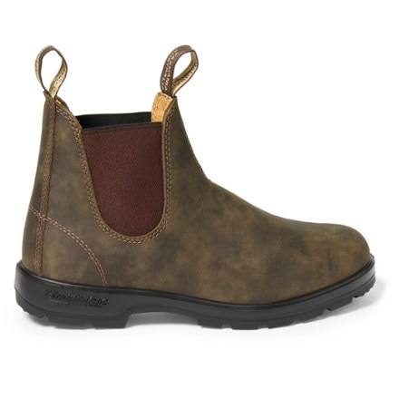
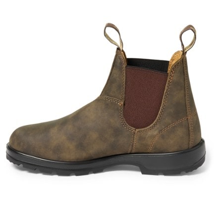
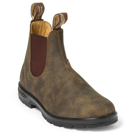
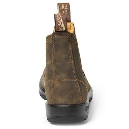
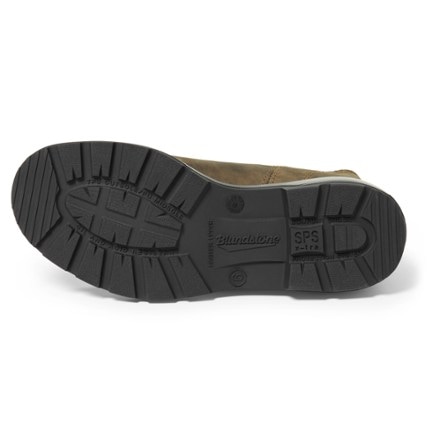
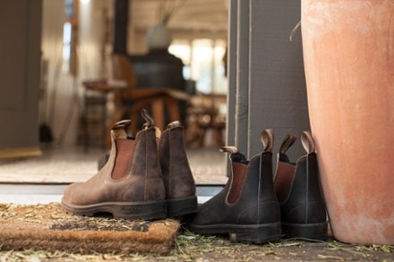
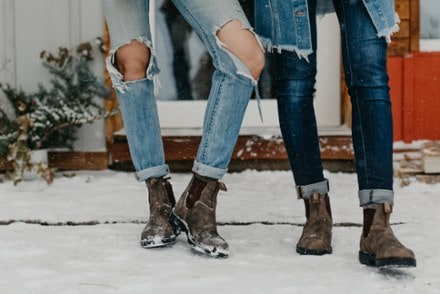
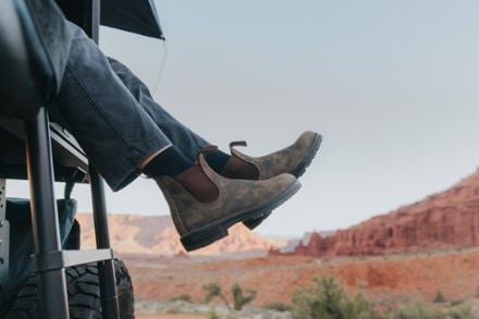
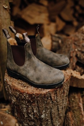
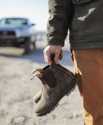
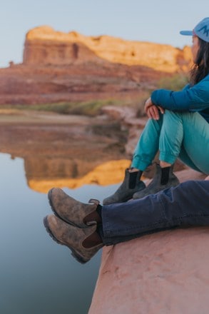
- BlundstoneClassic Chelsea BootsTop Rated$209.95 - $219.95(147)147 reviews with an average rating of 4.6 out of 5 stars
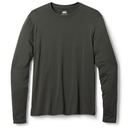
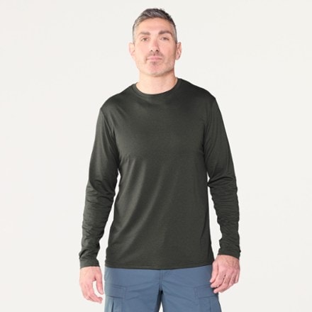
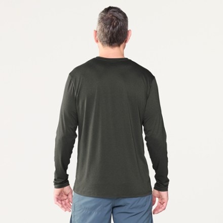
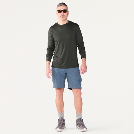
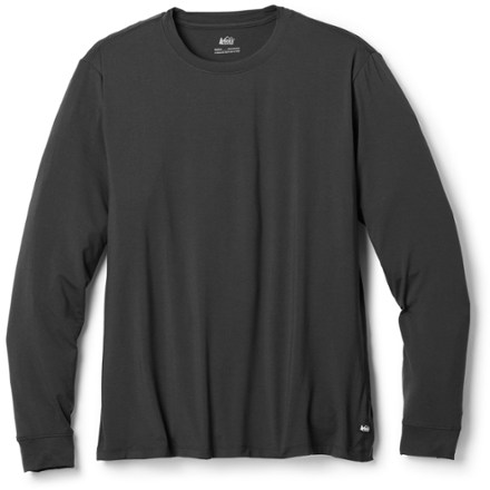
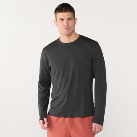
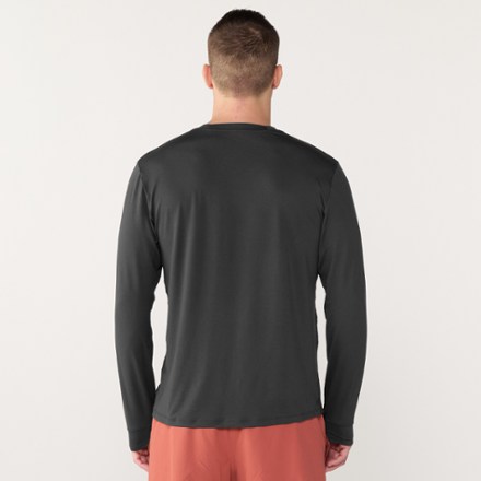
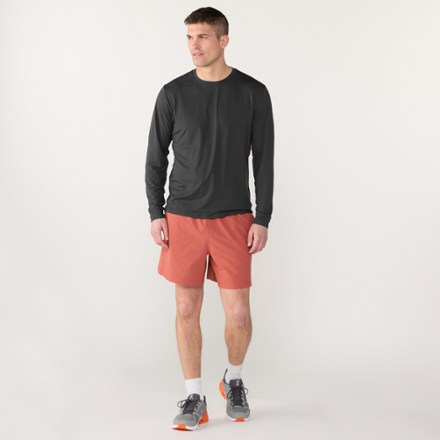
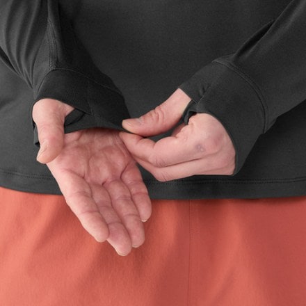
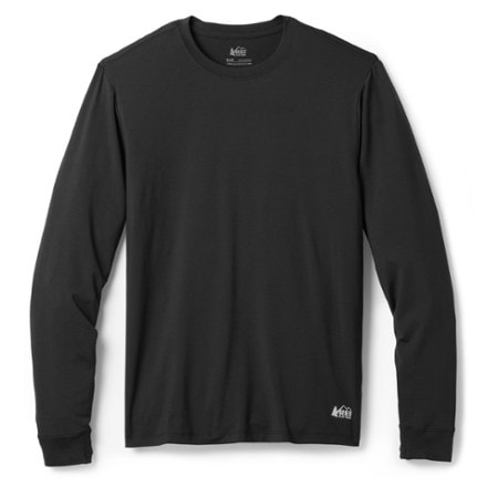
- REI Co-opSahara Long-Sleeve T-Shirt - Men'sTop Rated$19.83Save 50%compared to $39.95(147)147 reviews with an average rating of 4.6 out of 5 stars
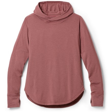
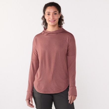
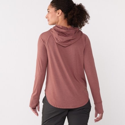
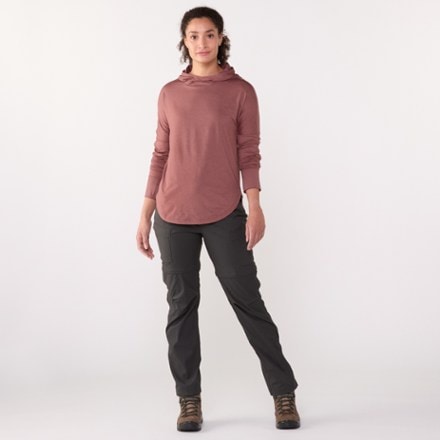
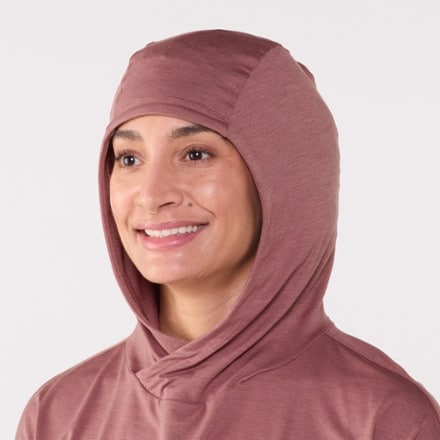
- REI Co-opSahara Shade Hoodie - Women'sTop Rated$34.93 - $59.95(1135)1135 reviews with an average rating of 4.6 out of 5 stars
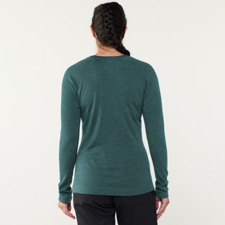
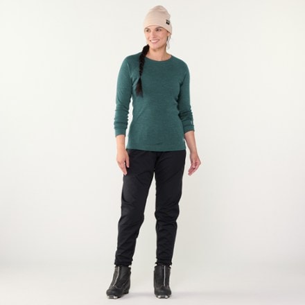
- SmartwoolClassic Thermal Merino Crew Base Layer Top - Women'sTop Rated$56.83 - $115.00(1188)1188 reviews with an average rating of 4.7 out of 5 stars
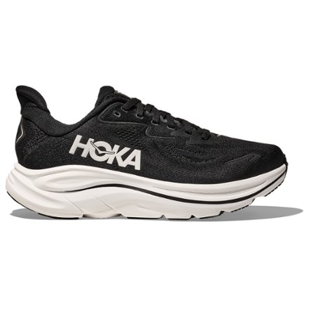
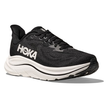
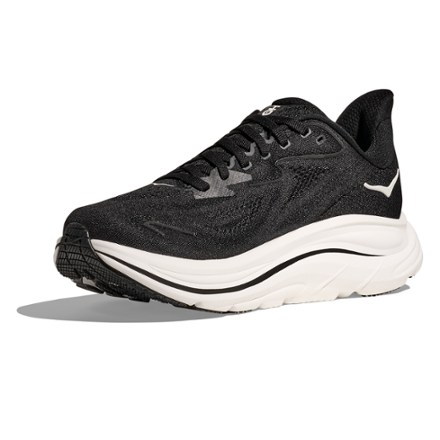
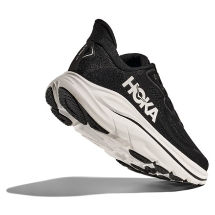
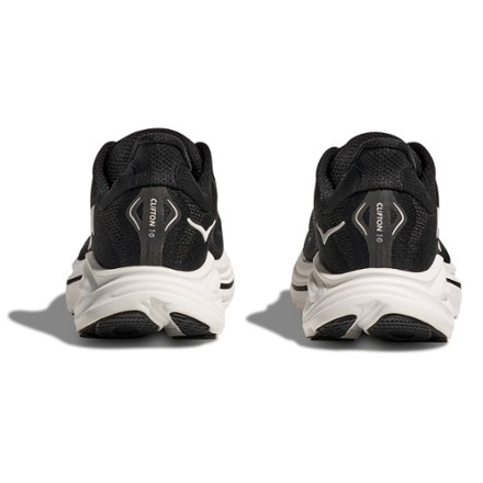
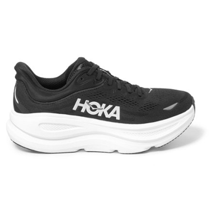
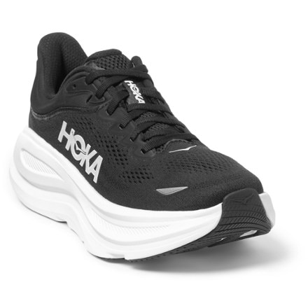
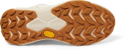
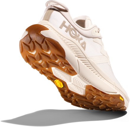
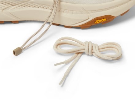
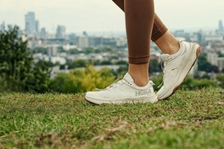
- HOKAClifton 10 Road-Running Shoes - Women'sTop Rated$155.00(103)103 reviews with an average rating of 4.6 out of 5 stars
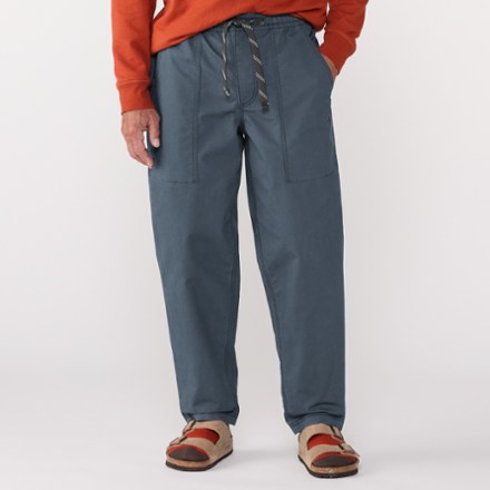
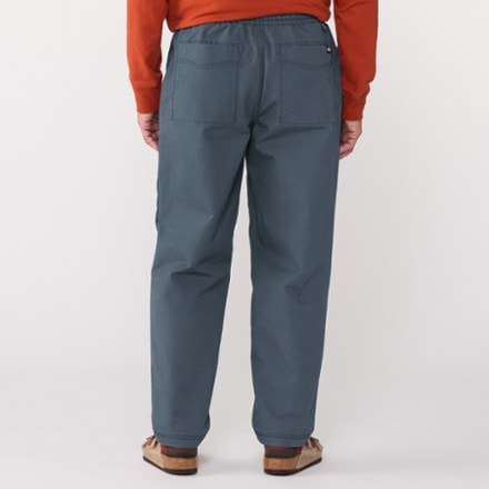
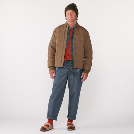
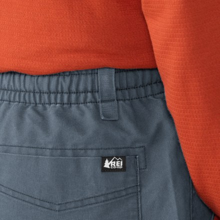
- REI Co-opTrailmade Pants - Men's$51.93 - $69.95(523)523 reviews with an average rating of 4.4 out of 5 stars
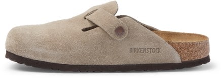
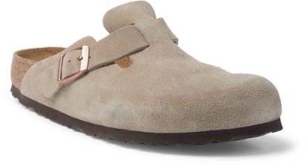
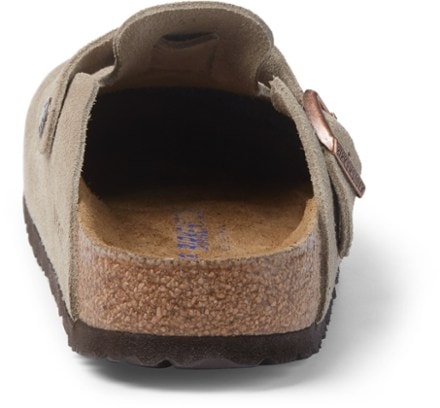
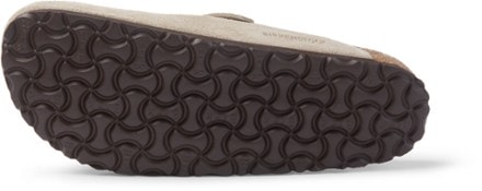
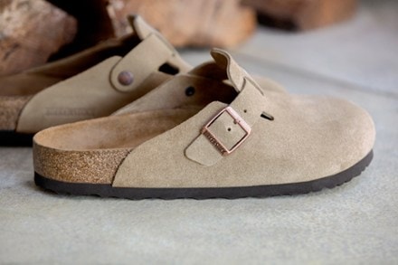
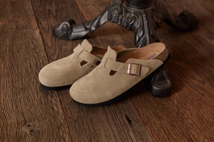
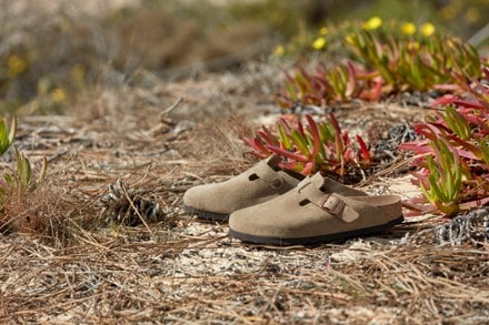
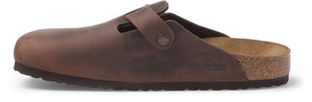
- BirkenstockBoston Soft Footbed Clogs - Women'sTop Rated$169.95(131)131 reviews with an average rating of 4.6 out of 5 stars
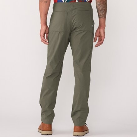
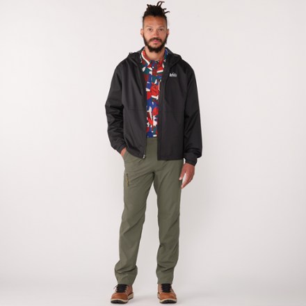
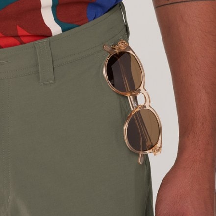
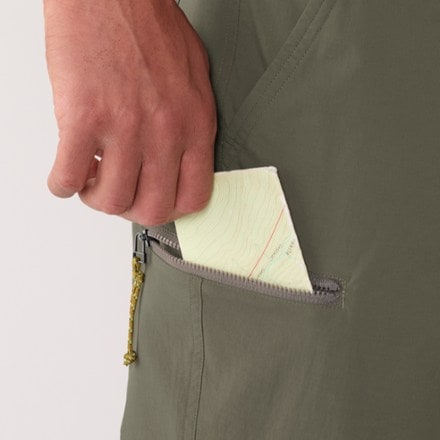
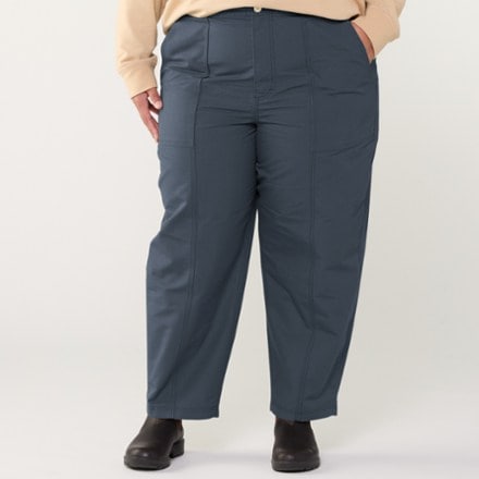
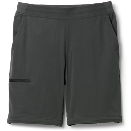
- REI Co-opCampwell Pants - Men'sTop Rated$38.83Save 51%compared to $79.95(9)9 reviews with an average rating of 4.6 out of 5 stars
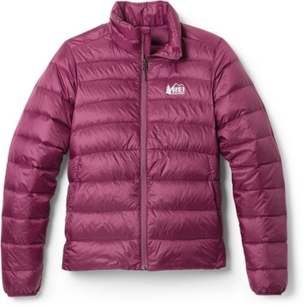
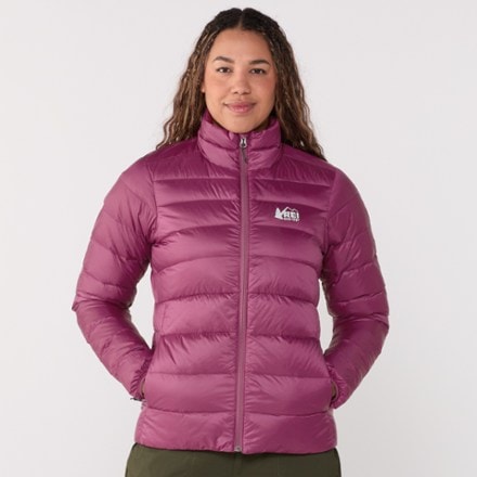
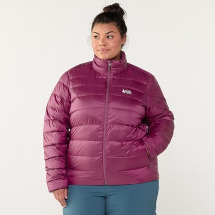
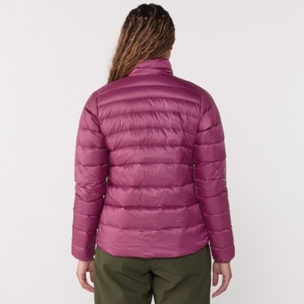
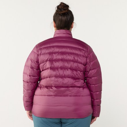
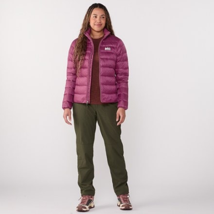
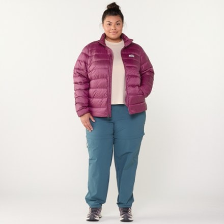
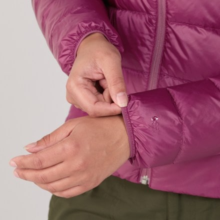
- REI Co-op650 Down Jacket - Women'sTop Rated$89.93 - $129.00(322)322 reviews with an average rating of 4.5 out of 5 stars
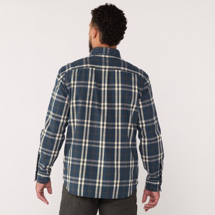
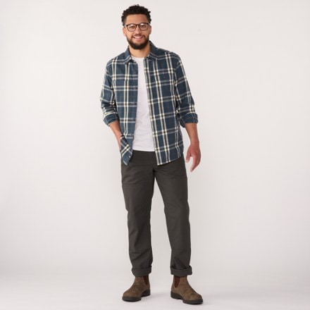
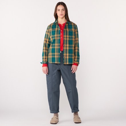
- REI Co-opCampwell Flannel Shirt - Men's$51.93Save 30%compared to $74.95(23)23 reviews with an average rating of 4.4 out of 5 stars
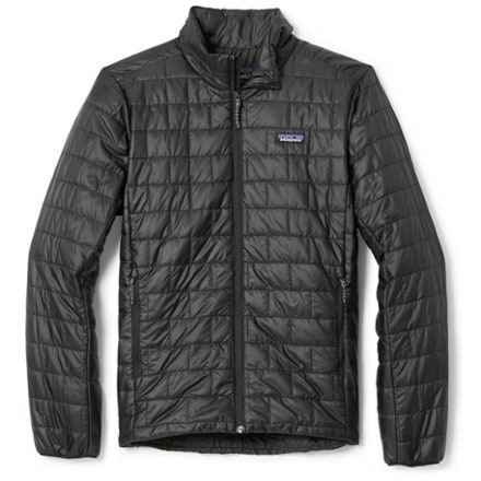
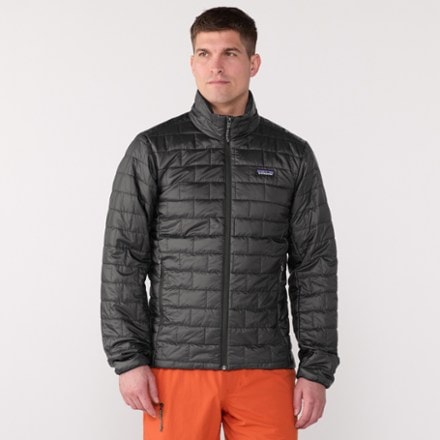
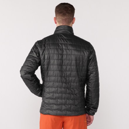
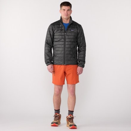
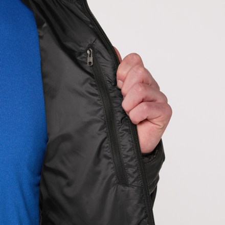
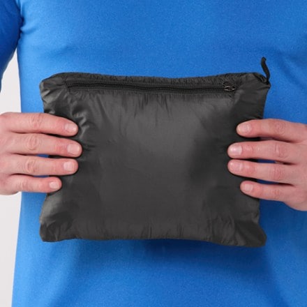
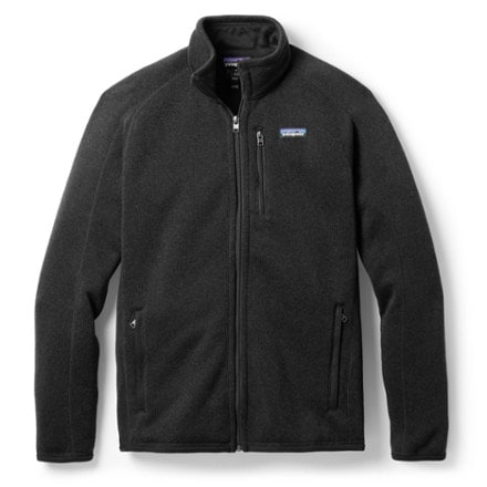
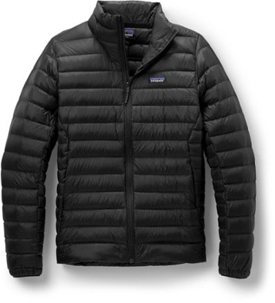
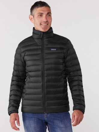
- PatagoniaNano Puff Insulated Jacket - Men'sTop Rated$229.00(31)31 reviews with an average rating of 4.6 out of 5 stars
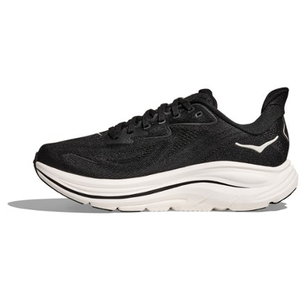
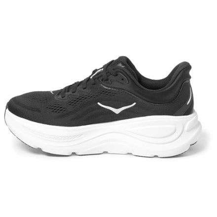
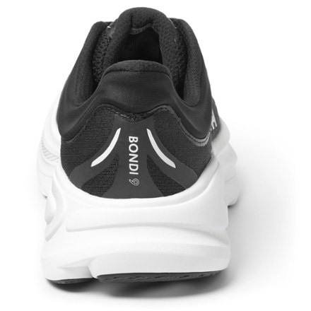
- HOKABondi 9 Road-Running Shoes - Women's$140.93 - $175.00(149)149 reviews with an average rating of 4.2 out of 5 stars
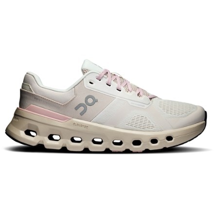
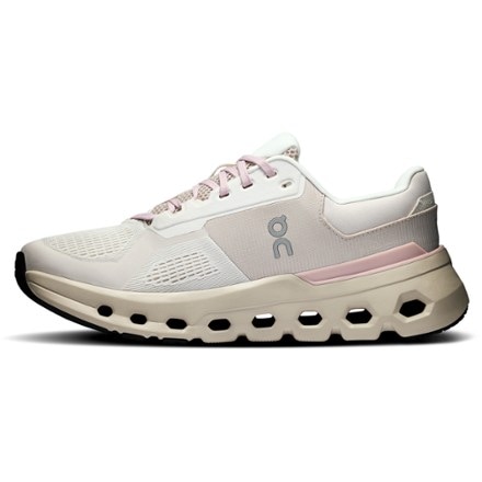
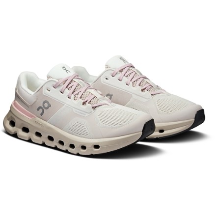
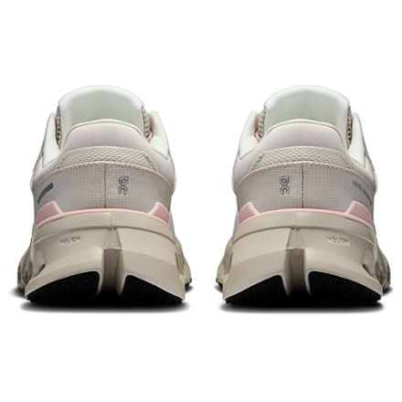
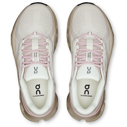
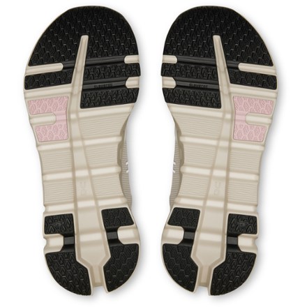
- OnCloudrunner 2 Road-Running Shoes - Women's$127.93 - $160.00(59)59 reviews with an average rating of 4.4 out of 5 stars
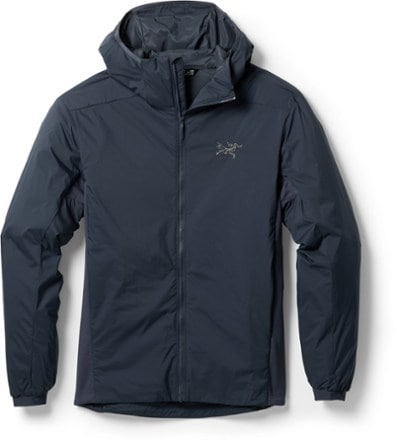
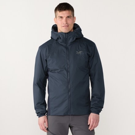
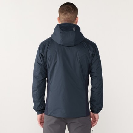
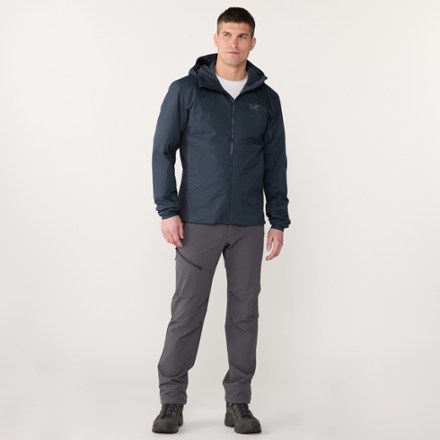
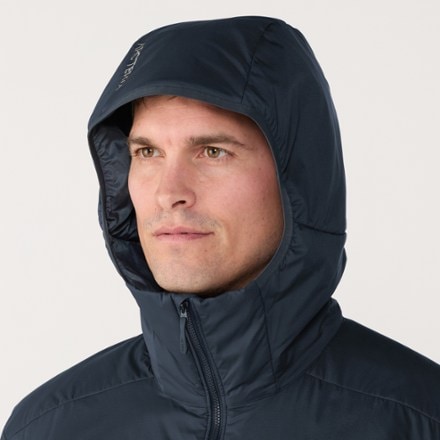
- Arc'teryxAtom Insulated Hoody - Men's$300.00(128)128 reviews with an average rating of 4.1 out of 5 stars
- REI Co-op650 Down Jacket - Men's$129.00(377)377 reviews with an average rating of 4.3 out of 5 stars
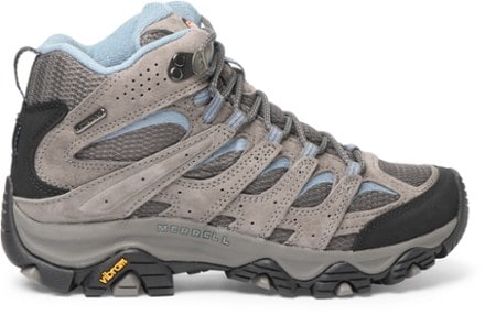
- MerrellMoab 3 Mid Waterproof Hiking Boots - Men'sTop Rated$126.93 - $170.00(1941)1941 reviews with an average rating of 4.6 out of 5 stars
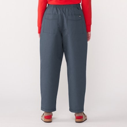
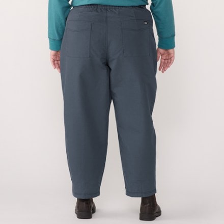
- REI Co-opCampwell Pants - Women's$39.83Save 50%compared to $79.95(26)26 reviews with an average rating of 4.0 out of 5 stars
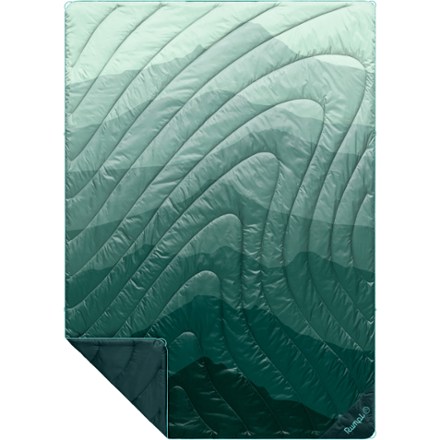
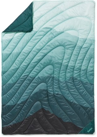
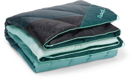
- RumplOriginal Puffy BlanketTop Rated$73.93 - $199.95(111)111 reviews with an average rating of 4.7 out of 5 stars
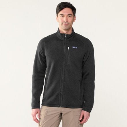
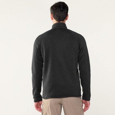
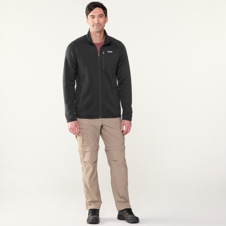
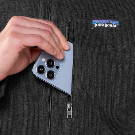
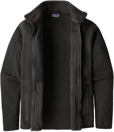
- PatagoniaBetter Sweater Fleece Jacket - Men'sTop Rated$159.00(608)608 reviews with an average rating of 4.5 out of 5 stars
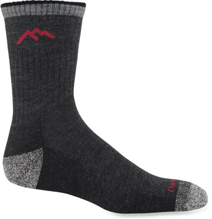
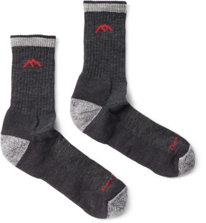
- Darn ToughHiker Micro Crew Cushion Socks - Men'sTop Rated$26.00(1269)1269 reviews with an average rating of 4.7 out of 5 stars
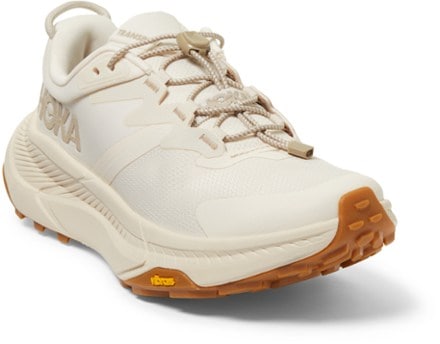
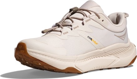
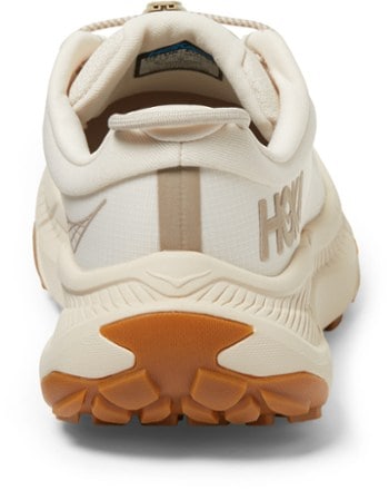
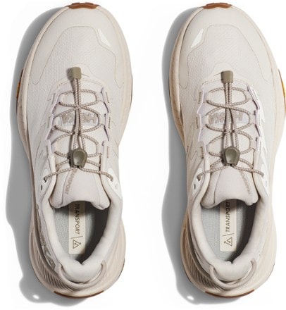
- HOKATransport Shoes - Women's$120.93Save 19%compared to $150.00(131)131 reviews with an average rating of 4.2 out of 5 stars
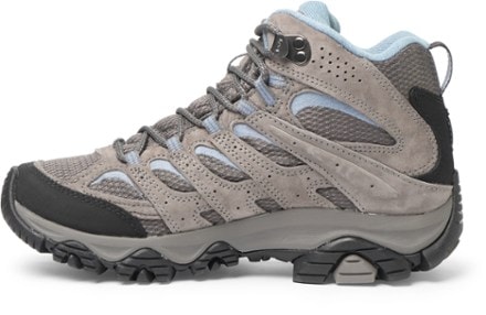
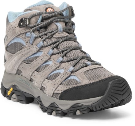
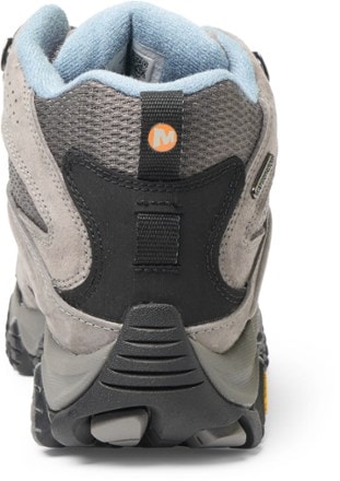
- MerrellMoab 3 Mid Waterproof Hiking Boots - Women'sTop Rated$126.93 - $170.00(1224)1224 reviews with an average rating of 4.6 out of 5 stars
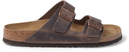
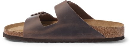
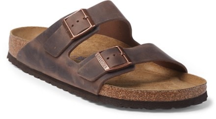
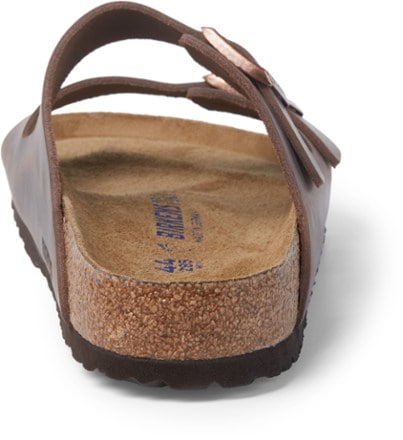
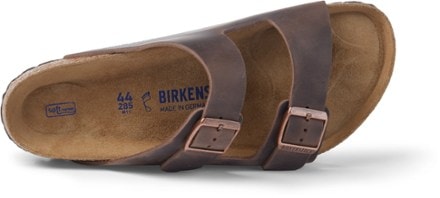
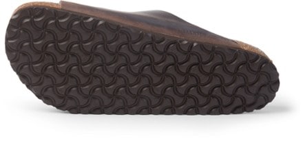
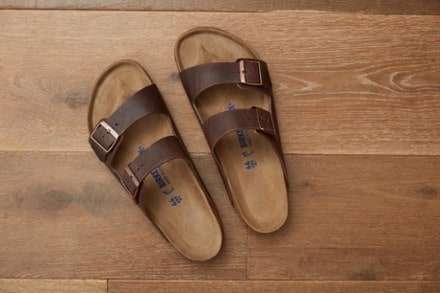
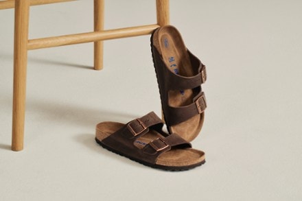
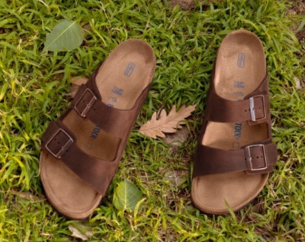
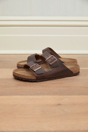
- BirkenstockArizona Soft Footbed Sandals - Men'sTop Rated$115.93 - $154.95(214)214 reviews with an average rating of 4.5 out of 5 stars
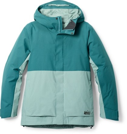
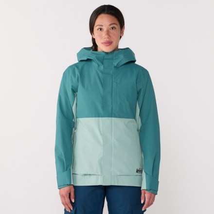
- REI Co-opPowderbound Insulated Jacket - Women'sTop Rated$113.83 - $229.00(90)90 reviews with an average rating of 4.6 out of 5 stars
- REI Co-opActive Pursuits Long-Sleeve T-Shirt - Men'sTop Rated$16.83 - $39.95(94)94 reviews with an average rating of 4.7 out of 5 stars
- PatagoniaDown Sweater - Men's$279.00(226)226 reviews with an average rating of 4.3 out of 5 stars
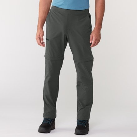
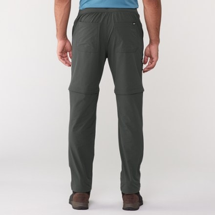
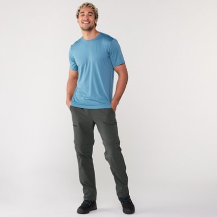
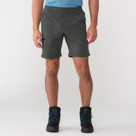
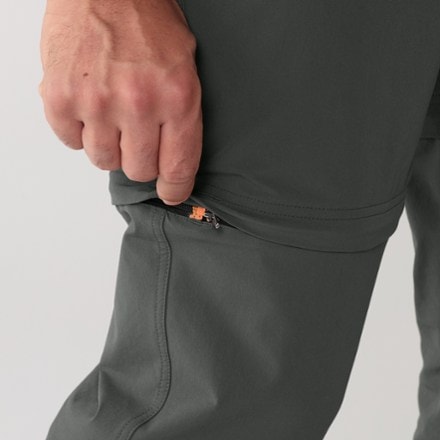
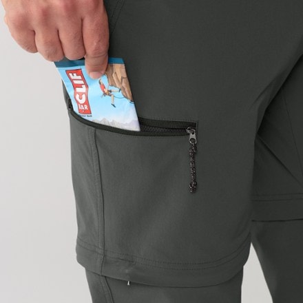
- REI Co-opSahara Stretch Convertible Pants - Men's$49.83Save 50%compared to $99.95(78)78 reviews with an average rating of 4.1 out of 5 stars
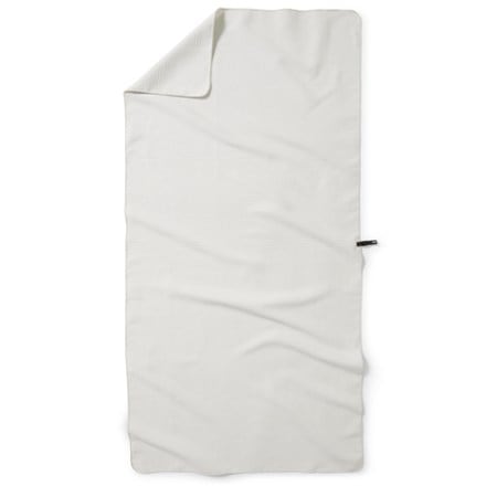
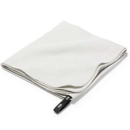
- REI Co-opMulti Towel LiteTop Rated$13.93 - $39.95(145)145 reviews with an average rating of 4.6 out of 5 stars
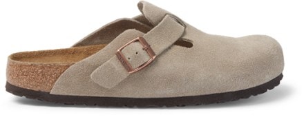
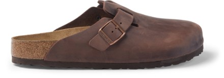
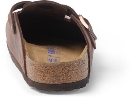
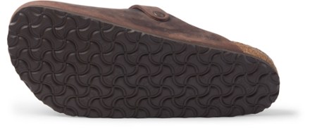
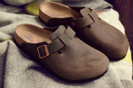
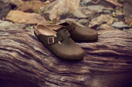
- BirkenstockBoston Soft Footbed Clogs - Men'sTop Rated$169.95(155)155 reviews with an average rating of 4.5 out of 5 stars
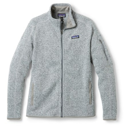
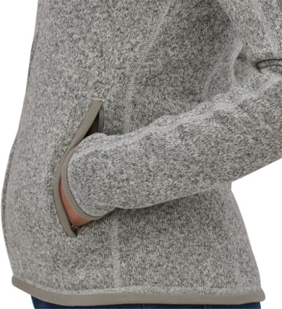
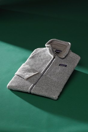
- PatagoniaBetter Sweater Fleece Jacket - Women's$159.00(479)479 reviews with an average rating of 4.4 out of 5 stars


1–30 of 10,000 products
Sort: Best Match