Skip to search results
loaded 5 results
AntiGravityGear Southeast Maps
(5 products)Products (5)
Sort: Best Match
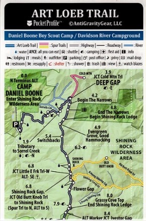
- AntiGravityGearArt Loeb Trail Elevation Profile map$4.95
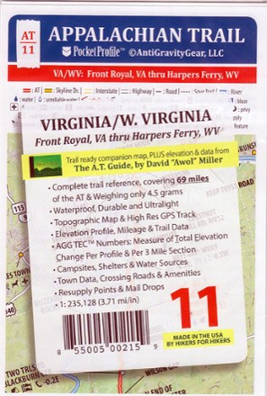
- AntiGravityGearAppalachian Trail Pocket Profile Map: Virginia/W. Virginia (Front Royal, VA - Harpers Ferry, WV)$4.95
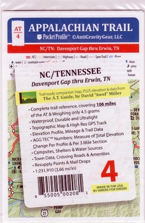
- AntiGravityGearAppalachian Trail Pocket Profile Map: North Carolina/Tennessee (Davenport Gap - Erwin, TN)$4.95
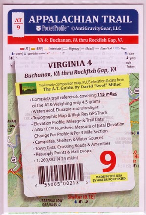
- AntiGravityGearAppalachian Trail Pocket Profile Map: Virginia 4 (Buchanan, VA - Rockfish Gap, VA)$4.95
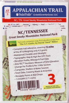
- AntiGravityGearAppalachian Trail Pocket Profile Map: North Carolina/Tennessee (Great Smoky Mountains National Park)$4.95

Earn 15% in total rewards
Get 5% on all REI Co-op purchases plus the 10% Co-op Member Reward you earn on eligible full-price purchases.
Apply now
Terms apply
Sort: Best Match