REI Accessibility Statement
Skip to main content
Skip to Shop REI categories
Shop REI
REI Outlet
Trade-In
Travel
Classes & Events
Expert Advice
Uncommon Path
Membership
REI Co-op, Go to REI.com Home Page
Shop
Clear Search
Search
Cancel
My REI
Find your store
Sign In
Cart
Open menu
Close menu
My Account - Sign in or Register
Camp & Hike
All Camp & Hike
Camp & Hike
All Camp & Hike
Hiking
Hiking
All Hiking
Footwear
Jackets
Shirts
Pants
Shorts
Socks
Backpacks
Backpacks
All Backpacks
Backpacking Packs
Daypacks
Hydration Packs
Baby Carrier Packs
Waist Packs
Accessories
Tents
Tents
All Tents
Backpacking Tents
Camping Tents
Roof-top Tents
Shelters
Bivy Sacks
Accessories
Sleeping Bags
Sleeping Bags
All Sleeping Bags
Men's
Women's
Double
Kids'
Bag Liners
Pads & Hammocks
Pads & Hammocks
All Pads & Hammocks
Sleeping Pads
Hammocks
Cots
Camp Mattresses
Pillows
Blankets
Camp Kitchen
Camp Kitchen
All Camp Kitchen
Stoves, Grills & Fuel
Cookware & Dinnerware
Coolers
Food
Drinkware
Camp Furniture
Camp Furniture
All Camp Furniture
Chairs
Tables
Fire Pits
Hydration
Hydration
All Hydration
Water Bottles
Tumblers
Water Treatment
Hydration Reservoirs
Lighting
Lighting
All Lighting
Headlamps
Flashlights
Lanterns
Electronics
Electronics
All Electronics
GPS
Solar Chargers
Power Banks
Power Stations
Satellite Communicators
Watches
Two-Way Radios
Health & Safety
Health & Safety
All Health & Safety
Camp Bathroom
Emergency & Survival
First Aid
Bear Safety Gear
Fire Starting Gear
Gadgets & Gear
Gadgets & Gear
All Gadgets & Gear
Trekking Poles
Knives & Tools
Binoculars
Compasses
Storage & Maintenance
Dog Gear
Games & Toys
Books & Maps
Camp & Hike Deals
Camp & Hike Deals
All Camp & Hike Deals
Tent Deals
Sleeping Bag Deals
Backpack Deals
New arrivals
Sale & Clearance
Save 10% on Co-op Camp Bundles
Expert Advice
Classes & Events
Climb
All Climb
Climb
All Climb
Climbing Shoes
Climbing Shoes
All Climbing Shoes
Men's Climbing
Men's Approach
Women's Climbing
Women's Approach
Climbing Harnesses
Climbing Harnesses
All Climbing Harnesses
Men's
Women's
Kids'
Climbing Ropes
Climbing Ropes
All Climbing Ropes
Single Ropes
Static & Rescue
Half Ropes
Twin Ropes
Rope Bags
Hardware
Hardware
All Hardware
Carabiners
Climbing Protection
Quickdraws
Belay & Rappel
Pulleys
Ascenders & Descenders
Essentials
Essentials
All Essentials
Chalk & Chalk Bags
Packs
Helmets
Holds
Training Gear
Bouldering Crash Pads
Climbing Clothing
Climbing Clothing
All Climbing Clothing
Men's Rock
Men's Mountaineering
Women's Rock
Women's Mountaineering
Climbing Gloves
Mountaineering
Mountaineering
All Mountaineering
Crampons
Ice Axes & Tools
Mountaineering Boots
Mountaineering Tents
Snow & Ice Protection
Webbing & Cords
Webbing & Cords
All Webbing & Cords
Cords
Slings
Webbing
Slacklines
Climbing Deals
Climbing Deals
All Climbing Deals
Climbing Shoe Deals
Mountaineering Deals
New Arrivals
Sale & Clearance
Expert Advice
Classes & Events
Cycle
All Cycle
Cycle
All Cycle
Bikes
Bikes
All Bikes
Mountain Bikes
Electric Bikes
Gravel Bikes
Cruiser Bikes
Hybrid Bikes
Kids' Bikes
Bike Helmets
Bike Helmets
All Bike Helmets
Mountain
Road
Kids'
Recreational
Cycling Clothing
Cycling Clothing
All Cycling Clothing
Jackets
Jerseys
Shorts
Tights & Pants
Accessories
Cycling Shoes
Cycling Shoes
All Cycling Shoes
Mountain
Road
City
Indoor
Cleats
Cycling Socks
Bike Parts
Bike Parts
All Bike Parts
Pedals
Tires
Wheels
Drivetrain Components
Handlebars
Brakes
Saddles
Bike Racks
Bike Racks
All Bike Racks
Hitch
Roof
Trunk
Truck Bed
Bike Storage Racks
Packs, Bags & Trailers
Packs, Bags & Trailers
All Packs, Bags & Trailers
Panniers & On-Bike Packs
Backpacks & Bags
Bike Trailers
Kids' Trailers
Bike Cargo Racks
Tools & Maintenance
Tools & Maintenance
All Tools & Maintenance
Bike Tools
Repair Stands
Lubricants & Cleaners
Pumps
Bike Accessories
Bike Accessories
All Bike Accessories
Locks
Lights
Fenders
Computers
Water Bottles
Child Bike Seats
Indoor Cycling
Indoor Cycling
All Indoor Cycling
Shoes
Trainers & Simulators
Trainer Accessories
Cycling Deals
Cycling Deals
All Cycling Deals
Bike Deals
Cycling Clothing Deals
Bike Accessories Deals
New Arrivals
Sale & Clearance
Brand Spotlight: USWE
Expert Advice
How to Choose
Shop Services
Classes & Events
Water
All Water
Water
All Water
Kayaking
Kayaking
All Kayaking
Kayaks
Kayak Paddles
Accessories
Carts
Paddle Boarding
Paddle Boarding
All Paddle Boarding
Paddle Boards
Paddle Board Paddles
Inflatable Paddle Boards
Accessories
Paddling Clothing
Paddling Clothing
All Paddling Clothing
Rashguards
Paddling Jackets
Wetsuits
Dry Suits
Water Accessories
Water Accessories
All Water Accessories
PFDs
Dry Bags
Waterproof Cases
Sunglasses
Beach Clothing & Footwear
Beach Clothing & Footwear
All Beach Clothing & Footwear
Men's Swimwear
Women's Swimwear
Kids' Swimwear
Beach Footwear
Sun Hats
Beach Gear & Furniture
Beach Gear & Furniture
All Beach Gear & Furniture
Picnic Blankets
Beach Towels
Outdoor Toys
Shade Shelters
Coolers
Camp Chairs
Racks & Storage
Racks & Storage
All Racks & Storage
Kayak Car Racks
Paddle Board Car Racks
Kayak Storage
Fishing
Watersports Deals
Watersports Deals
All Watersports Deals
Paddle Clothing Deals
Women's Swim Deals
Men's Swim Deals
New Arrivals
New at REI: Simms
Brand spotlight: BOTE
Sale & Clearance
Expert Advice
Classes & Events
Run
All Run
Run
All Run
Men's Running Shoes
Men's Running Shoes
All Men's Running Shoes
Trail-Running
Road-Running
Insoles
Running Socks
Men's Running Clothes
Men's Running Clothes
All Men's Running Clothes
Jackets
Vests
Shirts
Shorts
Pants
Tights
Accessories
Women's Running Shoes
Women's Running Shoes
All Women's Running Shoes
Trail-Running
Road-Running
Insoles
Running Socks
Women's Running Clothes
Women's Running Clothes
All Women's Running Clothes
Jackets
Vests
Shirts
Running Bras
Shorts
Pants
Tights
Accessories
Running Packs
Running Packs
All Running Packs
Hydration Belts
Hydration Vests
Race Belts
Water Bottles
Fitness Electronics
Fitness Electronics
All Fitness Electronics
Heart Rate Monitors
Fitness Trackers
GPS Sports Watches
Headphones
Running Lights
Running Gear
Running Gear
All Running Gear
Sport Sunglasses
Recovery Essentials
Strollers & Accessories
Energy Food & Drinks
Running Safety
Run Deals
Run Deals
All Run Deals
Men's Clothing Deals
Men's Shoe Deals
Women's Clothing Deals
Women's Shoe Deals
New Arrivals
Just-released running shoes
All Fitness
Workout clothing
Sale & Clearance
Expert Advice
Classes & Events
Snow
All Snow
Snow
All Snow
Snow Clothing
Snow Clothing
All Snow Clothing
Jackets
Snow Pants
Snowsuits
Base Layers
Hats & Headwear
Gloves & Mittens
Socks
Downhill Skiing
Downhill Skiing
All Downhill Skiing
Skis
Boots
Bindings
Poles
Helmets
Goggles
Ski Packs & Bags
Snowboarding
Snowboarding
All Snowboarding
Snowboards
Boots
Bindings
Helmets
Goggles
Snowboard Packs & Bags
Backcountry
Backcountry
All Backcountry
Skis
Ski Boots
Bindings
Poles
Skins
Splitboards
Splitboard Bindings
Cross-Country Skiing
Cross-Country Skiing
All Cross-Country Skiing
Skis
Boots
Bindings
Poles
Waxing & Tuning
Snowshoeing
Snowshoeing
All Snowshoeing
Snowshoes
Winter Boots
Poles
Avalanche Safety Gear
Avalanche Safety Gear
All Avalanche Safety Gear
Avalanche Backpacks
Avalanche Transceivers
Snow Shovels
Snow Probes
Snow Gear
Snow Gear
All Snow Gear
Ski & Snowboard Racks
Cargo Roof Boxes
Winter Traction
Hand & Foot Warmers
Snow Deals
Snow Deals
All Snow Deals
Downhill Ski Deals
Snowboarding Deals
REI Outlet Snow
New Arrivals
Sale & Clearance
Snow Gear: Packs, Bags & Racks
Expert Advice
Shop Services
Travel
All Travel
Travel
All Travel
Luggage
Luggage
All Luggage
Carry-On Luggage
Wheeled Luggage
Travel Packs
Travel Duffel Bags
Packing Organizers
Accessories
Backpacks
Backpacks
All Backpacks
Travel Backpacks
Travel Daypacks
Laptop Backpacks
Day Bags
Day Bags
All Day Bags
Duffel Bags
Shoulder Bags
Messenger Bags
Fanny Packs
Tote Bags
Wallets & Money Belts
Car Racks
Car Racks
All Car Racks
Cargo Boxes & Bags
Bike Racks
Watercraft Racks
Ski & Snowboard
Base Roof Racks
Travel Clothing
Travel Clothing
All Travel Clothing
Men's
Women's
Kids'
Electronics, Bags & Cases
Electronics, Bags & Cases
All Electronics, Bags & Cases
Photography
Action Cameras
Camera Bags
Laptop Bags
Phone Cases
Travel Accessories
Travel Accessories
All Travel Accessories
Pillows & Sleeping
Converters & Adapters
Keychains
Toiletry Bags
Travel Mugs
Travel Deals
Travel Deals
All Travel Deals
Luggage Deals
Backpack Deals
Day Bag Deals
Travel Clothing Deals
Trips with Intrepid
New Arrivals
Sale & Clearance
Expert Advice
Men
All Men
Men
All Men
Shoes
Shoes
All Shoes
Hiking Shoes
Running Shoes
Boots
Casual Shoes
Sneakers
Sandals
Socks
Insoles
Jackets
Jackets
All Jackets
Casual Jackets
Down & Insulated
Fleece & Soft-Shell
Rain Jackets
Running Jackets
Windbreakers
Ski & Snowboard
Tops
Tops
All Tops
Shirts
T-Shirts
Graphic Tops
Sweaters & Sweatshirts
Vests
Bottoms
Bottoms
All Bottoms
Pants
Shorts
Underwear
Underwear
All Underwear
Briefs & Boxers
Base Layer Tops
Base Layer Bottoms
Swimwear
Swimwear
All Swimwear
Swim Trunks
Rashguards
Goggles
Accessories
Accessories
All Accessories
Gloves & Mittens
Belts
Leg Gaiters
Sunglasses
Watches
Headwear
Headwear
All Headwear
Hats
Sun Hats
Bandanas
Neck Gaiters
Balaclavas
Activity Collections
Activity Collections
Activity Collections
Snow Clothing
Hiking Clothing
Cycling Clothing
Running Clothes
Cycling Shoes
Big, Tall & Short
Big, Tall & Short
All Big, Tall & Short
Big
Tall
Short
Men's Deals
Men's Deals
All Men's Deals
Jacket Deals
Shirt Deals
Pant Deals
Footwear Deals
New Arrivals
Sale & Clearance
Expert Advice
Women
All Women
Women
All Women
Shoes
Shoes
All Shoes
Hiking Shoes
Running Shoes
Boots
Casual Shoes
Sneakers
Sandals
Socks
Insoles
Jackets
Jackets
All Jackets
Casual Jackets
Down & Insulated
Fleece & Soft-Shell
Rain Jackets
Running Jackets
Windbreakers
Ski & Snowboard
Tops
Tops
All Tops
Shirts
T-Shirts
Tank Tops
Graphic Tops
Sweaters & Sweatshirts
Vests
Bottoms
Bottoms
All Bottoms
Pants
Leggings
Shorts
Skirts & Dresses
Skirts & Dresses
All Skirts & Dresses
Dresses
Skirts
Skorts
Underwear
Underwear
All Underwear
Briefs
Sports Bras
Base Layer Tops
Base Layer Bottoms
Swimwear
Swimwear
All Swimwear
Swimsuits
Rashguards
Water Shorts
Cover Ups
Goggles
Accessories
Accessories
All Accessories
Sunglasses
Watches
Bags
Gloves & Mittens
Belts
Leg Gaiters
Headwear
Headwear
All Headwear
Hats
Sun Hats
Bandanas
Neck Gaiters
Balaclavas
Activity Collections
Activity Collections
Activity Collections
Snow Clothing
Hiking Clothing
Cycling Clothing
Running Clothes
Yoga Clothing
Cycling Shoes
Plus, Petite & Tall
Plus, Petite & Tall
All Plus, Petite & Tall
Plus
Petite
Tall
Women's Deals
Women's Deals
All Women's Deals
Jacket Deals
Shirt Deals
Pant Deals
Footwear Deals
New Arrivals
Sale & Clearance
Expert Advice
Kids
All Kids
Kids
All Kids
Footwear
Footwear
All Footwear
Boots
Shoes
Sandals
Socks
Jackets
Jackets
All Jackets
Down & insulated
Fleece & Soft-Shell
Rain Jackets
Ski & Snowboard
Clothing
Clothing
All Clothing
Shirts
T-Shirts
Graphic Clothing
Sweaters & Sweatshirts
Pants
Shorts
Swimwear
Accessories
Accessories
All Accessories
Hats
Sun Hats
Gloves & Mittens
Sunglasses
Base Layers
Snow
Snow
All Snow
Downhill Skiing
Cross-Country Skiing
Snowboarding
Snowshoes
Kids' Camp & Hike
Kids' Camp & Hike
All Kids' Camp & Hike
Baby Carrier Packs
Backpacks
Sleeping Bags
Kids' Cycling
Kids' Cycling
All Kids' Cycling
Bikes
Helmets
Accessories
Strollers
Strollers
All Strollers
Jogging Strollers
Accessories
Conversion Kits
Weather Shields
More
More
More
Kids' Climbing
Kids' Watersports
Toys & Games
By Gender & Age
By Gender & Age
By Gender & Age
Boys
Girls
Infant & Toddler
Kids' Deals
Kids' Deals
All Kids' Deals
Boys' Deals
Girls' Deals
Infant & Toddler Deals
New Arrivals
Sale & Clearance
Expert Advice
Deals
All Deals
Deals
All Deals
Men's Deals
Men's Deals
All Men's Deals
Jackets
Pants
Shirts
Underwear
Women's Deals
Women's Deals
All Women's Deals
Jackets
Pants
Shirts
Underwear
Footwear Deals
Footwear Deals
All Footwear Deals
Men's Footwear
Women's Footwear
Kids' Footwear
Socks
Camp & Hike Deals
Camp & Hike Deals
All Camp & Hike Deals
Tents
Sleeping Bags
Backpacks
Camp Kitchen
Cycling Deals
Cycling Deals
All Cycling Deals
Bikes
Bike Helmets
Cycling Clothing
Bike Accessories
Run & Fitness Deals
Run & Fitness Deals
All Run & Fitness Deals
Men's Clothing
Women's Clothing
Men's Running Shoes
Women's Running Shoes
More Deals
More Deals
All More Deals
Snowsports
Climbing
Travel Gear
Kids' Clothing
Watersports
REI Outlet
REI Outlet
All REI Outlet
50% Off
Deals under $50
Just Reduced
Men's Clothing
Women's Clothing
Shop all deals
REI Outlet deals
Clothing deals
Footwear deals
Camping deals
Brands
All Brands
Brands
All Brands
Made by REI
Made by REI
Made by REI
Shop all REI Co-op
Co-op Cycles
Camp & Hike
Run
Men's Clothing
Women's Clothing
Kids' Clothing
Sleeping Bags
Packs & Bags
Top Brands
Top Brands
Top Brands
Arc'teryx
KUHL
Black Diamond
Garmin
HOKA
La Sportiva
Osprey
Patagonia
Salomon
Smartwool
The North Face
Thule
Trending Brands
Trending Brands
Trending Brands
prAna
Brooks
Cotopaxi
Danner
Dometic
Electra
Janji
On
Snow Peak
YETI
Thousand
Vuori
Member Favorites
Member Favorites
Member Favorites
Big Agnes
Cannondale
Darn Tough
Fjallraven
Exped
Gregory
Keen
Merrell
NEMO
Oboz
Sea to Summit
Yakima
Patagonia Deals
The North Face Deals
Deals by Brand
More
More
New Arrivals
Packs & Bags
Books & Maps
Returns & Exchanges
Gift Cards
Electronics
Car Racks
All Brands
Dog Gear
Footwear
Outdoor Gifts
All Categories
Rental Gear
Sunglasses
Membership
Opt Outside
Classes & Events
Expert Advice
Uncommon Path
Impact
Contact Us
Need some help?
Help Center
Find answers online any time
Live Chat
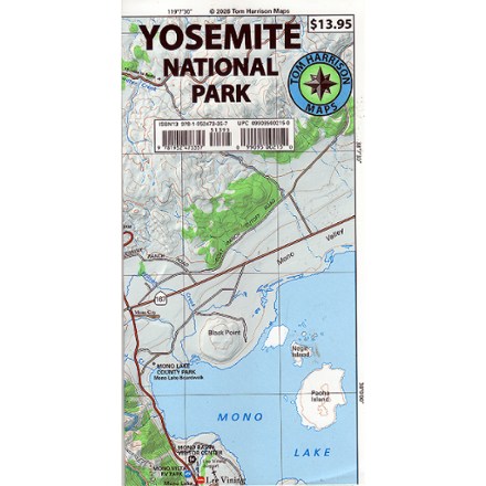
Tom Harrison Cartography
Shop all Tom Harrison Cartography
REI offers 2 Tom Harrison Cartography products
Shop by category
California Maps
 California Maps