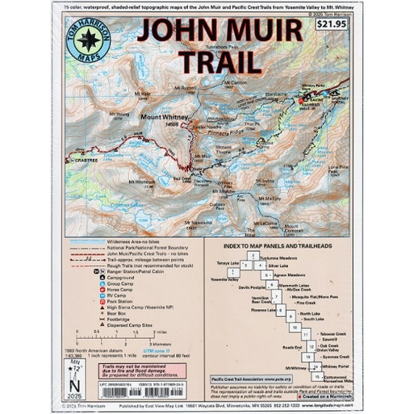

Tom Harrison Cartography John Muir Trail Flat Map Pack
$21.95
Members get an est. $2.19 in rewards
Get a comprehensive view of the entire John Muir Trail with this Tom Harrison Cartography map set. It's great whether you're planning a thru-hike or wanting to tackle segments on day hikes.
- Includes 15 individual 8.5 x 11 in. shaded-relief topographic maps of the John Muir Trail (JMT) and Pacific Crest Trail (PCT)
- Covers the entire distance from Mt. Whitney to Yosemite Valley
- Map 15 extends to Cottonwood/Horseshoe Meadow if you plan to start or exit there
- The maps easily fold into quarters so you can mail the upcoming segments in your resupply boxes
- GPS compatible with complete UTM grid
- Details include trail mileage and elevation points, along with trailheads, campgrounds, ranger stations, bear boxes, access roads and more
- Each map weighs 0.19 oz. (5.4 g); total weight: 2.85 oz. (81 g)
Made in USA.
View all Tom Harrison Cartography California Maps| Best Use | Hiking Backpacking |
|---|---|
| State / Province | California |
| Unfolded Dimensions | 11 x 8.5 inches |
| Map Scale | 1:63,360 |
| Waterproof | Yes |
| Publisher | Tom Harrison Maps |
| Copyright Year | 2025 |
Be the first to write a review!
Adding a review will require a valid email for verification