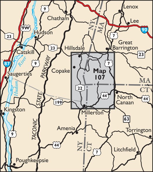
New York New Jersey Trail South Taconic Trails Map - 4th Edition
Featuring trails in the mountains at the junction of New York, Massachusetts and Connecticut, the 4th edition New York New Jersey Trail South Taconic Trails map is a must-have for enjoying the region.
- Map is printed in vibrant color on waterproof and tear-resistant Tyvek and features more than 100 miles of marked trails throughout the South Taconic Mountains
- More than 20 parks and preserves, including Taconic State Park, Bash Bish Falls State Park, Mount Washington State Forest and Mount Everett State Reservation
- Also includes Jug End State Reservation and Mount Riga State Park
- Enlarged inset map of popular Bash Bish area and adjacent state park campground at Copake Falls
- Includes sections of the Appalachian Trail, the entire South Taconic Trail and nearly 10 miles of recently completed sections of the Harlem Valley Rail Trail
- 4th edition features several trail routes that have been updated with more recent GPS data
- Includes significant trail updates at Overmountain Conservation Area (formerly named Round Ball Mountain)
- Features several newer preserves and trails in the Connecticut section of the map, many managed by the Salisbury Association Land Trust
- Includes viewpoint adjustments, trail mileage number additions and corrections, newly-acquired open space additions, and other adjustments throughout the map
- Map includes parking areas, shelters, viewpoints, waterfalls and other points of interest, as well as parkland boundaries, unmaintained trails and woods roads
- Detailed trail mileage numbers
- Park contact information, history and regulations
- 20-foot elevation contours
- Convenient map size to carry and use on the trail
- UTM coordinate grid
Made in USA.
View all New York New Jersey Trail New England and Mid-Atlantic Maps| Best Use | Camping Backpacking Hiking |
|---|---|
| State / Province | New York Connecticut Massachusetts |
| Folded Dimensions | 8.5 x 3.75 x 0.125 inches |
| Unfolded Dimensions | 22 x 17 inches |
| Map Scale | 1:50,000 scale |
| Double Sided | Yes |
| Waterproof | Yes |
| Publisher | New York-New Jersey Trail Conference |
| Copyright Year | 2024 |
| Map Number | 107 |
Be the first to write a review!
Adding a review will require a valid email for verification

