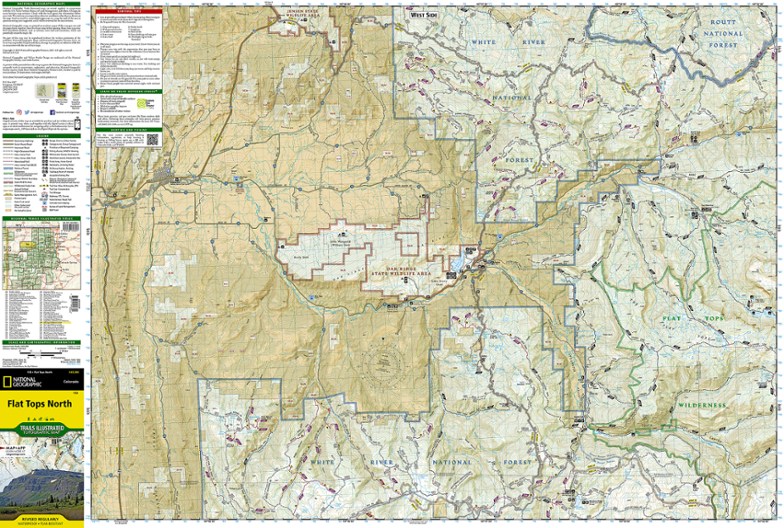
National Geographic Flat Tops North Topographic Map
Your key to adventuring in Colorado's second-largest wilderness, the Trails Illustrated Flat Tops North topographic map offers unmatched detail and valuable info to assist you in your exploration.
- Expertly researched and created in partnership with the U.S. Forest Service, Bureau of Land Management and other agencies
- Key areas of interest include Oak Ridge State Wildlife Area, North Fork White River, Flat Tops Trail Scenic Byway, Meeker, Trappers Lake and Yamcolo and Stillwater reservoirs
- Other areas covered on this map include Routt and White River national forests
- Clearly marked trails include mileage between intersections and are highlighted according to use
- Includes contour lines, shaded relief and elevations for summits, passes and many lakes
- Also includes campgrounds, fishing areas, whitewater access, boat launches, trailheads, interpretive sites, horse corrals, picnic areas and more
- Features survival tips and agency contacts
- Printed on durable, lightweight, waterproof and tear-resistant material that's designed to withstand all weather conditions
Made in USA.
View the National Geographic Trails Illustrated Product LineView all National Geographic Colorado Maps| Best Use | Hiking |
|---|---|
| Folded Dimensions | 7.5 x 4 inches |
| Unfolded Dimensions | 37.75 x 25.5 inches |
| Map Scale | 1:63,360 |
| Double Sided | Yes |
| Waterproof | Yes |
| Publisher | National Geographic |
| Copyright Year | 2016 |
| State / Province | Colorado |
| Map Number | 150 |
Write a Review
Adding a review will require a valid email for verification
Great Map Poor Shipping
As always these maps have everything a backpacker needs to get in and out safely. It shows trails, elevation, and is water resistance and easy to fold in a variety of different ways. I will say that REI is not living up to their claimed responsibility for helping to keep waste down to help the environment. The map was sent in a box large enough for a lantern, yet only a map that should have been sent in an envelope was inside.

