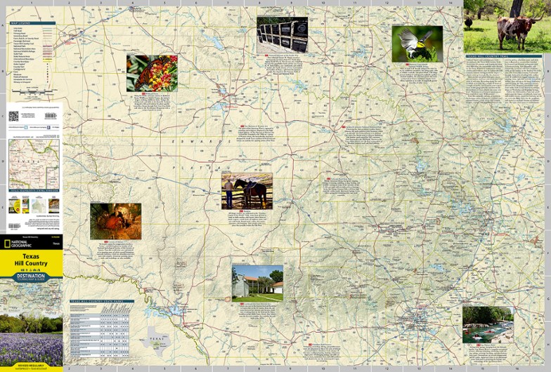
National Geographic Texas Hill Country Destination Touring Map and Guide
The National Geographic Texas Hill Country Destination Touring map and guide strikes a balance between map and guidebook—perfect for touring this culturally and geographically unique region.
- The front features a map of this region of central Texas whose southern border almost touches San Antonio and whose eastern border nudges up against Austin's suburbs
- Traversing 19 counties, the 800-mile Texas Hill Country Trail is outlined
- Reverse insets about Austin, museums, wineries and local culture, along with outdoor activities such as wildlife and wildflower viewing, hiking and caving and biking
- Double-sided design contains detailed maps and useful travel information
- Includes a comprehensive road network, local infrastructure and abundant natural, historical and cultural places
- Beautiful photographs and valuable travel information aid travelers with pre-trip planning and on-the-ground adventures
- Printed in the USA on durable, lightweight, waterproof and tear-resistant material designed to withstand all weather conditions
- Folded dimensions: 4.25 x 9.25 in.; Unfolded dimensions: 37.75 x 25.5 in.
- 1:578,640 scale
- National Geographic Maps; copyright 2013
Made in USA.
View all National Geographic Southwest Maps| Best Use | Travel Hiking |
|---|---|
| State / Province | Texas |
Write a Review
Adding a review will require a valid email for verification
Designed to be more a tourism brochure than a map.
Even after 30+ years living in Central Texas, I still get confused about the back roads of the Hill Country, and was excited to have a map to help me visualize and navigate the twists and turns of this beautiful area. Unfortunately, the map itself is (very) marred by 12 "post it" type inserts of images and text about places on the map (Wildseed Farms, Bandera, a fancy Inn, etc.) which OBSCURE THE MAP so you cannot see the roads and other features under those images and notes. Defeats the purpose of having a map, but OK if all you want is a tourism piece for ideas about what to do and where to go. I have not encountered this problem with other Nat. Geo maps. :(
Great Maps
Nat Geo makes really detailed and clear maps. Reminds me of the Ordnance Maps of Britain.

