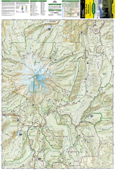
National Geographic Mount Hood Wilderness Topographic Map
This product is not available.
The detailed Trails Illustrated Mount Hood Wilderness topographic map showcases the snowcapped Oregon icon of Mt. Hood—a premier destination for outdoor enthusiasts.
Shop similar products- Expertly researched and created in partnership with the U.S. Forest Service, this map covers mountains, forests, wildernesses, rivers and an abundance of recreation activities
- Includes Mount Hood Wilderness, National Forest and Recreation Area and Sandy, Salmon and Zigzag wild and scenic rivers
- Also includes Salmon-Huckleberry and Badger Creek wilderness areas, Richard L. Kohnstamm Memorial Area and Mount Hood Scenic Byway
- Easy-to-read, yet highly detailed map shows comprehensive trail and road networks, along with designated trails for hiking, horseback riding, biking and more
- Clearly marked navigational aids with UTM coordinate grids, scale bar and full legend, essential for safely navigating the backcountry with GPS or compass
- Features key points of interest such as scenic views, campgrounds, trailheads, boat launches and picnic sites
- Color-coded boundaries for public lands including national parks, national forests, national monuments, ranger districts, wilderness areas, state parks and wildlife refuges
- Printed in the U.S.A. on a durable, lightweight, waterproof, tear-resistant material designed to withstand all weather conditions
- Folded dimensions: 4 x 7.5 in.; unfolded dimensions: 37.75 x 25.5 in.
- 1:35,000 scale
- National Geographic Maps; copyright 2012
Made in USA.
View the National Geographic Trails Illustrated Product LineView all National Geographic Washington and Oregon Maps| Best Use | Hiking |
|---|---|
| State / Province | Oregon |
| Map Number | 321 |
Write a Review
Adding a review will require a valid email for verification
Good Map
I bought and used this to hike the Timberline Trail around Mount Hood. I'm a bit old fashion and like having paper maps. They don't run out of power, I don't have to squint at a tiny screen, and they are hard to destroy or damage; unlike my phone. Especially nice are the National Geographic maps with their waterproofing, which is essential on the Timberline. The map is current and accurate. It was only missing one small link trail that is brand new.
Camp sites
Although it's a great topo it doesn't have all the campsites.

