Skip to search results
loaded 1 results
AntiGravityGear New England and Mid-Atlantic Maps
(1 product)Products (1)
Sort: Best Match
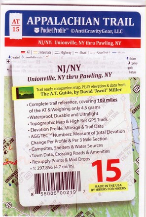
- AntiGravityGearAppalachian Trail Pocket Profile Map: New Jersey/New York (Unionville, NY - Pawling, NY)$4.95

Earn 15% in total rewards
Get 5% on all REI Co-op purchases plus the 10% Co-op Member Reward you earn on eligible full-price purchases.
Apply now
Terms apply
Sort: Best Match