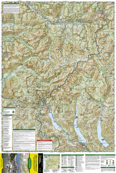
National Geographic Alpine Lakes Wilderness Topographic Map
Outdoor enthusiasts looking to explore of the Central Cascades will find the Trails Illustrated Alpine Lakes Wilderness Topographic Map an indispensable tool.
- Expertly researched and created in partnership with the U.S. Forest Service and others
- Covers surrounding parts of the Mt. Baker-Snoqualmie and Okanogan-Wenatchee national forests, Skykomish and Wenatchee rivers, Lake Easton State Park and Stevens Pass
- Easy-to-read, yet highly detailed map shows comprehensive trail and road networks, along with designated trails for hiking, horseback riding, biking and more
- Clearly marked navigational aids with UTM coordinate grids, scale bar and full legend, essential for safely navigating the backcountry with GPS or compass
- Features key points of interest such as scenic views, campgrounds, trailheads, boat launches and picnic sites
- Color-coded boundaries for public lands including national parks, national forests, national monuments, ranger districts, wilderness areas, state parks and wildlife refuges
- 1:75,000 scale
- Printed in the USA on durable, lightweight, waterproof and tear-resistant material designed to withstand all weather conditions
- Folded dimensions: 4.25 x 9.25 in.; unfolded dimensions: 25.5 x 37.75 in.
- National Geographic Maps; copyright 2010
Made in USA.
View the National Geographic Trails Illustrated Product LineView all National Geographic Washington and Oregon Maps| Best Use | Hiking |
|---|---|
| State / Province | Washington |
| Map Number | 825 |
Write a Review
Adding a review will require a valid email for verification
Get a Green Trail SX map instead
I'm a big fan of Green Trails maps, but it seems that REI is only carrying these National Geographic maps in-store so I gave one a try. At first glance, the printing, paper, and shading of the topography look very good. However, after getting it home and pouring over the area where I will be hiking I quickly realized they don't have two very useful features: 1) the elevation at key points in trails; 2) the mileage between key points and trail intersections. The newer Green Trails maps also show typical campsite areas. I will be returning these maps and buying Green Trails ultralight, waterproof maps instead.
Disappointing map from this usually solid brand
Of all the NatGeo maps I own, this is the only one that doesn't show mileage for any of the trail segments - on the entire map!! Yet there are switchbacks so zig-zagged that they are jumbled, dotted-line mess, i.e. impossible to gauge using the scale provided. The GreenTrails versions of this area include this information, so it's definitely available and NatGeo chose to not include it, which is so bizarre to me. Save your money/time and pick up the GreenTrails versions if you want to have accurate data to plan your trips. Unfortunately I wasted time ordering this and now I have to waste more returning it and buying the GT ones.
Great map of the Enchantments
Very detailed map. I wanted this map for the Enchantment Lakes near Leavenworth. It had everything I needed.

