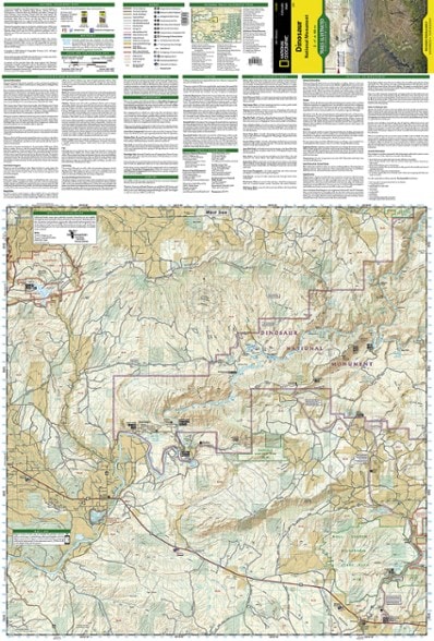
National Geographic Dinosaur National Monument Topographic Map
This product is not available.
With the Trails Illustrated Dinosaur National Monument topographic map in hand you can discover pieces of a long ago world where the largest land creatures of all time once roamed and died.
Shop similar products- Map features key points of interest including Dinosaur Quarry, Red Fleet State Park, Canyon of Lodore, Harpers Corner and the town of Dinosaur
- Map highlights many popular routes for scenic driving including Dinosaur Diamond, Harpers Corner, Tour of the Tilted Rocks, Browns Park and Jones Hole
- Features detailed topography with shaded relief, elevations, easy-to-read trails and clearly defined, color-coded boundaries for parks
- Also indicates wildlife study areas, public lands and areas of critical environmental concern
- Includes information about the region, its history and culture, geology and natural history
- Other features found on the map include: Canyon of Lodore, Diamond Gulch, Dinosaur, Douglas Mountain, Split Mountain and Yampa River
- For exploration by boat, the map includes river campsites, river mileage and access points along the Yampa and Green rivers
- Other recreation features noted include campgrounds, boat launches, interpretive trails, fishing access, scenic viewpoints and visitors centers
- Every Trails Illustrated map is printed on "Backcountry Tough" waterproof, tear-resistant paper
- A full UTM grid is printed on the map to aid with digital navigation
Made in USA.
View the National Geographic Trails Illustrated Product LineView all National Geographic Colorado Maps| Best Use | Hiking |
|---|---|
| State / Province | Utah Colorado |
| Folded Dimensions | 9.25 x 4.25 inches |
| Unfolded Dimensions | 37.75 x 25.5 inches |
| Map Scale | 1:75,000 |
| Double Sided | Yes |
| Waterproof | Yes |
| Publisher | National Geographic |
| Copyright Year | 2019 |
| Map Number | 220 |
Be the first to write a review!
Adding a review will require a valid email for verification

