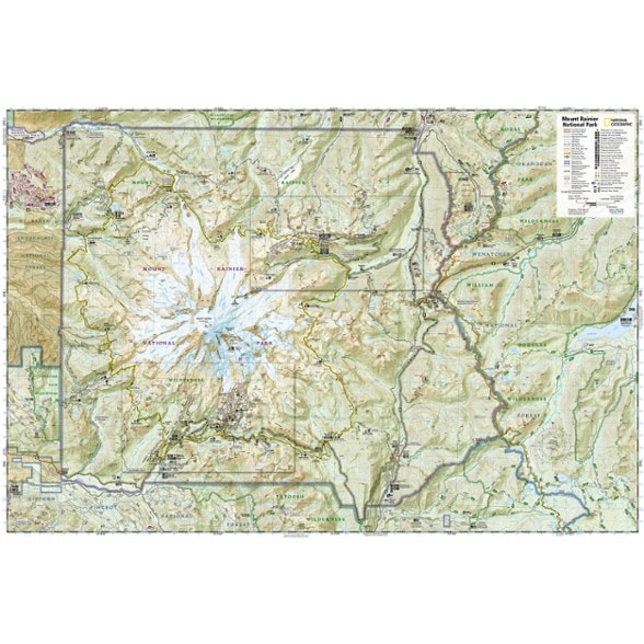
National Geographic Mount Rainier National Park Trail Map
This colorful Trails Illustrated folded map offers detailed coverage of Mount Rainier National Park in Washington State.
- Lists valuable wilderness tips and Leave No Trace guidelines, along with updated trails, trailheads, points of interest, campgrounds and much more
- Printed on waterproof, tear-resistant material with a plastic coating that offers supreme durability for your next outdoor adventure
- Includes selected waypoints in both lat./lon. and UTM coordinate systems as well as GPS-compatible UTM grid lines for easy navigation
- Measures 9.25 x 4.25 in. folded and 37.75 x 25.5 in. fully opened; scale of 1:55,000 and 1:27,500
- National Geographic Maps; copyright 1989 (revised 2003)
Made in USA.
View the National Geographic Trails Illustrated Product LineView all National Geographic Washington and Oregon Maps| Best Use | Hiking |
|---|---|
| State / Province | Washington |
| Map Number | 217 |
Write a Review
Adding a review will require a valid email for verification
Solid, but needs more details
We purchased this map for an overnight backpacking trip, as it's one of the few available for Mt. Rainier that has topo coverage. This map has nice coverage of Mt. Rainier and the trails around Paradise, but suffers from one huge flaw: it can't decide if it's a climbing map or a backpacking map. There's a nice detailed map on one side (1:27,500 as opposed to the main 1:55,000 map), which you'd hope focuses on trails, but instead it's a huge map of the mountain itself, with a few pieces of the Wonderland Trail and the Paradise trails skirting around the edge. Far more useful would be to have a detailed map of the Wonderland Trail and Paradise, even in sections. Instead you're left muddling with the 1:55,000 main map unless you're on a few specific sections of trail. It includes some great info - locations of backcountry campgrounds and details about Rainier backpacking procedures - but I could do with the huge infodump of the Leave No Trace ethics in full detail (don't mind them in summary), activities, interpretive trails, a history of the park, ten essentials, etc. This is part of the reason the map is so bulky and weighs so much! Also why it's so hard to fold. The map is waterproof, but unfortunately the ink rubs off easily, especially when you fold it, which you have to do given its size. It also smells really funky; I've used plenty of waterproof maps that smell fine, fold fine, and don't rub off, but this map fails at all of these things. Wish Tom Harrison made maps of Rainier! There are also a few topographical errors, but they're present on all maps of the region including the USGS quads. Still, makes navigating a pain in the rear. The map is at least easy to read; the contours are at 100' intervals, with bold lines every 500'; I find this a lot easier to read than the 400' bold/80' line setups. I have no idea how it works with a GPS, but it worked well with a compass. So - I bought it (and would again) because it's one of the few maps of the region and is easier to deal with than a set of USGS quad printouts. But if there were other options, this would be relegated to trip planning at home due to its bulk, weight, and the ink rubbing off.
Mt. Rainier Wall Chart
The map is excellent for planning at home or before leaving camp or a vehicle to hit the trail. Very detailed and much additional information about the park and mountain. I got one as a gift for a Florida friend who had never visited the PWN - before we drove around the entire loop road on a beautiful day. Including up to Sunrise and Paradise and White River trail head. She looked forward to using it to show family and friends on returning home, to assist her to describe the stops we made at all the scenic spots along the route.
Definitely waterproof
Used this map for the Wonderland Trail where it went down the Mowich River. The map stayed intact and no issues with fading.
Future Hike Planning
Have not used this product, but have used this product for other hikes and love the details
map of mount rainier national park
not much to say about a map other than it's a good map, very useful.
nice map with lots of detail
nice map with lots of detail and good quality for the outdoors
Wonderful Map
Nice feel, water proof, lots of detail, what else need I say?

