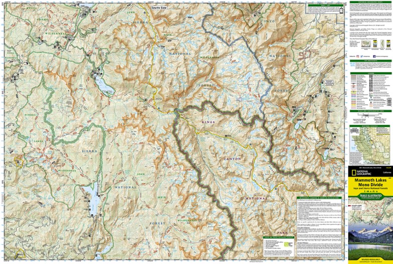
National Geographic Mammoth Lakes and Mono Divide Trail Map
This detailed Trails Illustrated folded map offers colorful, comprehensive coverage of Mammoth Lakes and Mono Divide in California.
- Lists valuable wilderness tips and Leave No Trace guidelines, along with updated trails, trailheads, points of interest, campgrounds and much more
- Printed on waterproof, tear-resistant material with a plastic coating that offers supreme durability for your next outdoor adventure
- Includes selected waypoints in both lat./lon. and UTM coordinate systems as well as GPS-compatible UTM grid lines for easy navigation
- Measures 9.25 x 4.25 in. folded and 37.75 x 25.5 in. fully opened; scale of 1:63,360
- National Geographic Maps; copyright 2008
Made in USA.
| Best Use | Hiking |
|---|---|
| State / Province | California |
| Map Number | 809 |
Write a Review
Adding a review will require a valid email for verification
Customer Images
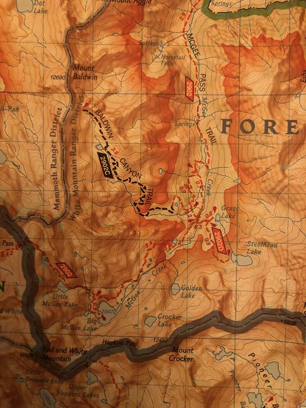
Red topo and trail lines are horrible
National Geographic provided a solution for a problem that did not exist and just about ruined these maps. They made hiker/horse trails red dashed lines and they are almost impossible to distinguish from the higher elevation topo lines that they made, get this, red too. Red was not needed in either instance and the maps is hard to read (think headache) in bright light let alone low light conditions. The yellow highlighted John Muir Trail is almost impossible to find in places. The black lines were way better. I could care less about whether a trail is horse/hiker or hiker only and can find that information elsewhere if I need it. These used to be the standard, not anymore. I tried a Calico Central Sierra map and think that is much better.
Trail information out of date
I bought this map for a backpacking trip in the John Muir Wilderness north of Lake Thomas Edison. A number of the trails around Silver Divide have been abandoned and are not maintained nor have trail markings. The legend on this map indicates Hike/Horse Trail and Primitive Trail by different colored dashed lines, however, the abandoned trails in this region are shown as Hike/Horse trails -- the same indication as trails in active use. This led to several days of bushwhacking and difficult trail navigation. I would not recommend relying on this map.
nice quality
Great map as far as quality and feel. It has good side information, particularly about bears. It certainly helped me get a better lay of the land especially the lakes and passes. At 1:63,000 scale this map is not the best for details or compass map navigation. However, it gives a good reference to the overall area.
A must have item for your backcountry travels
This has long been one of my very favorite backpacking area choices. This map is very easy to read and includes a lot of additional information about the area that most other maps do not have. The added main bonus is that they are waterproof and tear resistant so you don't have to worry about referring to it in bad weather and high winds.
Not up to date at all !
Some of the trails that we based our plans on for this back packing trip do not exist anymore. We send our back packing box to Lake Edison to provide for our last week but never made it there because after two days (out of four) there was no more trail! We had to come back, re-supply an go a different direction.


