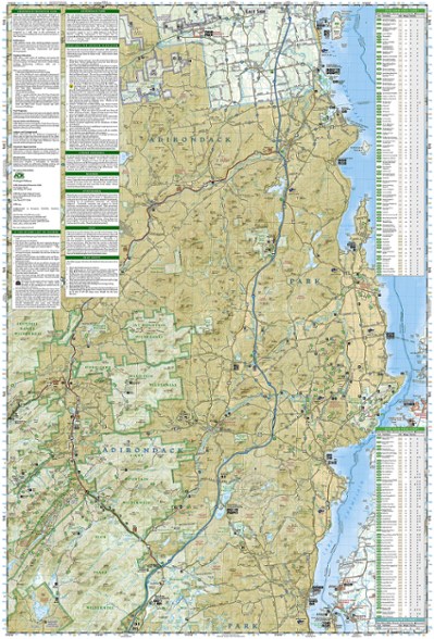
National Geographic Adirondack Park - Lake Placid/High Peaks Trail Map
This product is not available.
This National Geographic Trails Illustrated folded map offers comprehensive coverage of Adirondack Park's Lake Placid and High Peaks in New York.
Shop similar products- Provides valuable wilderness tips and Leave No Trace guidelines, along with updated trails, trailheads, points of interest, campgrounds and much more
- Printed on waterproof, tear-resistant material with a plastic coating that offers the durability needed for outdoor use
- Includes selected waypoints in both lat./lon. and UTM coordinate systems as well as GPS-compatible UTM grid lines for easy navigation
- Measures 9.25 x 4.25 in. folded and 37.75 x 25.5 in. fully opened; scale of 1:75,000
- National Geographic Maps; copyright 2004
Made in USA.
View the National Geographic Trails Illustrated Product LineView all National Geographic New England and Mid-Atlantic Maps| Best Use | Hiking |
|---|---|
| State / Province | New York |
| Map Number | 742 |
Write a Review
Adding a review will require a valid email for verification
Shows most trails and lean-to's
I have the whole set for the Adirondack Park and are very helpful choosing a backpacking trip. I can figure out how many miles I need to walk before I get to a shelter for the night.
Adirondack Park map
Great map with lots of details. I'm going to be using it next weekend for a 3 day backpack trip!

