


National Geographic Glacier/Waterton Lakes National Parks Trail Map
This Trails Illustrated folded map offers comprehensive coverage of Glacier and Waterton Lakes national parks in Montana and Alberta.
- Lists wilderness tips and Leave No Trace guidelines, along with trails, trailheads, points of interest, campgrounds, geologic history and much more
- Printed on waterproof, tear-resistant material with a plastic coating that offers supreme durability for your next outdoor adventure
- Includes selected waypoints in both lat./lon. and UTM coordinate systems as well as GPS-compatible UTM grid lines for easy navigation
- Measures 9.25 x 4.25 in. folded and 37.75 x 25.5 in. fully opened; scale of 1:100,000
- National Geographic Maps; copyright 1989 (revised 2004)
Made in USA.
View the National Geographic Trails Illustrated Product LineView all National Geographic Canada Maps| Best Use | Hiking |
|---|---|
| State / Province | Alberta |
| Map Number | 215 |
Write a Review
Adding a review will require a valid email for verification
Customer Images
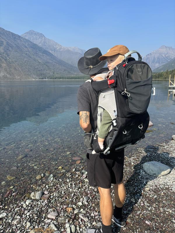
Hiking Montana
Hello, we recently eloped to Montana with our 2 year old daughter! We used the Osprey poco carrier and it made the trip a special experience! Being able to strap her in and hike hands free was perfect!
Great Map
This is a great map, very detailed. The material seems very durable.
A map that withstands anything
Tear resistant and water resistant can't get much better than that. Proved tough throughout time in Glacier. Very informational as far as were suspension bridges, snowfields, and fords are. Folded and refolded in many ways and still held up through the whole trip. Excellent for using UTM.
Detailed & Durable
As with all of the National Geographic field maps, this map is manufactured with high quality weather & tear resistant materials. This coupled with the highly detailed contour map details & illustration, makes this map an invaluable tool for backcountry navigation.
REI Travelers
REI is our go-to store for Nat Geo maps. Our next adventure (2026) is to Glacier. This means we will be visiting our local REI a lot. Can't wait to think of something we need so we can visit in person. Always an adventure. Keep up the good work.
Amazing Trail Maps
These maps are very detailed, and as well durable! The information provided is easy to read and intuitive, you won't get lost. The entire thing is made of a plastic material so water, dirt, etc. won't mess it up.
Great Map
Obviously bought this map for a trip to Glacier. Used it a lot while there! The park rangers will give you a map of the park/trails but this one is much better and the one we used. Very glad I bought it.
Tracking
This map was vey helpful to have when backpacking Glacier for 2 weeks. It even allowed to see the hidden gem trails of Glacier. Harder to get to hidden gem but was worth it in the end
Very accurate map
We used it as a road map and for hiking. Very accurate and precise. It’s also very durable for the number of times we folded and unfolded it in all the sections we were hiking.
Great overview map of Glacier for trip planning.
This is what I used to plan the trip. For the actual hike I will get more zoomed in topo maps. I think they are called 7.5 minute maps?