Purple Lizard Maps Loyalsock Pennsylvania State Forest Map
This product is not available.
A real map for people who love real-world experiences, the Purple Lizard Maps Loyalsock map will help you plan all your adventures in and around Loyalsock State Forest and Worlds End State Park.
Shop similar products- A beautifully designed, easy-to-read topographic map featuring contour lines, elevation data, shaded relief and all the key details you need to plan your adventures
- Highlights public trails and paths including hiking, biking, equestrian, skiing and rail trails managed by federal, state and local authorities
- Shows which roads are paved, dirt/gravel and/or gated—perfect for bicyclists, dual sport riders and overlanders putting together a remote backcountry route across public lands
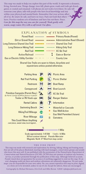
- Shows points of interest such as campgrounds, picnic areas, river access, boat launches, primitive car camping sites, scenic overlooks, waterfalls and "lizard spots"
- The little purple lizards you'll find scattered on the map signify interesting spots to check out—cool places, sweet views, local legends, etc.
- Map is durable, waterproof and folds down small to fit in your back pocket
- Includes both latitude/longitude and UTM coordinate systems
- Covers all of Loyalsock State Forest and Worlds End State Park; sections of State Game Lands 12, 13, 133, 134 and 298; McIntyre Wild Area and Devils Elbow Natural Area
- Rider Park Trails, Kettle Creek Gorge Natural Area, Conklin Run Wilderness Area, Glacier Pools Preserve and the PA Fish and Boat Commission's Hunters Lake and Rose Valley Lake
- Loyalsock Creek, Haystack Rapid, Bear Wallow Pond, Sones Pond, historic CCC camps, numerous waterfalls, cascades and vistas throughout the trails system and roads
- Covers the 59 mi. Loyalsock Trail, one of the best point-to-point remote backpacking trails in the state, and the complete Old Loggers Path, a 27 mi. backpacking loop
- Covers the Lycoming Creek Bikeway, Susquehanna River Walk, Loyalsock Bikeway and Montoursville Bikeway—located near Williamsport and the West Branch of the Susquehanna River
- The Susquehanna Water Trail is shown from mile 44 at Susquehanna State Park to mile 28 at the confluence with Muncy Creek
- Covers McIntyre Wild Area, Devils Elbow Natural Area, Rider Park Trails, Kettle Creek Gorge Natural Area, Conklin Run Wilderness Area, and Glacier Pools Preserve
- Covers towns of Dushore, Eagles Mere, Ellenton, Forksville, Laporte, Loyalsockville, Montoursville, Ogdonia, Picture Rocks, Shunk, Sonestown, Trout Run and Williamsport, PA
Made in USA.
View all Purple Lizard Maps New England and Mid-Atlantic Maps| Best Use | Travel Hiking |
|---|---|
| Folded Dimensions | 8 x 4 inches |
| Unfolded Dimensions | 36 x 24 inches |
| Map Scale | 1:47,550 |
| Double Sided | Yes |
| Waterproof | Yes |
| Publisher | Purple Lizard Maps |
| Copyright Year | 2020 |
| State / Province | Pennsylvania |
Write a Review
Adding a review will require a valid email for verification
Durable and reliable
Purple Lizard maps are my favorite, I have 3 of them so far. They are built to last and take some abuse on the trail - no need to worry about them getting ruined from some moisture.
Great Maps, well worth the money!
I would agree with the other reviewer if you were looking for a map/guidebook for the Loyalsock Trail, then purchase the guidebook from the Alpine Club, or for that matter any thru hike, pick up the appropriate guidebook. However, this Purple Lizard map is for the Loyalsock State Forest, not just the LT. I have several and they are great maps. I frequent this state forest and this map has helped me plan out many hikes (not just on the LT) and find some cool places.
Stop wasting Money!
This PL map is just a combination of FREE maps offered by the DNC. If you would like a map(much better) purchase the guide book from the Alpine Club of Williamsport. The $$ goes directly to help maintain the trail! Unlike PL maps.

