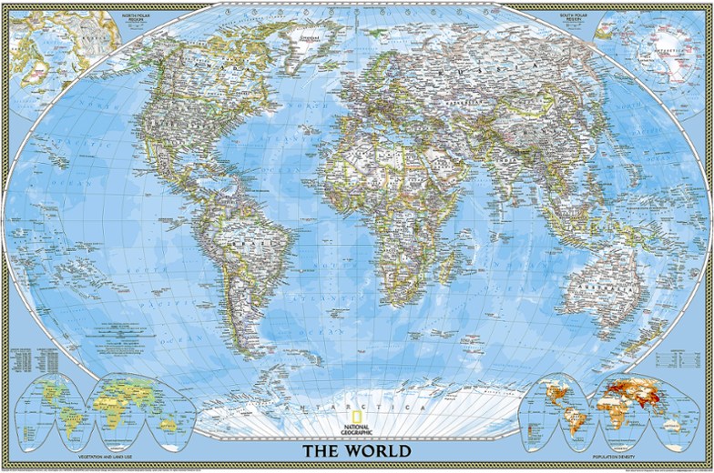
National Geographic World Map - Folded
Setting the standard by which all other reference maps are measured, the folded National Geographic World Map is meticulously researched and uses a bright, easy-to-read color palette.
- World map adheres to the National Geographic convention of independent, apolitical decisions based on extensive research using multiple authoritative sources
- Bright, easy-to-read color palette features the blue oceans and stunning shaded relief that have been featured on National Geographic wall maps for over 75 years
- Thousands of place names are carefully and artistically placed on the map to maintain legibility, even in the heavily populated areas of Europe, Asia and the Middle East
- Details include clearly defined international boundaries, cities, physical features, rivers and ocean floor features
- Corner inset maps feature vegetation and land use, population density, and the north and south polar regions
- One entire side is dedicated to World Facts and Flags, with vital statistics such as area, population, capital cities and GDP per capita
- Printed on durable synthetic paper that's waterproof, tear-resistant and tough—capable of withstanding enthusiastic kids and repeated folding without ripping at the seams
- Your purchase helps support the National Geographic Society nonprofit's mission of research, education, conservation and exploration
Made in USA.
View all National Geographic Asia Maps| Best Use | Travel |
|---|---|
| Folded Dimensions | 9.25 x 4.25 x 0.3 inches |
| Unfolded Dimensions | 37.75 x 25.5 inches |
| Map Scale | 1:37,213,000 |
| Double Sided | Yes |
| Waterproof | Yes |
| Publisher | National Geographic |
| Copyright Year | 2019 |
Write a Review
Adding a review will require a valid email for verification
Impractical & not laminated
I was seeking a laminated world wall map - not for use while traveling, but to mark where I have been and for general reference. This option seemed like a long shot but since it said ‘waterproof’ and is from Nat Geo, was worth a try. It is thin, treated paper but not laminated so any markings you make would be permanent. Since it is a folded map one can assume the intended purpose is for the car/glove compartment or backpack; but that is impractical bcos a map of the entire world is not useful for a road or backpacking trip. Hence I am unclear how this particular map could be useful for anyone.
World Map for Reference
World Map for Reference of places around the world. Just wanted an updated map for future vewing
Great quality world map!
Great quality map! Gotta buy a new one every few years because the world keeps changing!
Map is great
Exactly what I was looking for and shipped quickly

