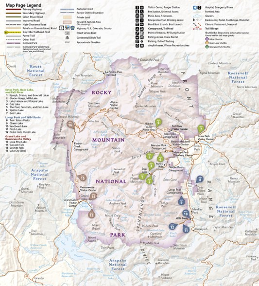
National Geographic Rocky Mountain National Park Day Hikes Topographic Map Guide
This product is not available.
Durably made from waterproof and tear-resistant material, National Geographic Rocky Mountain National Park Day Hikes map guide features 16 diverse hiking routes to explore in rich topographic detail.
Shop similar products- Each hike has a detailed map, trail profile stating the elevation changes, and a summary of the interesting features you'll encounter along the way
- UTM grid is printed on the map to make navigation easier
- Explore some of the more interesting features in the region, like Ouzel Falls and Calypso Falls in the Wild Basin and the historic prospecting site of Lulu City
- Your purchase helps support National Geographic Society's nonprofit mission of research, education, conservation and exploration
Made in USA.
View the National Geographic Trails Illustrated Product LineView all National Geographic Colorado Maps| Best Use | Hiking |
|---|---|
| State / Province | Colorado |
| Folded Dimensions | 9.25 x 4.25 x 0.3 inches |
| Map Scale | 1:50,000 |
| Double Sided | Yes |
| Waterproof | Yes |
| Publisher | National Geographic |
| Copyright Year | 2020 |
| Map Number | 1701 |
Write a Review
Adding a review will require a valid email for verification
Very Helpful Map
The map was extremely useful for planning which trails to hike. The trail data was helpful to assess the difficulty of each trail.

