National Geographic Pacific Crest Trail Topographic Map Guide: Klamath Mountains
This product is not available.
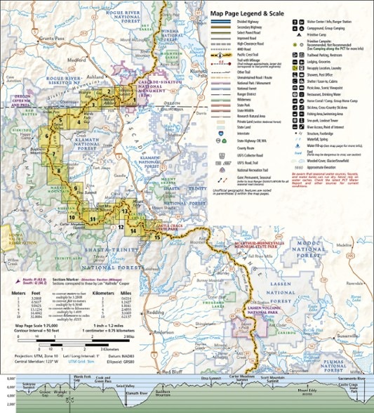
From Siskiyou Summit to Castle Crags, this Trails Illustrated Pacific Crest Trail topographic map guide covers the wildflower-dotted meadows and conifer forests of the Klamath Mountains.
Shop similar products- Map guide 5 of 11 covers miles 1,735–1,490 of the Pacific Crest Trail at a scale of almost 1 inch : 1 mile
- Each page is centered on the PCT and overlaps with the adjacent pages to reduce chances of getting lost
- Along the bottom of each page is a trail profile that shows the distance between camping areas, trailheads and other points of interest
- Maps and trail profiles provide a step-by-step visual guide to hiking the trail, mile by rugged mile
- This map booklet is convenient and easier to use than folded maps, but just as compact and lightweight
- Ideal for all levels of hiking enthusiasts, from day-trippers to multimonth thru-hikers
- Front pages include resupply locations, health and safety information and much more
- Printed in the USA on durable, lightweight, waterproof and tear-resistant material that's designed to withstand all weather conditions
Made in USA.
View the National Geographic Trails Illustrated Product LineView all National Geographic California Maps| Best Use | Backpacking |
|---|---|
| Folded Dimensions | 9.25 x 4.25 x 0.1 inches |
| Map Scale | 1:75,000 |
| Double Sided | Yes |
| Publisher | National Geographic |
| Copyright Year | 2019 |
| State / Province | California |
| Map Number | 1006 |
Be the first to write a review!
Adding a review will require a valid email for verification

