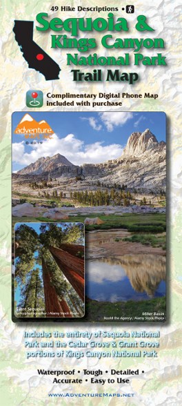

Adventure Maps Sequoia & Kings Canyon National Park Trail Map
Design your own Californian national park adventure with this Adventure Maps Sequoia & Kings Canyon National Park topographic trail map. It comes with a matching digital map for use on your phone.
- Covers the areas of Sequoia National Park in its entirety and the Grant and Cedar Grove portions of Kings Canyon National Park
- Features insets/closeups of Cedar Grove, Grant Grove, Lodgepole, Giant Forest and Mineral King
- Includes descriptions for 49 hikes ranging from short jaunts suitable for the entire family to all-day epics
- Thoroughly researched and updated frequently, this easy-to-read topographic (lat/long, UTM grids) map is waterproof, tough, detailed and accurate
- Includes matching digital map for use on phone; no need for cell service to use it once it's been downloaded
Made in USA.
View all Adventure Maps California Maps| Best Use | Hiking |
|---|---|
| Folded Dimensions | 9.75 x 4 x 0.25 inches |
| Unfolded Dimensions | 39 x 27 inches |
| Map Scale | 1:80,000 & 1:31,680 |
| Double Sided | Yes |
| Waterproof | Yes |
| Publisher | Adventure Maps, Inc. |
| Copyright Year | 2019 |
| State / Province | California |
Write a Review
Adding a review will require a valid email for verification
Overall good resource for planning day hikes
Great quality map with topo lines and trails covering the entire park. I bought this map to use in planning various hikes within the parks. I loved that it had numbers for each of the hikes with descriptions and mileages for each trail in a separate place for reference. I also loved that it had each major section of the park blown up separately so that it was much easier to find things. The one thing I did find a bit frustrating was that the trails were at times hard to follow (i.e., this trail continues on here vs turning that way, etc.) and the trail names were largely missing on the map portion (only the particular hike number corresponding to a particular loop or trail was there).
Fair quality
Map includes some labels that don't exist on usgs, usfs or any other maps, and that don't show up on any internet searches. This leads me to wonder whether they just made some of it up. If you're just looking for a decent overview map for trip planning, this will do the job. Tom Harrison maps are generally better quality and contain more features like the altitudes of trail junctions.