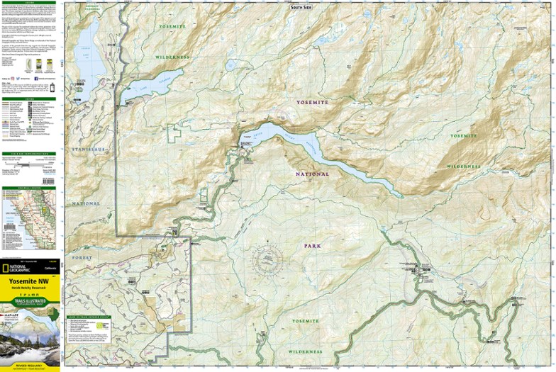
National Geographic Yosemite NW: Hetch Hetchy Reservoir Topographic Map
Offering comprehensive coverage of northwestern Yosemite National Park, the Trails Illustrated Yosemite NW: Hetch Hetchy Reservoir topographic map provides excellent detail of this magnificent region.
- Coverage extends from the park's northwestern border to the White Wolf area
- Key points of interest include Lake Eleanor, Grand Canyon of the Tuolumne River, Tilden Lake and Pate Valley; also includes Emigrant Wilderness in Stanislaus National Forest
- Expertly researched and created in partnership with the National Park Service, U.S. Forest Service and others
- Precisely mapped trails with mileage markers let you get off the beaten path; includes portions of the Pacific Crest Trail and John Muir Trail
- Provides valuable wilderness tips and Leave No Trace guidelines, along with updated trails, trailheads, points of interest, campgrounds and much more
- To aid navigation, the map includes contour lines, elevations, labeled peaks and summits, water features and selected waypoints
- Marked recreation features include campgrounds, campsites, fee stations and ski areas; ranger stations are clearly marked
- Also includes camping, hiking, wilderness permit and safety information
- Every Trails Illustrated map is printed on "Backcountry Tough" waterproof, tear-resistant paper
- A full UTM grid is printed on the map to aid with GPS navigation
- Measures 7.5 x 4.25 in. folded and 36 x 22 in. fully opened; scale of 1:40,000
Made in USA.
View the National Geographic Trails Illustrated Product LineView all National Geographic California Maps| Best Use | Backpacking |
|---|---|
| State / Province | California |
| Folded Dimensions | 7.5 x 4.25 inches |
| Unfolded Dimensions | 36 x 22 inches |
| Map Scale | 1:40,000 |
| Double Sided | Yes |
| Waterproof | Yes |
| Publisher | National Geographic |
| Copyright Year | 2019 |
| Map Number | 307 |
Write a Review
Adding a review will require a valid email for verification
Yosemite Hiker
Great maps, can either purchase the large scale map that covers the entire park or 4 maps that cover the park in quarters. Waterproof, excellent detail, great for planning trips.

