National Geographic Pacific Crest Trail Topographic Map Guide: Washington South
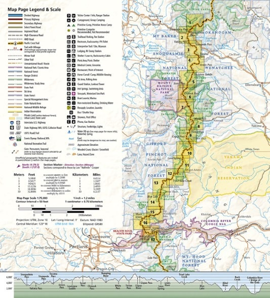
Lightweight, convenient and easier to read than folded paper maps, this Topographic Map from National Geographic follows the Washington South portion of the Pacific Crest Trail.
- Map guide 2 of 11 covers miles 2,393 to 2,147 of the PCT, from Snoqualmie Pass to Cascade Locks, at a scale of almost 1 inch : 1 mile
- Made for all levels of hiking enthusiasts, from the day tripper to the thru-hiker
- The front pages of the printed topographic map guide include resupply locations, health and safety information, and much more
- Each page is centered on the PCT and overlaps with the adjacent pages so there is little chance of getting lost
- Along the bottom of each page is a trail profile that shows the distance between camping areas, trailheads and other points of interest
- The map and trail profile provide a step-by-step visual guide to hiking the trail, mile by rugged mile
- Waterproof, tear-resistant and backcountry tough
- A full UTM grid is printed on the map to aid with GPS navigation
Made in USA.
View all National Geographic Washington and Oregon Maps| Best Use | Backpacking |
|---|---|
| Folded Dimensions | 9.25 x 4.25 inches |
| Map Scale | 1:75,000 |
| Double Sided | Yes |
| Waterproof | Yes |
| Publisher | National Geographic |
| Copyright Year | 2019 |
| State / Province | Washington |
| Map Number | 1003 |
Write a Review
Adding a review will require a valid email for verification

