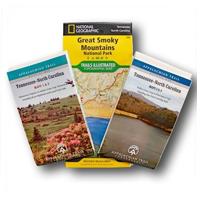
Appalachian Trail Conservancy Appalachian Trail Tennessee-North Carolina Guidebook and Maps Set
Plot your thru-hike with the Tennessee-North Carolina guidebook and maps set. It covers 302 miles of the Appalachian Trail from Damascus, VA to Fontana Dam, NC with a pocket guide and durable maps.
- Pocket-size planning guide contains background information, points of interest and general advice; omnidirectional format includes shelters, water sources and road crossings
- Provides long- and short-distance hiking info to help you know where you are, what went here before you, how to get to where you want to go and how to get help if you need it
- Includes 4 water- and tear-resistant, 7-color maps on 2 sheets (1:63,360 scale) and a National Geographic map of Great Smoky Mountains National Park (1:62,500 scale).
- Maps 1 and 2 cover Damascus, VA to Indian Grave Gap, TN and include Roan Highlands and Laurel Fork Falls
- Maps 3 and 4 cover Indian Grave Gap to Davenport Gap, including Max Patch and Big Bald
- With 100 ft. contour intervals, each map focuses on the Appalachian Trail and overlaps with the neighboring maps; they include surrounding areas and side trails
- Easy-to-use elevation profile shows the distance to the next campsite or shelter, side trails and water sources; road crossings, waterfalls and scenic areas are also indicated
- Set also includes a Trails Illustrated Great Smoky Mountains National Park map; it offers 1:70,000-scale topographic detail with 50 ft. contour intervals
- Set is packaged in a resealable plastic bag so you can choose whether to take the guidebook or maps—or both—on the trail
- Official Appalachian Trail guidebook and map sets provide up-to-date descriptions of each part of the legendary trail as it meanders more than 2,189 mi. from Maine to Georgia
Made in USA.
View the Appalachian Trail Conservancy Trails Illustrated Product LineView all Appalachian Trail Conservancy Appalachian Trail Hiking Guidebooks| Best Use | Hiking |
|---|---|
| Dimensions | 11 x 6.75 inches |
| Author(s) | Vic Hasler |
| Number of Pages | 317 |
| Format | Paperback |
| ISBN-13 | 9781889386980 |
| Publisher | Appalachian Trail Conservancy |
| Copyright Year | 2016 |
Write a Review
Adding a review will require a valid email for verification
ATC maps for hiking the AT
The ATC maps are in my opinion better detailed for any AT hikes than the Nat Geo maps. Better water source marking and shelter and tent sites. Profile map of terrain also with mileage markers. If you want more Lat. and Longitude markings for orienteering and compass work and contour markings go with the Nat Geo Maps.
APPALACHIAN TRAIL MAPS
I needed a couple maps to plan my next section hike on the AT and REI is the place to go get them

