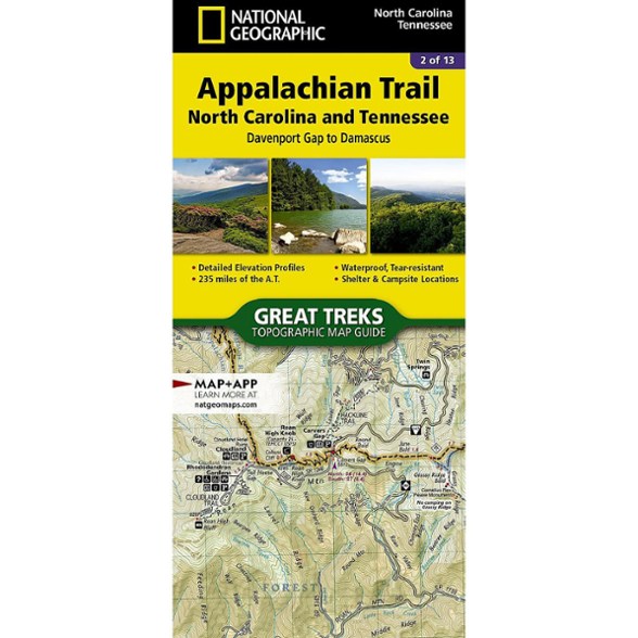


National Geographic Appalachian Trail: North Carolina and Tennessee Topographic Map Guide
$14.95
Hike the North Carolina and Tennessee sections of the Appalachian Trail. This National Geographic map covers the A.T. from Davenport Gap to Damascus.
- Unique, user-friendly booklet format contains detailed topographic maps centered on the trail, page by page, mile by mile
- Helpful trail profiles show the distance between shelters, camping areas and trail access points
- Features resupply locations, key points of interest, safety guidelines, local contact information, area history and more
- Printed on durable, lightweight, waterproof and tear-resistant material designed to withstand all weather conditions
Made in USA.
View all National Geographic Southeast Maps| Best Use | Backpacking |
|---|---|
| State / Province | North Carolina Tennessee |
| Folded Dimensions | 9.25 x 4.25 inches |
| Map Scale | 1:63,360 |
| Publisher | National Geographic |
| Copyright Year | 2015 |
| Map Number | 1502 |
Write a Review
Adding a review will require a valid email for verification
Location:Ft Myers Fl
7 years ago
At
Yes , I recommend this product
Can’t wait to use this on my next section hike of the AT. Like the elevation map at the bottom.
Age:55–64
4 years ago
Age:55–64
6 years ago