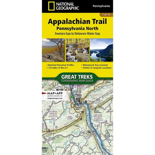


National Geographic Appalachian Trail: Pennsylvania North Topographic Map Guide
Hike the northern Pennsylvania section of the Appalachian Trail. This National Geographic map covers the A.T. from Swatara Gap to Delaware Water Gap.
- Unique, user-friendly booklet format contains detailed topographic maps centered on the trail, page by page, mile by mile
- Helpful trail profiles show the distance between shelters, camping areas and trail access points
- Features resupply locations, key points of interest, safety guidelines, local contact information, area history and more
- Printed on durable, lightweight, waterproof and tear-resistant material designed to withstand all weather conditions
Made in USA.
View all National Geographic New England and Mid-Atlantic Maps| Best Use | Backpacking |
|---|---|
| State / Province | Delaware Pennsylvania |
| Folded Dimensions | 9.25 x 4.25 inches |
| Map Scale | 1:63,360 |
| Publisher | National Geographic |
| Copyright Year | 2015 |
| Map Number | 1507 |
Write a Review
Adding a review will require a valid email for verification
Great "bird's eye" Trail information.
I NEVER hike the Appalachian Trail without one and you shouldn't either and I'll tell you why! These waterproof map pamphlets are an excellent source of information that may help you in an emergency. I hike the AT and use updated 'AWOL' guides which are also very informative but for example, "At NOBO AT mileage xxxx.x On left is a blue blazed trail called XYZ". By also looking at the Nat Geo section pamphlet, you see that the blue blaze leads to a Forest Service Road that leads to a parking lot on US highway XX Pretty good information to have and they weigh little and comprise 200-300 mile sections so you only need to carry one, or maybe two for any hike. 100% THE BEST PIECE OF GEAR I OWN
Nearly worthless
If you are looking to go hiking, stop considering these maps. They are challenging to orient to and lacking lots of important information. I tried to buy some greentrails maps from my local REI, but they were out of stock of the ones that I needed. I thought that I would give these NatGeo ones a try, and it was a mistake. I have since gone and paid for shipping on the greentrails maps that I needed and am planning to return the NatGeo maps that I bought.
Excellent map to have on the AT
A must for anyone on the AT especially when traversing "Rocksylvania".