

National Geographic Moab Day Hikes Map Guide
$14.95
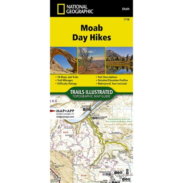
Explore Moab on foot with this National Geographic map guide. It covers a large area of northeast Utah, including Canyonlands National Park and Arches National Park. The guide includes 18 maps.
- From Jurassic-era dunes and prehistoric petroglyphs, to amber-tinted cliffs and spires, Moab offers a plethora of options for every type of traveler
- Covers a large area of northeast Utah including 2 national parks (Canyonland and Arches), as well as Dead Horse Point State Park, Manti-La Sal National Forest and BLM land
- Moab Day Hikes contains detailed maps for 18 of Moab's finest day hikes
- Includes well-known hikes and some off-the-beaten-path trails; they range from easy strolls to strenuous climbs, selected to give you a sampling of all the region has to offer
- Together, the hikes cover more than 70 miles of adventures; two-thirds of the selected hikes are less than 5 miles long and 1 hike is 8 miles long
- Each of the 18 maps include directions to the trailhead, the total distance to complete the hike and an estimate of the degree of difficulty
- Also provided are elevations of key points on the trail, an elevation profile for the hike and a calculation of the hike's total elevation gain
- Concise trail descriptions will help you find the hikes that best suit your interests, conditioning and available time
- Every Day Hikes map is printed on "Backcountry Tough" waterproof, tear-resistant paper
- Every map purchase helps support the National Geographic Society, an impact-driven nonprofit organization with global reach
- National Geographic Society uses the power of science, exploration, education and storytelling to illuminate and protect the wonder of our world
Made in USA.
View all National Geographic Mountain West Maps| Best Use | Hiking |
|---|---|
| State / Province | Utah |
| Folded Dimensions | 9.25 x 4.25 inches |
| Unfolded Dimensions | Booklet: 9.25 x 8.5 inches |
| Map Scale | 1:35,000 |
| Double Sided | Yes |
| Waterproof | Yes |
| Publisher | National Geographic |
| Copyright Year | 2024 |
| Map Number | 1718 |
Be the first to write a review!
Adding a review will require a valid email for verification