

Benchmark Maps Maine Recreation Map
$9.95
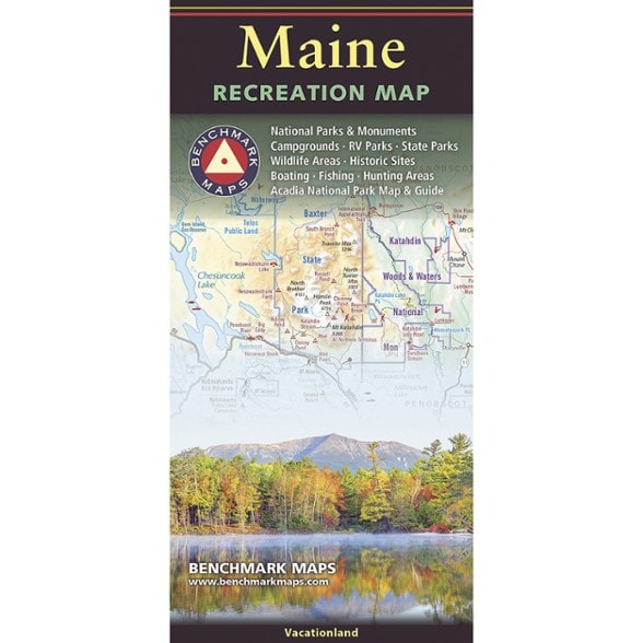
Plan your trip to the summit of Mount Katahdin or the shores of Mount Desert Island with this map from Benchmark Maps. It showcases Maine's unique geography in gorgeous detail.
- Map side covers the entire state with extensive highway road detail, points of interest, public land boundaries and elevation tints overlaid on beautiful shaded relief
- Reverse side features categorized recreation listings for parks, forests, campgrounds, fishing spots and more
- Also includes a dedicated map and guide for Acadia National Park
Imported.
View all Benchmark Maps New England and Mid-Atlantic Maps| Best Use | Travel |
|---|---|
| State / Province | Maine |
| Folded Dimensions | 9 x 4.25 inches |
| Unfolded Dimensions | 38.25 x 27 inches |
| Map Scale | 1:190,080 |
| Double Sided | Yes |
| Publisher | Benchmark |
| Copyright Year | 2026 |
Be the first to write a review!
Adding a review will require a valid email for verification