

National Geographic Bryce Canyon Day Hikes Map Guide
$14.95
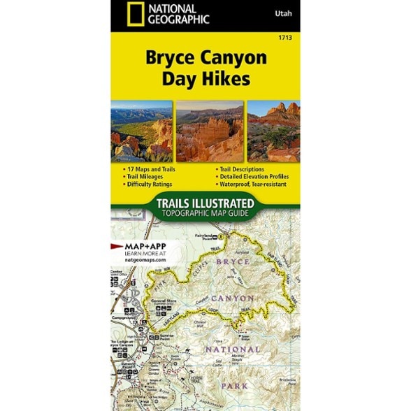
Explore Bryce Canyon with this National Geographic Trails Illustrated map guide. You'll discover vibrant red rock formations, vast wilderness and rich geological history. The guide has 17 day hikes.
- This area offers a plethora of options for every type of traveler, from hiking and biking to stargazing under the Milky Way
- Bryce Canyon National Park is famous for its unique hoodoos (thin spires of rock), but there is much more to see in the surrounding public lands
- Explore the spruce forests of the Paunsaugunt Plateau, admire the various geologic layers of the Grand Staircase, or hike the canyons of Bull Valley Gorge
- The Bryce Canyon Day Hikes Topographic Map Guide contains detailed maps for 17 of Bryce Canyon's finest day hikes
- Includes well-known hikes and some off-the-beaten-path trails; they range from easy strolls to strenuous climbs, selected to give you a sampling of all the park has to offer
- Together, they cover almost 70 miles of adventures
- One-third of the selected hikes are less than 3 miles long, two-thirds are less than 6 miles, and 2 hikes are longer than 8 miles
- Each of the 17 maps include directions to the trailhead, the total distance to complete the hike ,and an estimate of the degree of difficulty
- Also provided are elevations of key points on the trail, an elevation profile for the hike, and a calculation of the hike's total elevation gain
- Concise trail descriptions will help you find the hikes that best suit your interests, conditioning and available time
- Every Trails Illustrated map is printed on "Backcountry Tough" waterproof, tear-resistant paper
- A full UTM grid is printed on the map to aid with GPS navigation
- Every map purchase helps support the National Geographic Society, an impact-driven nonprofit organization with global reach
- National Geographic Society uses the power of science, exploration, education and storytelling to illuminate and protect the wonder of our world
Made in USA.
View the National Geographic Trails Illustrated Product LineView all National Geographic Mountain West Maps| Best Use | Hiking |
|---|---|
| State / Province | Utah |
| Folded Dimensions | 9.25 x 4.25 x 0.5 inches |
| Map Scale | 1:31,680 |
| Double Sided | Yes |
| Waterproof | Yes |
| Publisher | National Geographic |
| Copyright Year | 2025 |
| Map Number | 1713 |
Be the first to write a review!
Adding a review will require a valid email for verification