

Garmin eTrex Touch
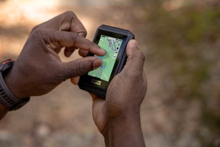
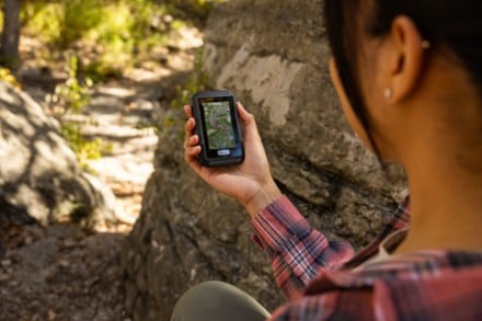
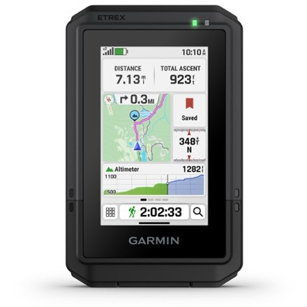
Tap into adventure with the rugged, easy-to-use Garmin eTrex® Touch. This GPS navigator has a bright, high-res color touch screen that's readable in sunlight. Swipe and zoom to follow your route.
- With an IP67 water rating, the rugged, easy-to-use eTrex® Touch GPS handheld navigator is purpose-built for exploration in any weather
- Bright, 3 in., high-resolution color touch screen is readable in sunlight so you don't miss a detail
- Compact and lightweight
- Preloaded with detailed maps for roads and trails so you can easily swipe and zoom to follow your route
- Maps include terrain contours, topographic elevations, summits, parks, coastlines, rivers, lakes and geographical points
- View thousands of points of interest, including geographic labels, shops, restaurants, schools and community places
- Option to purchase an Outdoor Maps+ plan from Garmin (not included) adds ongoing access to premium map content you can download via Wi-Fi
- Compatible with the Garmin Explore™ mobile app to plan and review trip data on your smartphone or tablet; also manage your waypoints, courses and activities
- Popularity routing helps you navigate the best routes
- Round-trip routing allows you to enter a distance you want to travel for route suggestions that will bring you back to where you started
- Ascent planning shows upcoming climbs on your route, when they will occur, and how steep they will be
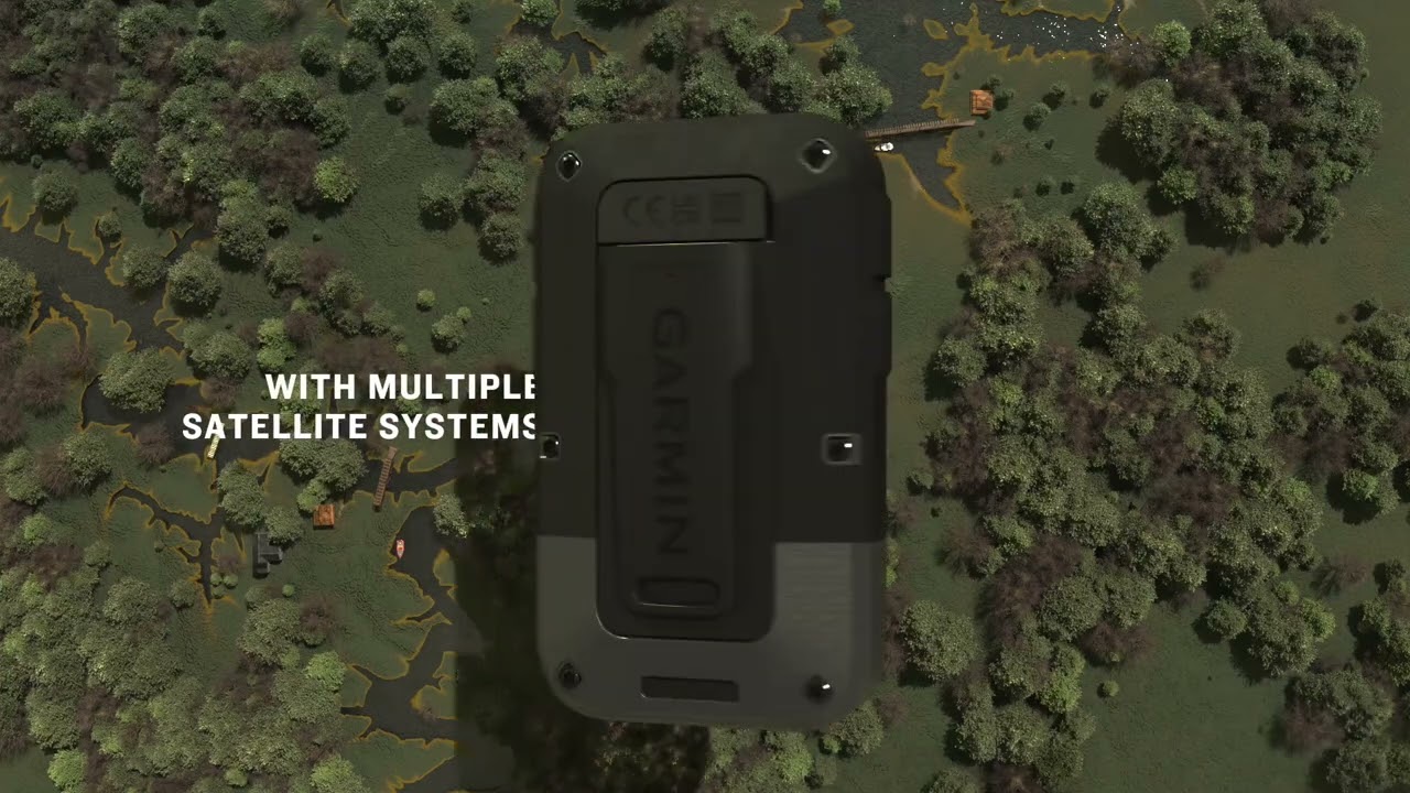
- Up to 130 hrs. of battery life in All Satellite Systems + Multiband mode (assuming typical use with SatIQ™ tech) and up to 650 hrs. in Expedition mode
- Multiband GPS support provides optimal positional accuracy, so you know exactly where you are
- Rechargeable battery; recharge easily with a standard USB-C cable
- Purpose-built with IP67 water rating to withstand weather and rugged conditions during a variety of outdoor activities
- Includes integrated Spine Mount 2, and is compatible with additional accessories (not included)
- Use the Garmin Share feature to easily share saved locations and courses with friends' compatible Garmin devices
- Pair with your connected smartphone running the Garmin Messenger™ app for 2-way messaging directly from the eTrex® Touch navigator
- Get cache updates from Geocaching Live, including descriptions, logs and hints when paired with the Garmin Explore™ app on your smartphone
- Beyond the limits of cell service, pair with your inReach® satellite communicator (not included) for 2-way messaging and interactive SOS messaging to Garmin ResponseSM
- Garmin ResponseSM is a 24/7-staffed international emergency response coordination center
- Note that for inReach® messaging, an active subscription is required (not included); some jurisdictions regulate or prohibit the use of satellite communication devices
Imported.
View all Garmin GPS Devices| Best Use | Navigating |
|---|---|
| Preloaded Map | Road / Topo |
| Basemap | Yes |
| OS Compatibility | Android iOS |
| Display Size | 3 inches |
| Screen Pixels | 240 x 400 |
| Touch Screen | Yes |
| Visual Map Display | Yes |
| Color Screen | Yes |
| Number of Routes | Unlimited |
| Number of Waypoints | Unlimited |
| Internal Memory | 32 gigabytes |
| Compass | Yes |
| Altimeter | Pressure-based |
| Compact Antenna | Yes |
| Position Accuracy | 3 meters |
| Battery Type | Lithium Ion |
| Batteries | Rechargeable, internal lithium ion |
| Average Battery Life | Up to 130 hrs. in All Satellite Systems + Multiband mode, assuming typical use with SatIQ technology; up to 650 hrs. in Expedition mode |
| Dimensions | 4.15 x 2.6 x 0.97 inches |
| Water-Resistance Rating | IP67 |
| Weight | 5.3 ounces |
Write a Review
Adding a review will require a valid email for verification
Powerful tool for the backcountry.
The small size, battery life and touch screen of the eTrex Touch make it a very useful tool for planning outings in the backcountry. I replaced a 66sr, a very good unit, with the Touch. The design of the screens and the ease of getting to the most important information with a touch screen makes all the difference. I have tried Garmin Explore and Komoot for trip planning. I find Komoot (subscription required) a better tool for planning routes with the Touch. It slips easily into a pocket making it easy to access when needed. Garmin has a number of excellent offerings in GPS navigation -and this is one of them.
A lot in a compact size
I've had it for a few weeks and like it very much. Its satellite connections are amazing, I can even connect in my living room. Though the screen size is small, it is very clear and easy to read. I added the city streets map and there is still almost half of the 32GB built-in memory left. I have not been on a serious walk or hike yet, but took it on a 250 mile ferry ride and was impressed with the map showing our location and speed. I think this is a very cool device, and compact enough to always have it with me.
Faster and Smoother Than Prior Garmin Touchscreen
I have used this a handful of times now and absolutely love it. I have owned prior Garmin touchscreen units, including earlier Touch models and Oregon devices, so I had a pretty good idea of what I wanted going into this one. For my hiking needs, this does exactly what I hoped it would do. The biggest thing I noticed right away is that it feels faster and smoother than the older generations. That alone makes a real difference when you are out on the trail and want something that responds well without feeling clunky or laggy. What I appreciate most is that Garmin stayed true to what makes these dedicated GPS units so useful for hiking. It feels familiar in a good way, but improved where it counts. For me, this has been a very worthwhile upgrade and a great fit for the way I hike.
Not very impressive
I hopped this would be better, but I wound up returning it. The interface was very outdated, and slow. There's a noticeable delay in loading even basic maps as you scroll around with your finger. You have to download and save any Maps+ overlays to the device in 2 mile squares and it doesn't have enough memory to handle any significant amount of mileage. So it would kind of work if I was going on a 6 mile day hike, but it couldn't handle the data to do a multi day 40-50mile trip. Very disappointed.
Not what I was expecting
The interface for this is very outdated, the device is slow overall and if you want to use any of the Maps+ overlays, you have to download them in 2mile squares and it takes up almost all of the storage space. There's enough room to download a weekend backpack trip, but there's not enough memory to download Maps+ overlays for a longer trip. I wound up returning this.
Decepción
He utilizado durante años GPS Garmin Oregon, los modelos 600 y 700, de los que he estado muy contento, por su fiabilidad, facilidad de uso y configuración. El modelo eTrex Touch es complicado de uso, de configuración. No es nada intuitivo. Sólo tiene un botón para el encendido y que además tienes que apretar con fuerza. No recomiendo su compra. Una enorme decepción.
Review etrex touch
I like the overall operation of this gps. The maps are very detailed, I had no problem with battery life, and I've loaded in my own custom maps and see no problem with the on board Memory capacity.\nOverall , i'm quite impressed with this unit
great little unit
great little unit. love the size. love the screen. much easier to navigate then the older units. the one important thing I miss is unable to load europe cycling maps. I wanted to use this unit for hiking and cycling
Excellent for all sports
This device works so well for hiking, biking, hunting etc. Compact yet powerful.

This item pays for membership!
Buy a lifetime $30 membership and make a $50 purchase by Sep 07, 2026.*
$45
10% Reward*
on this and every eligible full-price item*
+
$30
Bonus Card*
valid for 30 days after joining*
=
$75
Value