
Garmin GPSMAP H1i Plus
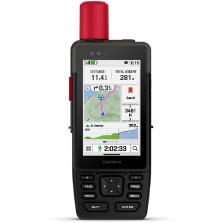
When adventure calls, respond. This rugged Garmin GPS has built-in inReach® Plus technology that lets you send photos, text messages and voice messages. And it has a bright touch-screen display.
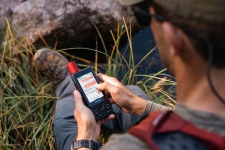
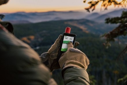

- GPSMAP® H1i Plus navigator with built-in inReach® Plus technology helps you stay in touch when you venture beyond cell service (requires active inReach satellite subscription)
- With an active inReach satellite subscription, you can exchange texts or use the built-in mic to capture and send voice messages directly from GPSMAP H1i Plus
- Integrated front and back cameras let you snap selfies and photos of your trip, then share them in real time without a cellular network (requires active inReach subscription)
- In an emergency, you can also trigger an SOS message to the 24/7-staffed Garmin Response℠ international coordination center for assistance
- You can also exchange photos, voice/text messages or trigger an SOS from the familiar interface of your smartphone by pairing this with Garmin Messenger™ on your mobile device
- Note: some jurisdictions regulate or prohibit the use of satellite communication devices
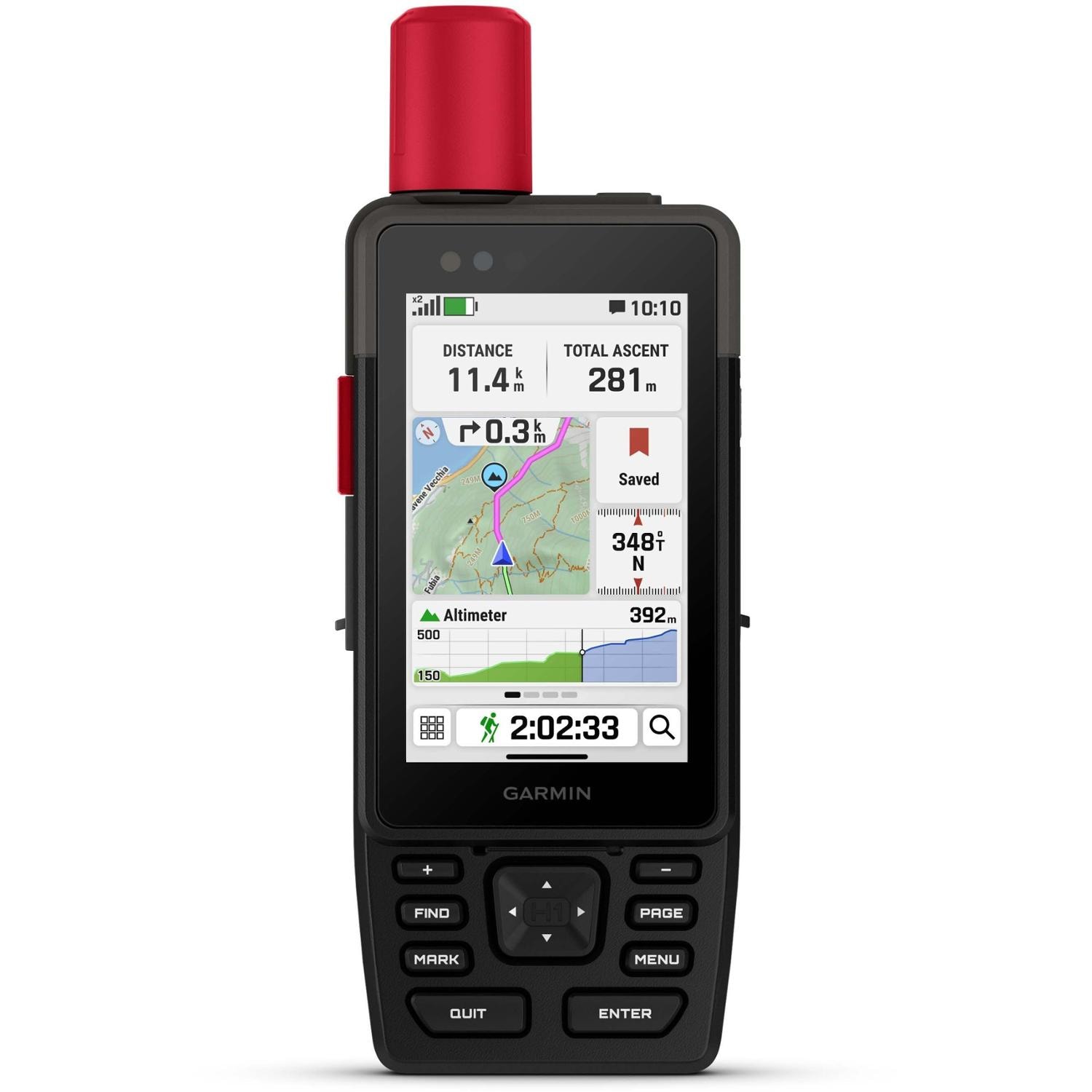
- Navigate with preloaded TopoActive maps, downloadable satellite imagery and the option to purchase an Outdoor Maps+ subscription for ongoing access to premium map content
- Multiband GPS and multi-GNSS support gives you optimal positional accuracy for precise knowledge of where your adventure takes you
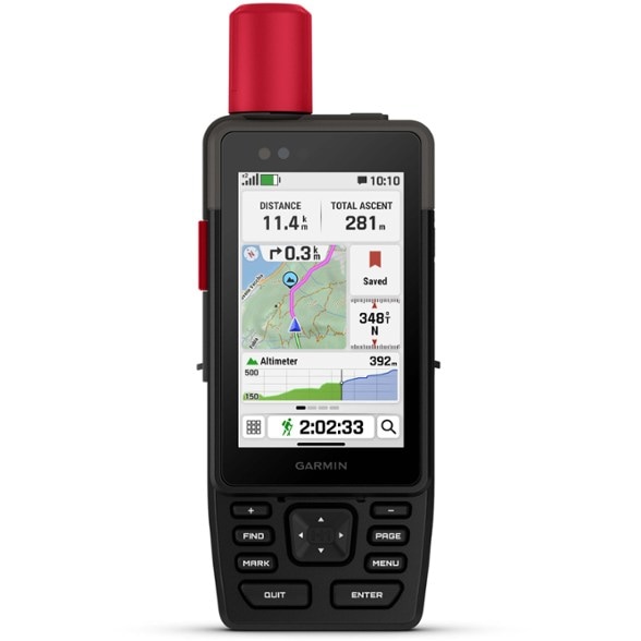
- Boasts a slick hybrid design offering a bright 3.5 in. touch screen that is sunlight-readable and glove-friendly; chemically strengthened glass resists scratches
- Physical buttons provide more versatility in any conditions
- Long battery life up to 145 hrs. in all Satellite Systems + MultiBand mode, assuming typical use with SatIQ™ technology; up to 845 hrs. in Expedition mode
- Built to meet MIL-STD 810 for thermal, shock, water (IP67) and vibration to withstand weather and extreme temperatures
- Compatible with the Garmin Explore™ smartphone app for seamless trip planning, locating geographic points and route-sharing capabilities
- Use the built-in flashlight as a beacon to signal for help, or use as a torch to light your way when the path goes dark
- Built-in siren can be activated to emit a loud alarm to help draw attention if you are in need
- When you venture off-grid, use LiveTrack™ location sharing to let friends or family follow your location while you are on the move
- They can see your progress, including distance, time and elevation
- ABC sensors provide an altimeter for elevation data, barometer to monitor weather and 3-axis electronic compass to provide direction
- Get weather reports and request forecasts for your destinations with an active inReach® satellite subscription
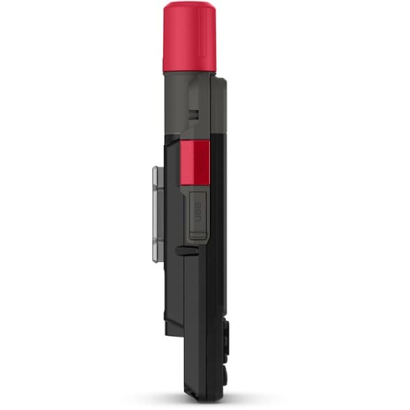
- Features an integrated Spine Mount 2 with included removable loop carabiner for versatility; compatible with additional Spine Mount 2 accessories (not included)
Imported.
- All Satellite Systems + Multiband: Up to 145 hrs. (assuming typical use with SatIQ™ technology)
- Expedition mode: Up to 840 hrs.
- Performance messaging mode with 10 min. inReach® tracking: Up to 48 hrs. (assuming typical use with SatIQ™ technology)
- Expedition mode with 10-min inReach® tracking: Up to 425 hrs.
| Best Use | Navigating |
|---|---|
| Preloaded Map | Road / Topo |
| Basemap | Yes |
| Wireless Communication | Yes |
| OS Compatibility | Android iOS |
| Camera | Yes |
| Display Size | 3.5 inches |
| Screen Pixels | 240 x 400 |
| Touch Screen | Yes |
| Visual Map Display | Yes |
| Color Screen | Yes |
| Number of Routes | Unlimited |
| Number of Waypoints | Unlimited |
| Internal Memory | 64 gigabytes |
| Compass | Yes |
| Altimeter | Pressure-based |
| Quad Helix Antenna | Yes |
| Position Accuracy | 3 meters |
| Battery Type | Lithium Ion |
| Batteries | Rechargeable, internal lithium-ion |
| Average Battery Life | All Satellite Systems + Multiband: Up to 145 hours (assuming typical use with SatIQ™ technology); Expedition mode: Up to 840 hours |
| Dimensions | 7 x 2.6 x 1.3 inches |
| Water-Resistance Rating | IP67 |
| Weight | 10.2 ounces |
Write a Review
Adding a review will require a valid email for verification
Customer Images
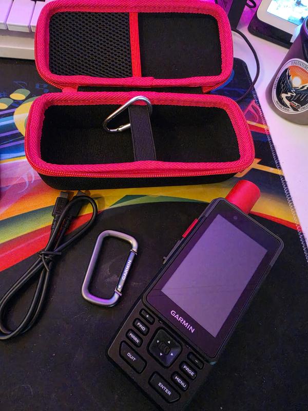
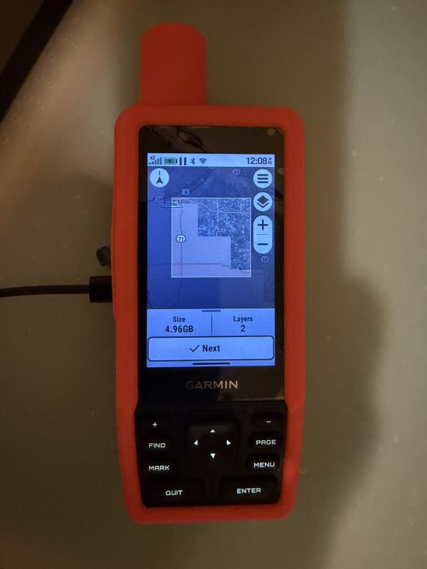
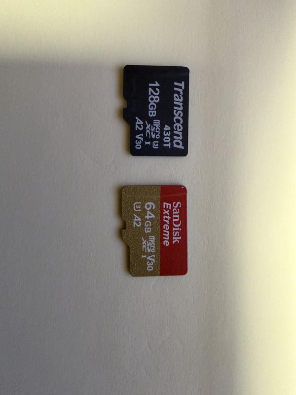
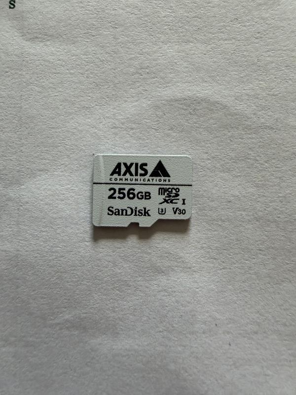

Most Helpful Favorable Review
Most Helpful Critical Review
Excellent Device, Uneven Software
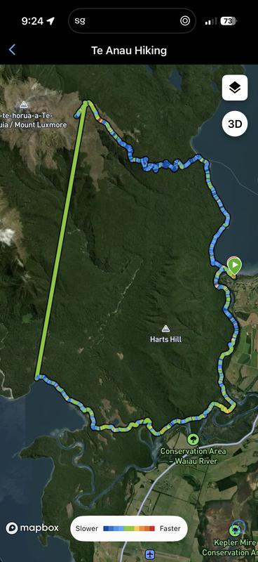
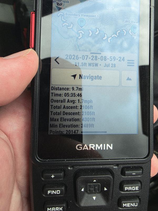
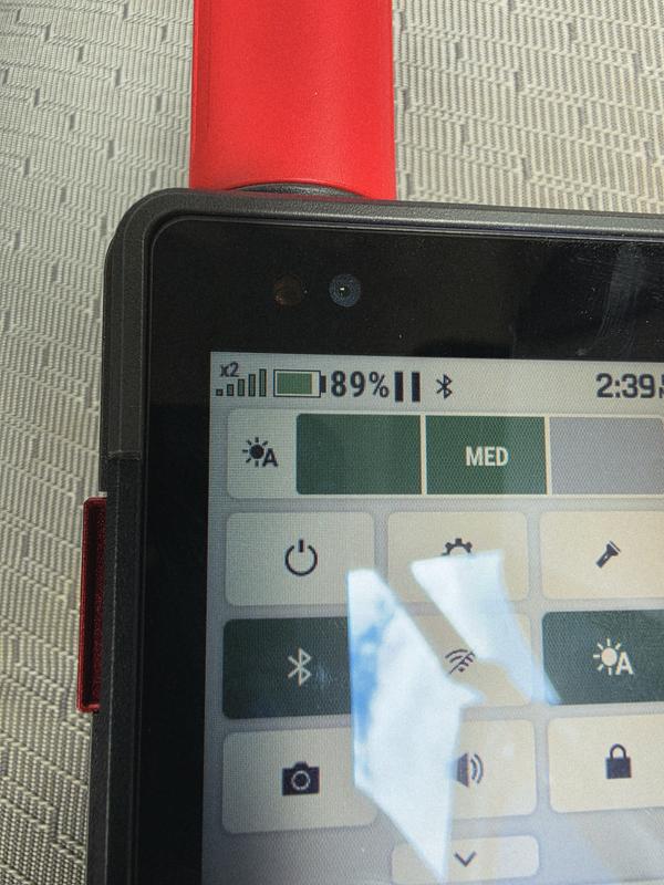
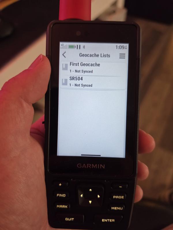
The GPSMAP H1i Plus is an impressive piece of outdoor hardware, and I already feel that I have gotten my money’s worth from it. GPS positioning has been accurate and reliable, the maps are detailed, the touchscreen and physical controls work well in the field, and the battery life has been excellent. During a 5½-hour hike with frequent map use, activity recording, and 10-minute LiveTrack updates, the battery dropped only about 11 percent. The inReach features have also performed extremely well. Satellite messages and replies have arrived very quickly during testing, and LiveTrack allowed my wife to follow my progress throughout a remote hike. The recorded activity data has been detailed and useful, and the device has become both a serious navigation and safety tool and something I genuinely enjoy using on casual family outings. I am also happy that I can continue building routes in Gaia GPS, export them as GPX files, import them through Garmin Explore, and sync them to the H1i Plus. Once the process is understood, it works well and avoids rebuilding the same route in multiple applications. Outdoor Maps+ provides an excellent selection of satellite imagery, contours, trails, hydrography, public-land information, and other useful layers. The weakest part of the experience is Garmin’s fragmented and sometimes unintuitive software ecosystem. Explore, Connect, Messenger, Express, Outdoor Maps+, and the handheld itself all perform different jobs, and the handoffs are not always clear. Terms such as route, track, and course can also change between applications. Downloading maps around a synced route is unnecessarily indirect. The most effective method I found was to open the saved route first, then locate it under Recent Finds while creating a new map. There should be a direct bridge from a saved course or Collection to downloading maps around it. I have also had persistent Wi-Fi credential problems. The device connects successfully and remains connected during downloads, but it does not remember either my home-network or mobile-hotspot password. I must re-enter the password every time. Geocaching Live has been inconsistent as well. The device can see my Geocaching Lists, but they have remained labeled “Not Synced,” synchronization screens sometimes spin without completing, and direct GC-code searches have produced “Data Request Failed” errors despite confirmed internet access. One cache eventually appeared after a long delay, but the status reporting did not accurately reflect what was happening. I have also received an Outdoor Maps+ server error and experienced an unusually slow map download even while Active Weather loaded immediately over the same connection. Overall, the H1i Plus itself is excellent: accurate, capable, enjoyable to use, and reassuring to carry. I would recommend it for hikers, explorers, geocachers, and families who understand that there is a learning curve. My biggest request is that Garmin improve the software integration, Wi-Fi credential handling, Geocaching Live reliability, and the clarity of route and map-management workflows.
Extremely disappointed in the dim screen
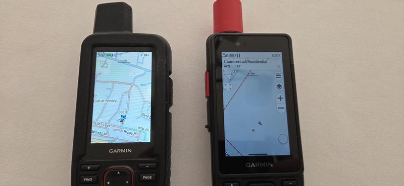
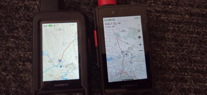
I'm pretty disappointed at the screen resolution and brightness. I have the 67i and the screen is noticeable brighter and clearer than this unit. The box and online promotional videos from Garmin show a very bright vibrant screen on the H1i. Not the case at all. I called Garmin today and sent them side by side pictures of the two units. They agreed the H1i unit is about 40% dimmer in dark environments. For $1000 you would think the new flagship model would be more impressive. In bright sunlight the screen is better but still doesn't pop like the 67i. I'm so disappointed I'm seriously considering returning the unit. The impressive new Inreach features are ruined by the horrible screen. Garmin needs to do better or release a firmware to improve the screen.
GPSMAP H1i Plus Powerful Tool - Demands Patience
Garmin GPSMAP H1i Plus Review The first thing prospective buyers need to understand is that the GPSMAP H1i Plus is not an iPhone running OnX Hunt. If that's your expectation, you'll probably be disappointed. This is a purpose-built navigation and satellite communication device designed for reliability, long battery life, and extensive customization. Be prepared to invest some time learning it. Read the owner's manual, customize the Activity screens, and don't judge it after the first day. The learning curve is steeper than I expected from Garmin's flagship handheld, but the device becomes much more capable once it's tailored to your needs. My biggest frustrations involved Outdoor Maps+ and the overall software experience. Downloading maps is slow, tile sizes are limited, and map management could be much more intuitive. I also experienced inconsistent microSD card compatibility. These issues made me seriously consider returning the device during my first week. Once I worked through those challenges, however, my opinion changed considerably. GPS accuracy has consistently been around ±2 meters during my use, battery life is dramatically better than my iPhone 17 Pro Max, and the built-in inReach communicator provides peace of mind that a smartphone simply can't match once you're outside cellular coverage. The display isn't as bright or sharp as a modern smartphone, but I found it performs surprisingly well in direct sunlight, where it matters most. Compared with my iPhone 17 Pro Max running OnX Hunt, I no longer view the H1i Plus as a competitor. I use my iPhone for planning trips and studying maps, while the H1i Plus has become my primary navigation device in the field because of its battery life, dedicated GPS, ruggedness, and satellite communication. Together they make an excellent combination. Garmin could significantly improve the ownership experience by simplifying Outdoor Maps+, improving microSD compatibility, increasing map download sizes, speeding up downloads, and adding a better tile management system. The good news is that most of these are software issues rather than hardware limitations. I have not yet completed extensive backcountry testing, but my confidence in the H1i Plus has grown considerably. What I initially thought was a purchase I might return has become a tool I genuinely appreciate. It isn't perfect, but if your priority is dependable navigation and emergency communication in remote areas, I believe the H1i Plus deserves serious consideration.
Out of date and buggy
It's not great. In many many ways. Unless the device is fundamentally improved, smartphones with Starlink like T-Mobile or even satellite SMS on iPhone and Samsung + offline maps will take it over. On user experience, this device is from the stone age. And some serious problems - satellite SMS doesn't get delivered reliably. And when it does, looks like spam that nobody will read. I can also list at least 25 UI bugs, most basic is that on the map, it's frequently impossible to locate yourself. Garmin was a pioneer in consumer GPS and I guess they never left the 90's because of loyal fans. But that's going to drop sharply like the blackberry.
Returned This Device
For now, there is no easy to recommend this device. I returned it and will wait in getting it or see what comes in the future. Screen was too dim for me, even taking it off of auto brightness. I do like the software layout and where Garmin is heading from a layout perspective. Very intuitive if they can stabilize the software. Maps loading was slow, updates and multiple reboots, not ready for release in my opinion. Especially at that price tag. Feel of the device was good holding it. Just the overall reliability, seemed like a big no for now. Again, will wait maybe for an H2 version of this and check again. Wanted to love it, but just not there
Can make the screen brighter
Just got this GPS, spending some time figuring out the new UI though haven't used in the field yet. I'll post more useful review later, but wanted to respond the previous review. The screen looks dim in the default setting. However, if you turn off Auto-Brightness, the screen can adjusted to the similar level of the 66/67 model.
Wait for Garmin to resolve issues
Buy this if you are bored and have nothing else to do. In typical Garmin fashion, a decent looking, although bulky, hardware has been betrayed by typical poor software. My unit refused to update to the latest software, and will not charge past 67%. I will be returning this.
Extremely buggy software
I have been using the H1i Plus for a few weeks now, and I wanted to share my experience with the device and the numerous problems I have encountered. For a $1,000 device, I feel like I am running beta software. For reference, I am running software version 9.06 which appears to be the latest firmware update, and I pay for an in-reach premium subscription on this device. Some problems are minor, but others are actually significant. 1. When unplugging the charging cable, sometimes the battery icon still shows up as connected to a cable. Occasionally, when unplugging the charging cable, the device freezes, and you have to hold down the power button to restart. 2. When requesting a weather update via satellite, I encountered a bug that the device would restart. This happened multiple times, and then I just gave up on requesting the weather update, despite being connected to satellite. 3. You never know how much power the device actually has; like on the Fenix watch, you can get a percent read out or estimated battery life in days. This is a needed function. I took this device on a 38-mile overnight hiking trip, and this is where the problems are actually quite concerning. 1. On my first day, during my hiking activity, I checked the device, and it is just completely off. I tried to press the power button to turn the screen on, but it didn’t work. I had to hold down the power button for 10 seconds, and then it did some type of hard restart. On my first day of this hike, thankfully, the data did save. I will also note that the device said it was connected to satellite the entire time, and tracking well before this occured. 2. Day two, and I am still connected to satellite, but now I am having issues with messages going through. Then, the same thing happens, and the device randomly turns off, and I do the same thing where I hold the power button to reset the device, but this time it has not stored my last eight hours of tracking and instead just connects the dots. Quite an inconvenience, but also very concerning that the entire time I could see it was collecting data and connected to satellite, and I do not believe my messages were actually getting through. 3. Towards the end of this hike, the device became incredibly slow, but after I ended the activity, I no longer had this problem. I am wondering if it was because over two days there were just too many data points collected, but that is again quite concerning for what the H1i plus is designed for. I think this device has a lot of potential, but Garmin seriously needs to fix this software for consumers to use this for its designed purpose. I am unsure what to do, because currently I have a $1,000 brick, and I hope at least the emergency function will work if I ever need to use it.
Too Many Bugs
This needs to be stabilized before releasing. Software was out of whack and not dependable (which is likely why you want a GPS). I returned this item and may try again in the future after a new H2 release if they fix the screen brightness. Software is okay from the perspective of layout, but WAY too many bugs.
Simple to use
Bought this two weeks ago and have used on two fairly long hikes so far. Really pleased with how it works and the simplicity of setting it up and using the Explorer app to map out the hikes. Quite and upgrade from the cell phone navigation. The Inreach function is a nice safety feature for sure.


This item pays for membership!
Buy a lifetime $30 membership and make a $50 purchase by Nov 12, 2026.*
$100
10% Reward*
on this and every eligible full-price item*
+
$30
Bonus Card*
valid for 30 days after joining*
=
$130
Value