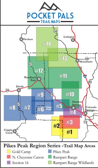
Pocket Pals Trail Maps Pikes Park Region: Rampart Range Area Trail Map #11
This product is not available.
Explore the trails of the Rampart Range in Colorado, located near the U.S. Air Force Academy, with this pocket-sized, durable and detailed Pikes Peak Region: Rampart Range Area Trail Map #11.
Shop similar products- Provides all the important details to plan a trip and stay on track—trail length, difficulty level, total elevation gain/loss, landmarks and directions to the trailhead
- Note, many trails on this map are located on the U.S. Air Force Academy property; always check for the current USAFA visitation policies before visiting
- Waterproof, tear-resistant map stands up to use out on the trails
- Perfectly sized to fit in your pocket, making it easy to take with you
Made in USA.
Covers Backdoor (723), Eagles Peak, Falcon, Kenyon Loop, Rainbow Gulch, Rampart Reservoir, Schubarth (307), Stanley Canyon (707), Stanley Rim (722), trail 709, trail 721, trail 775 and West Monument Creek
View all Pocket Pals Trail Maps Colorado Maps| Best Use | Hiking |
|---|---|
| State / Province | Colorado |
| Folded Dimensions | 4.25 x 3.625 x 0.1 inches |
| Unfolded Dimensions | 17 x 11 x 1 inches |
| Map Scale | 1:39,000 |
| Double Sided | Yes |
| Waterproof | Yes |
| Publisher | Outdoors LLC |
| Copyright Year | 2015 |
| Map Number | 11 |
Be the first to write a review!
Adding a review will require a valid email for verification

