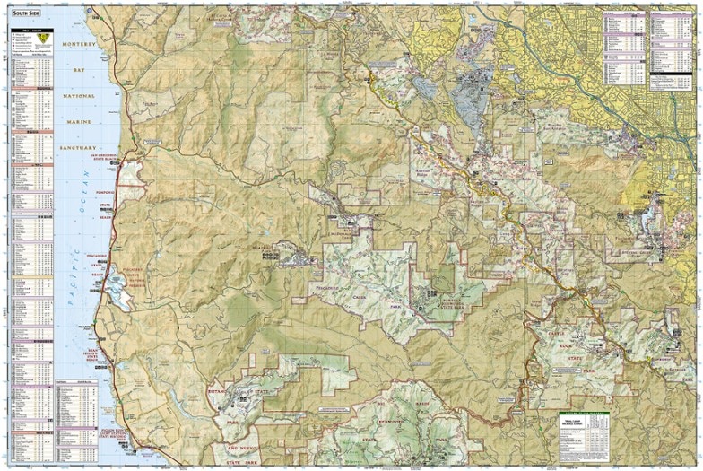
National Geographic Skyline Boulevard Topographic Map
The Trails Illustrated Skyline Boulevard topographic map shows you the way to the scenic attractions and recreational opportunities along the side of the Santa Cruz Mountains.
- Coverage includes state and county parks, beaches, recreation areas, Half Moon Bay, Monterey Bay, South San Francisco, San Mateo and the Santa Cruz Mountains
- Expertly researched and created in partnership with Midpeninsula Regional Open Space, California State Parks and other agencies
- Covers the Skyline Boulevard area with unparalleled detail, starting from Golden Gate's Milagra Ridge and Mori Point to Sanborn-Skyline Park and Castle Rock State Park
- Easy-to-read, yet highly detailed mapping shows comprehensive trail and road networks and designated trails for hiking, horseback riding, biking and more
- Clearly marked navigational aids with UTM coordinate grids, scale bar and full legend, essential for safely navigating the backcountry with GPS or compass
- Key points of interest include scenic views, campgrounds, trailheads, boat launches and picnic sites
- Color-coded boundaries for public lands including national parks, national forests, national monuments, ranger districts, wilderness areas, state parks and wildlife refuges
- Printed in the USA on durable, lightweight, waterproof and tear-resistant material designed to withstand all weather conditions
- Folded dimensions: 4.25 x 9.25 in.; unfolded dimensions: 25.5 x 37.75 in.
- 1:40,000 scale
- National Geographic Maps; copyright 2013
Made in USA.
View the National Geographic Trails Illustrated Product LineView all National Geographic California Maps| Best Use | Hiking |
|---|---|
| State / Province | California |
| Map Number | 815 |
Write a Review
Adding a review will require a valid email for verification
Okay, given the area covered, but has defects
I was researching Skyline to the Sea. REI had no other maps in stock, so I grabbed this and its adjacent map. This map is quite difficult to read. *Usually* the detail is there, but it's not always presented in an accessible way. "Cluttered" would not be a bad description. To give it credit, they did manage to come up with a way to make it work (i.e. abbreviating trail names in as usually intuitive letters), but it can still be a handful. I noticed that some of the abbreviations created were not actually used on the map as the trail segment in question was unlabeled. (Perhaps it was too short but the abbreviation had been generated anyway?) Trying to figure out where a particular closure was required using an alternate map. I'll keep the map because ultimately I'll hike in many of the areas depicted, but it wouldn't be my first choice. (As an example. Borrowing a copy of the Windy Hill map from the preserve is a much clearer alternative.)

