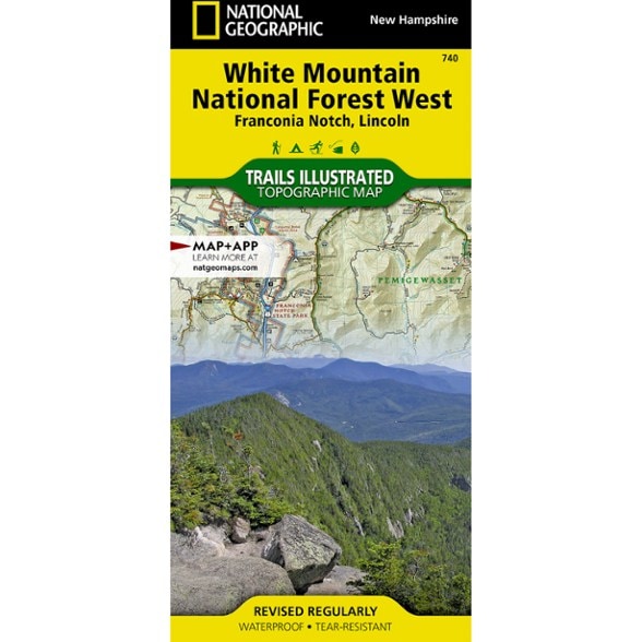


National Geographic Franconia Notch/North Conway Trail Map
$14.95
This detailed National Geographic Trails Illustrated folded map offers comprehensive coverage of Franconia Notch and Lincoln in New Hampshire.
- Provides valuable wilderness tips and Leave No Trace guidelines, along with updated trails, trailheads, points of interest, campgrounds and much more
- Printed on waterproof, tear-resistant material with a plastic coating that offers the durability needed for outdoor use
- Includes selected waypoints in both Lat./Lon. and UTM coordinate systems as well as GPS-compatible UTM grid lines for easy navigation
- Includes coverage of White Mountain National Forest
- Measures 9.25 x 4.25 in. folded and 37.75 x 25.5 in. fully opened; scale of 1:63,360
- National Geographic Maps; copyright 2002
Made in USA.
View the National Geographic Trails Illustrated Product LineView all National Geographic New England and Mid-Atlantic Maps| Best Use | Hiking |
|---|---|
| State / Province | New Hampshire |
| Map Number | 740 |
Be the first to write a review!
Adding a review will require a valid email for verification