

Custom Correct Map Set - Olympic Pennisula
$99.95
Members get an est. $9.99 in rewards
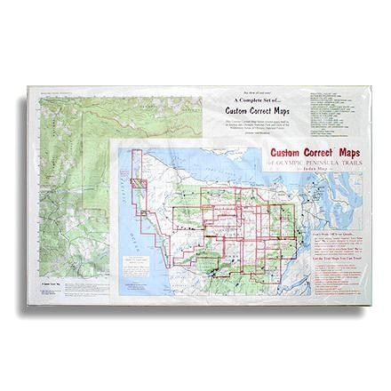
Custom topographic map, set to the trails of Olympic National Park and the Olympic Peninsula--specially formatted for hikers and climbers
- No more piecing quads together: each map includes entire trail systems on a single topographic map without compromising map size or scale
- Includes 16 separate maps for the Bogachiel Valley, Buckhorn Wilderness, Elwha Valley, Enchanted Valley, Gray Wolf-Dosewallips, Hurricane Ridge,
- Lake Crescent-Happy Lake Ridge, Mount Olympus Climbers Map, Mount Skokomish-Lake Cushman, North Olympic Coast, Ozette Beach Loop
- Queets Valley, Quinault-Colonel Bob, Seven Lakes Basin-Hoh, South Olympic Coast and The Brothers-Mount Anderson
- Includes 1997 - 2011 revisions; scale 1:62,500 or 1 inch to the mile except for Ozette Beach Loop at 1:24,000, contours interval 80 feet
Made in USA.
Includes 1997 - 2011 revisions; scale 1:62,500 or 1 inch to the mile except for Ozette Beach Loop at 1:24,000, contours interval 80 feet.
View all Custom Correct Washington and Oregon Maps| Best Use | Hiking |
|---|---|
| State / Province | Washington |
Write a Review
Adding a review will require a valid email for verification
2 years ago
Most useful backpacking maps
The most useful maps for hiking the Olympic Peninsula wilderness areas, this is a must-carry for all our ONP backpacking trips. Coast maps include the most accurate maximum-tide marks for the many low-tide crossing points. Also essential for extended day hikes.

This purchase pays for membership!
Buy a lifetime $30 membership and make a $50 purchase by Sep 07, 2026.*
$9
10% Reward*
on this and every eligible full-price item*
+
$30
Bonus Card*
valid for 30 days after joining*
=
$39
Value