
Latitude 40 Maps Moab East Trails Recreation Topo Map - 7th Edition
This product is not available.
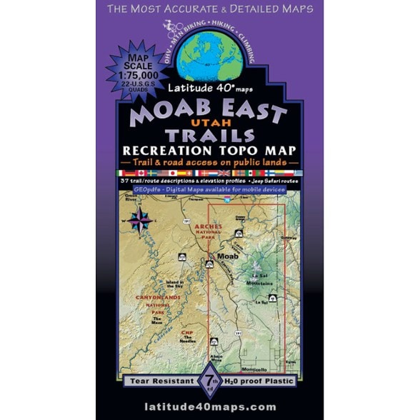
Explore the roads and trails to the east, north and south of Moab, Utah, with this map. It covers the La Sal Mountains east of Moab and Canyon Country to the north and south.
Shop similar products- Explore the roads and trails of the La Sal Mountains east of Moab and Canyon Country to the north and south
- Map area is 73 mi. north to south (from I-70 to the northern Abajo Mountains) and 50 mi. east to west (from the Colorado state line to Moab)
- Map overlaps the Moab West Trails map for 100 mi. of contiguous coverage east to west (Moab West Trails map not included)
- Public access trails and routes highlighted for all trail users (nonmotorized and motorized); includes all trailheads, recreation areas and campgrounds
- Difficulty ratings and mileage between junctions
- The main northern area is on one side; the southern half of the map and 37 trail/route descriptions are on the other side
- Covers all or part of 42 USGS 7.5-minute, 1:24,000 quadrangles
- Map scale: 1 in. = 1.2 mi.
- Contour interval: 80 ft.
Made in USA.
View all Latitude 40 Maps Mountain West Maps| Best Use | Hiking |
|---|---|
| State / Province | Utah |
| Folded Dimensions | 8 x 4.2 inches |
| Unfolded Dimensions | 39 x 27 inches |
| Map Scale | 1:75,000 |
| Double Sided | Yes |
| Waterproof | Yes |
| Publisher | Latitude 40 Maps |
| Copyright Year | 2024 |
Be the first to write a review!
Adding a review will require a valid email for verification