
Outdoor Trail Maps Colorado Greenhorn Mountain/Spanish Peaks Wilderness Map
$8.95
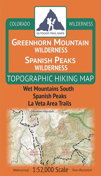
Explore southern Colorado with this topographic map, covering the hiking trails in the Greenhorn Mountain Wilderness and Spanish Peaks Wilderness areas of southern Colorado.
- Covers Wet Mountains South, Spanish Peaks and La Veta Area Trails
- This rugged trail map was designed for on-trail use in the toughest outdoor conditions in a compact and easy-to-fold size—no more fumbling with huge, inaccurate maps
- Printed on waterproof and tear-resistant material
- Mileage provided for all trail segments (updated in 2018 with accurate trail routings and distances)
- GPS coordinates provided for trailheads and trail junctions
Made in USA.
View all Outdoor Trail Maps Colorado Maps| Best Use | Hiking |
|---|---|
| Folded Dimensions | 7 x 4 inches |
| Unfolded Dimensions | 27 x 19 inches |
| Map Scale | 1:52,000 |
| Double Sided | Yes |
| Waterproof | Yes |
| Publisher | Outdoor Trail Maps |
| Copyright Year | 2018 |
| State / Province | Colorado |
Be the first to write a review!
Adding a review will require a valid email for verification