Outdoor Trail Maps Colorado 14ers Series Map: Mount Sherman, Mount Bross, Mount Cameron, Mount Democrat, Mount Lincoln, Quandary Peak
This product is not available.
Get a strong start on your 14er bucket list with Colorado 14ers Series Map 4 of 16, which covers 6 majestic peaks in the Mosquito and Tenmile Ranges in central Colorado.
Shop similar products- This rugged trail map was designed for on-trail use in the toughest outdoor conditions in a compact and easy-to-fold size—no more fumbling with huge, inaccurate maps
- Map 4 front side shows access to Mount Sherman—the southernmost 14er of the Mosquito Range—from both the west side via Iowa Gulch and east side via Four Mile Creek Road
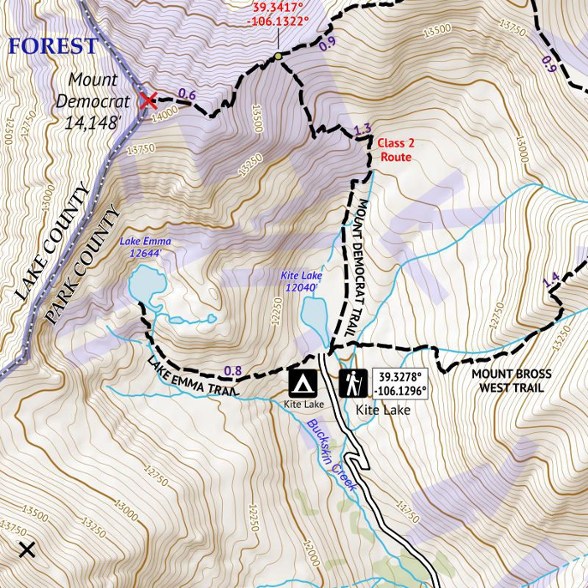
- The back side shows the lone 14er of the Tenmile Range (Quandary Peak) and four of the five 14ers of the Mosquito Range (Mount Bross, Cameron, Democrat and Lincoln)
- Includes Kite Lake Trailhead and area trails including Lake Emma Trail, Windy Ridge area, Crystal Lake Trail (at Hoosier Pass), Blue Lakes Trail and McCullough Gulch Trails
- Note: Some of the peaks and trails on this map are near or on private property; please review access restrictions before visiting and respect those restrictions while hiking
- Printed on waterproof and tear-resistant material; UTM and GPS compatible
- Part of a beautifully designed series of 16 topographic hiking trails maps, which cover all 58 of Colorado's awe-inspiring 14ers (summits higher than 14,000 ft. elevation)
Made in USA.
View all Outdoor Trail Maps Colorado Maps| Best Use | Hiking |
|---|---|
| State / Province | Colorado Iowa |
| Folded Dimensions | 6.5 x 3.8 x 0.02 inches |
| Unfolded Dimensions | 19 x 13 inches |
| Map Scale | 1:30,000 |
| Double Sided | Yes |
| Waterproof | Yes |
| Publisher | Outdoor Trail Maps |
| Copyright Year | 2017 |
| Map Number | 4 of 16 |
Write a Review
Adding a review will require a valid email for verification
Great detailed map!
Great detailed map, waterproof, easy to read and use with GPS if needed.

