
Mt. Rainier Wall Chart - Centennial Edition
This product is not available.
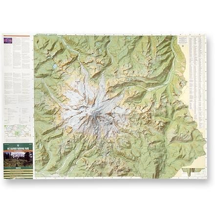
Frame it, mat it, or plan your next ascent; this spectacular wall chart provides a detailed view of Mount Rainier National Park
Shop similar products- Providing a topographical view of Rainier this beautifully detailed chart provides 1:30,000 scale, shaded relief, illustrations of physical features
- Measures 56.5 x 40.5 inches
- Jean-Luc Pottier: Cartographer; Stanley Maps
- Identifies hiking trails including the Wonderland Trail, 7 major routes to the summit, and 3 high elevation circumnavigation routes
- Also provides information on campgrounds, backpacking campsites, and visitor facilities
- Sturdy tube for storage or transport provided
Made in USA.
| Best Use | Hiking |
|---|
Be the first to write a review!
Adding a review will require a valid email for verification