
National Geographic Wisconsin's Door Peninsula Destination Map
$14.95
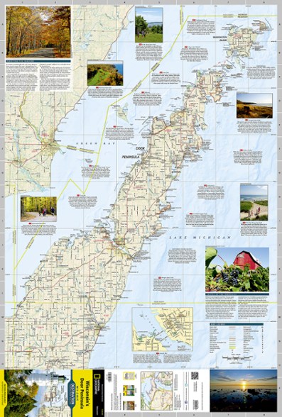
Trails Illustrated Wisconsin's Door Peninsula Destination Map strikes a balance between travel map and guidebook—a great resource for touring this culturally and geographically unique region.
- Contains detailed and useful travel information including comprehensive road networks, infrastructure and natural, historical and cultural places
- Stunning photography and valuable travel tips inspire travelers and help with pre-trip planning and on-the-ground adventures
- Printed in the USA on durable, lightweight, waterproof and tear-resistant material that's designed to withstand the rigors of travel
- Folded dimensions: 4.25 x 9.25 in.; unfolded dimensions: 25.5 x 37.75 in.
- 1:129,660 scale
- National Geographic Maps; copyright 2013
Made in USA.
View the National Geographic Trails Illustrated Product LineView all National Geographic Midwest Maps| Best Use | Travel |
|---|---|
| State / Province | Wisconsin |
Review this Product
Adding a review will require a valid email for verification
LEichler
Northern Illinois
Door County, Wisconsin trail map
3 years ago
Love the details on the trails and points of interest on this map of Door County, Wisconsin. The protective coating gives me the ability to hike in all weather
Age:55–64
Yes , I recommend this product