

Garmin GPSMAP 67i
Go outdoors—and stay connected—with the Garmin GPSMAP 67i. Using inReach® technology, this button-operated GPS handheld and satellite communicator enables 2-way messaging and location tracking.
Key Details


This item pays for membership!
$60
10% Reward
on this and every eligible full-price item*
+
$30
Bonus Card
valid for 60 days after joining*
=
$90
Value
Keep shopping

- In case of emergency, trigger an interactive SOS message to the Garmin Response center, a 24/7-staffed professional emergency response coordination center
- Exchange text messages with loved ones, post to social media, or communicate from one inReach device to another in the field
- Track your location and share it with those at home or out in the field—they'll be able to see your progress or ping your device for your GPS location and more
- inReach technology enables 2-way messaging and location tracking (active subscription required)
- Instead of relying on cellphone coverage, your messages, SOS alerts and tracking are transferred via the global Iridium® satellite network
- Track your position in challenging conditions with multi-band technology and expanded GNSS support
- Navigate every trail with ABC sensors, including an altimeter for elevation data, a barometer to monitor weather and a 3-axis electronic compass
- Large 3 in. sunlight-readable color display for easy viewing
- When paired with your compatible smartphone, you can access active weather forecasts and Geocaching Live
- Use with the Garmin Explore™ website or app on your compatible smartphone to help you plan trips and more
- Internal, rechargeable lithium battery provides up to 165 hrs. in 10 min. tracking mode and up to 425 hrs. in expedition mode with 30 min. tracking intervals
- Preloaded TopoActive U.S., Mexico and Canada maps show you terrain contours, topographic elevations, summits, parks, coastlines, rivers, lakes and geographical points
- Features a built-in LED flashlight that can be used as a beacon to signal for help
- Built to military standards for thermal, shock and water performance (MIL-STD-810), and it's even compatible with night vision goggles
- Get access to a wide variety of premium mapping content with an Outdoor Maps+ subscription (not included)
Imported.
A subscription plan is required to send and receive satellite messages on this device. Visit vendor website to shop satellite subscription plans and additional services.
| Best Use | Multisport Emergency Preparedness Navigating |
|---|---|
| GPS/Satellite Detectable | Yes |
| Average Battery Life | Default mode: up to 165 hours; expedition mode: up to 425 hours |
| Battery Type | Lithium Ion |
| Batteries | Rechargeable, internal lithium-ion |
| Messaging Capability | 2-Way Messaging |
| SOS Function | Yes |
| Number of Waypoints | 10,000 |
| Compass | Yes |
| Altimeter | Pressure-based |
| Visual Map Display | Yes |
| Basemap | Yes |
| Preloaded Map | Topo |
| Display Size | 3 inches |
| Color Screen | Yes |
| Water-Resistance Rating | IPX7 |
| Dimensions | 6.4 x 2.5 x 1.4 inches |
| Weight | 8.1 ounces |
| Internal Memory | 16 gigabytes |
| Number of Routes | 250 |
| Expandable Memory | Yes |
| Wireless Communication | Yes |
| Quad Helix Antenna | Yes |
| OS Compatibility | Android iOS |
| Position Accuracy | 3 meters |
| Screen Pixels | 240 x 400 |
Review this Product
Adding a review will require a valid email for verification
Most Helpful Favorable Review
Most Helpful Critical Review
Customer Images

So happy I bought this!
I purchased this from another retailer a couple of weeks ago before it was available at REI -- if REI had it back then, I would much rather have purchased with them. This device performs exactly as expected and allows me to stay in touch with my family back home via SMS as well as by sharing my location with them via an online map portal as frequently as often as every 2 minutes. The only thing I would suggest to a first-type buyer of any brand of this type of product is to research what the subscription fees in advance so you know what you're getting yourself into -- which I did -- and even with one of the more expensive plans -- am extremely pleased.
Not durable/rugged at all
Not remotely rugged - do not buy. I have owned a number of Garmin products over a 20 year period and generally have found them to be phenomenal. I've got a ~2008 eTrex which has sustained all sorts of abuse and still works as expected. I've got an InReach Mini2 which has survived multiple dunkings, a biking accident and the general mashing/abuse that happens on the outside of a pack. This unit was a real splurge replacement for the eTrex, and I am bitterly sorry I didn't go for the cheaper eTrex. The first trip out with this unit, and the screen is cracked - 24" fall. My Google Pixel is more durable. Do Not Buy, it's not suitable for an outdoors backpacking environment.
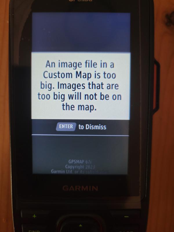
Garmin severely throttles custom maps.
This unit as a 1 megapixel and 3 MB limit on custom maps. Which essentially means you can't make custom maps. As a map maker who spent $600 on a GPS, I hate Garmin's business model which forces their customers to buy their maps. I make better maps, and I can't use them because Garmin has throttled their product in order to milk their customers.
A great all in 1 unit
I decided to get the 67i because it's an all in one for hiking (satellite communicator, GPS, and maps). The battery life is amazing. That alone is worth it. The maps have more trails shown than National Geographic trail maps and All Trails. I was worried about having to spend extra for more detailed maps, but I can't honestly see why hardly anyone would need to have that extra expense. So, I would advise any one to not buy the extra maps until you at least have tried it out. The only negative thing is that it takes awhile to figure everything out. Garmin needs to do better at this.
Great all in one with long battery life
This product is great! The battery life is amazing even in the cold, super durable. It was a small challenge learning to use it versus Gaia or Alltrails on my cell (which is more intuitive). There is a phone app that you use to make routes as well but even that is just a bit behind the other major apps. I like to record my hike so it eats cell battery even in airplane mode. This unit lasts forever days without needing to use my cell at all. I needed an SOS button anyway so for the added cost it was more than worth it. I don’t care about the extra ounces stuck on my pack strap vs the inreach mini
There must be a better way Garmin.
Just got this Garmin 67I. My first GPS device. What a bad design. Can't use it without reading tutorials which are not very clear to understand either. They all require that you already know how to use a GPS devices. Although I could learn all that - I am getting frustrated that there is such a high learning curve. My main complaint is that there are too many options. No intuitive user interface. Too many buttons to press... After all I want to enjoy and being in touch with nature and not being constantly in touch with the GPS device instead. There must be a better way Garmin.
not bad, but...
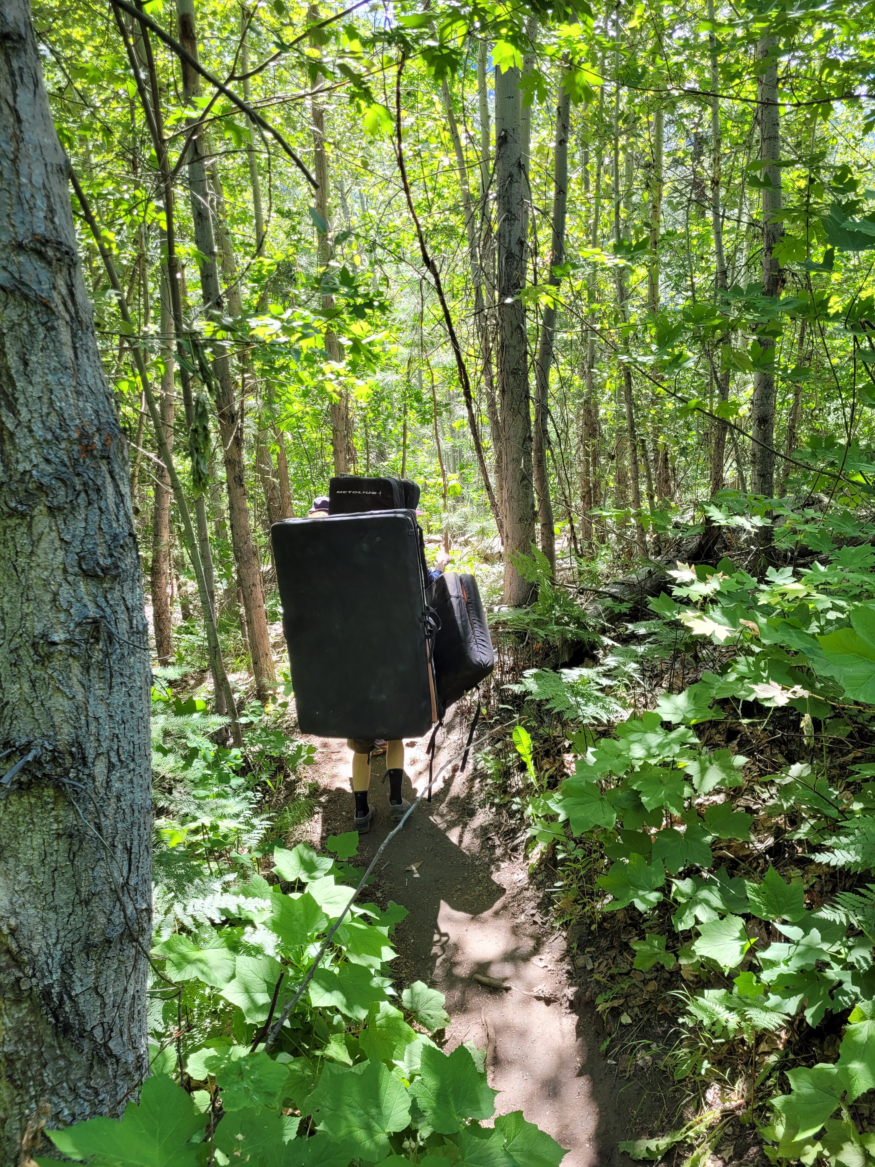
It is my first Garmin and the following points are my personal opinion/experience, exclusively for hiking. I bought the Garmin GPSMAP 67i for longer backcountry trips. So far I used my phone with offline maps and additional battery packs to extend the runtime of my phone. Pro: - fast device and fast satellite connection setup. - fast and stable Bluetooth connection. Easy download and synchronization of new routes - incredible runtime, battery lasts extremely long - good quality of the device and stable feeling - Decent operability through buttons in rain/dust - nice idea to add the SOS function (additional subscription necessary) - like the carabiner in the pack, but would still trade for the Garmin Backpack Tether Cons: - Software / interface way too outdated! The biggest Zonk so far. - not intuitive, you have to invest some days to understand the functions - only a manual with the basic functions, nothing to learn how to use the device. Also the tutorials on the Garmin homepage are a joke. - weather updates exclusively with an internet connection via cell phone - limitation to only 32-gigabyte microSD card @ Garmin: Please improve the interface / software and include a reasonable manual for new users Buy recommendation? Yes, for multi-day trips without power supply and internet connection. However, you need access to additional tutorials / explanations via the Internet.
Great device.
The 67i really is a great for travel. I’m traveling through Morocco and it’s been very helpful to communicate via text to friends and family when I don’t have Wi-Fi. Its maps are helpful but not complete without paying for additional map that I didn’t want to spend money on. I also share or trave location with family to enable them to follow or movement. It’s a wonderful communication tool with great gps. I recommend it for traveling to exotic or remote places.
Pinpoint accuracy, expensive required map sets.
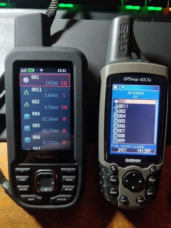
I bought this newest model after my old Garmin 60cs was starting to reach its end of life. I figured that Garmin had to have made some major advances in GPS technology. They absolutely did, right out of the box it found over a dozen satellites from 3 systems. Pinpoint accuracy and decent map details. Then I tried to look at my hiking areas, needed more details. I soon realized that Garmin had advanced the technology but not its maps. There are 6 different topo 24 k map sets that you need depending on what states you hike in, so I bought West and North Central to cover my main areas. You have to switch SD cards as you cross state lines between the sets, but this is fairly easily done. Then I tried to navigate from my starting city to a waypoint in another state, and all I got was a straight line. 2 hours in two separate chats and 1 hour long phone call with Garmin, trying EVERY possible setting in the unit, I was finally told that I would need to purchase another map set to navigate highways from state to state. So if you're a beginner GPS user, this is not the unit for you. If you are a patient and experienced user and are willing to purchase all of the separate maps and spend MANY hours learning how to use the features of this unit, maybe give it a shot.
Best GPS but Requires Learning to Use Time Investm
Bought the 67i in August 2023. Have used it in Glacier and Big Bend National Parks. I have owed and used several Garmin products but this is my first GPS Satellite communicator handheld. I found the learning curve to be steep but with thehikingguy on utube and Garmin support to be very helpful. I now take it everywhere I go: hiking, on cruise ships, long distance drives anywhere in the world where GPS devices are permitted. Excellent accuracy, c usb type connector, weatherproof resistant, nice color display, okay keyboard for sending receiving messages, ability to post tracking events via Garmin Mapshare app posted on Facebook. Excellent build quality. Zero issues except user error. Quite capable device at 8.1oz. I have since bought the Garmin Fenix 7x Pro Solar Sapphire and setup remote IR which allows sending SOS from Garmin watch if handheld is within a short distance away (can’t recall supported distance). Note: SOS, satellite messaging, IR, Facebook Mapshare tracking require Garmin Iridium subscription that can be activated and suspended on a monthly basis. Best product available should you ever need help on land or sea.