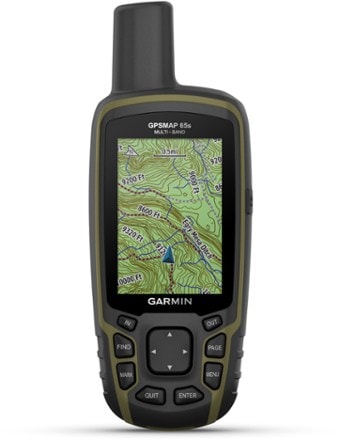
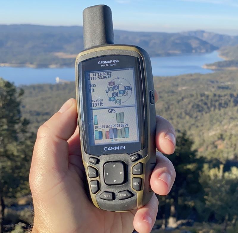
Garmin GPSMAP 65s
Find your way through steep country, urban canyons and densely treed forests with the Garmin GPSMAP 65s, a rugged handheld with multi-band technology and expanded GNSS support.


This item pays for membership!
$40
10% Reward
on this and every eligible full-price item*
+
$30
Bonus Card
valid for 60 days after joining*
=
$70
Value
Keep shopping
- Expanded global navigation satellite systems (GNSS) and multi-band technology help to track your route in challenging environments that would prove difficult for GPS alone
- Navigate every trail with ABC sensors, including an altimeter for elevation data, barometer to monitor weather and 3-axis electronic compass
- Large, sunlight-readable display measures 2.6 in. with 160 x 240 pixels to present imagery in crisp and colorful detail
- Connectivity via Bluetooth and ANT+ lets you share your waypoints, tracks, routes and geocaches wirelessly with other compatible devices
- Compatible with Garmin Explore™ website and app to help you manage tracks, routes and waypoints and review statistics from the field
- Includes routable TopoActive mapping and federal public land map
- IPX7 rating means this is considered waterproof; it can withstand submersion in water up to 1 m deep for up to 30 min.
Imported.
View all Garmin GPS Devices| Best Use | Multisport Navigating |
|---|---|
| Preloaded Map | Topo |
| Basemap | Yes |
| Wireless Communication | Yes |
| OS Compatibility | Windows / Mac Android iOS |
| Display Size | 2.6 inches |
| Screen Pixels | 160 x 240 |
| Visual Map Display | Yes |
| Color Screen | Yes |
| Number of Routes | 200 |
| Number of Waypoints | 5000 |
| Internal Memory | 16 gigabytes |
| Expandable Memory | Yes |
| Compass | Yes |
| Altimeter | Pressure-based |
| Quad Helix Antenna | Yes |
| Compact Antenna | Yes |
| Position Accuracy | 3 meters |
| Battery Type | NiMH |
| Batteries | 2 AA |
| Average Battery Life | 16 hours |
| Dimensions | 6.3 x 2.4 x 1.4 inches |
| Water-Resistance Rating | IPX7 |
| Weight | 7.8 ounces |
Write a Review
Adding a review will require a valid email for verification
Customer Images
Most Helpful Favorable Review
Most Helpful Critical Review
Great Product For What It Does
This is basically a suped-up GPSMAP 64. The new multi-GNSS and multi-band receiver works really well. I generally get 6 ft of GPS precision and GPS elevation is mostly within 10-20 feet if not less. The Bluetooth and Explore integration is meh - Explore is a weak product anyway but it's a nice option to have. Otherwise just pair this with the free Garmin Basecamp program for the best workflow. If you want a solid handheld GPS without the bells and whistles like InReach, this is about as good as you'll get without going professional.
Pretty Package, Ugly Performance
I was so looking forward in getting this GPS unit for my geocaching addiction. I have always been happy with Garmin products and own several starting with my first eTrex bought in 2001 then another eTrex, Rino 530, Rino 120, and now the all-new GPSMAP 65s. The problem I have been having is with geocaches. Loading the caches have never been easier, however,when I power off the unit and then power it back on, ALL of my caches have disappeared. They get moved to the waypoint menu and I lose all Geocaching function. The cache names diappear, I cannot log finds or DNFs, or look at hints. I have spoke with Garmin at length about this and have even provided files from the unit to their engineers, but still no solution can be found.
Great GPS receiver in a durable package.
I've owned previous units in this line, and wasn't really planning to upgrade, but my gpsmap 64s, while still working, was starting to act a little wonky (wouldn't automatically turn on when plugged in to external power, would go blank when I'd try to mark a geocache as "found" while I was on anything but the compass screen). So far, this is the best GPS receiver I've owned. The black rubber/plastic so far seems much more durable than the 62 or the 64. And like others, I use mine primarily for geocaching, but unlike others, a simple google search told me how to display the geocaches on the map screen, which I'm reposting here to save others the trouble - 1)Press Menu twice to access the Main menu 2)Select Setup 3)Select Map 4)Select Advanced Map Setup 5)Select Adjust Zoom Ranges 6)Select Zoom Levels 7)Set the highest zoom level at which you want to see geocaches on your map screen
Refflections on Garmin GPS units
• I have owned several Garmin GPS units during the last 10+ years, mainly because what other hand-held, push-button, replaceable battery powered, rugged GPS units are there on the market? With the loss of DeLorme to Garmin, precious few. Or maybe none? • These Garmin units have worked for me because I don’t have inflated expectations for them and avoid most of the extra “features” that seem to frustrate other users. I’ve always used my Garmin GPS units for just 3 things: (1) to log my route, (2) to navigate between waypoints, and (3) to follow a previously set route. • I carry an ARC ResLink 400 PLB in case things go horribly wrong (absolutely life threatening) out back of beyond. But I am tempted by satellite communicators that pair with a phone to allow two-way texting – for staying in touch and communicating the details of a situation that is less than life and death. I’m still giving this some thought – especially now that there are options here in addition to Garmin. • For (1), I download the GPX file from the unit into CalTopo and map my logged route there. I do not use Basecamp to do this as it’s just not that easy to use – plus it has a lot of extraneous features I don’t need. CalTopo, on the other hand, has several features that I do use. • Since I log routes at short intervals, battery life has always been an issue and extra batteries are carried. Less frequent logging, expedition mode, or only powering-up to check your location are ways to extend battery life almost to the times given in the specs (almost). • I just purchased another 65s, not out of love for the product, but because Garmin’s newer units only have internal batteries. I’m not interested in exchanging the simplicity of replaceable, rechargeable lithium AA batteries (with 2 AA NiCad batteries as emergency back-up) for having to carry a separate power pack to recharge internals on longer backpacking trips. • One irritation that has persisted across different units is the recalling of mileage from a previous location. If I want to start fresh at a new trailhead – particularly if I’m closely tracking miles to some point – I have to clear everything in “Trip Computer” and “Track Manager” (particularly in “Current Track”) – sometimes twice - or I’ll often find that the unit has added many extra miles not long after I’ve left the trailhead. • For (2) and (3), I establish the waypoints and/or route with CalTopo, then transfer the resulting GPX file to Basecamp, and hence to the unit. Trying to perform (2) and (3) with just the unit alone seems impossibly frustrating. • That said, I’ve never had a problem locating a waypoint or following a route that were established in CalTopo and then transferred into the unit. If the 65s has a clear view of the sky, it’s remarkably accurate. • One thing I can say without reservation is that these units are INCREDIBLY rugged. Dropped, kicked, run over, submerged, banged on (or with) rocks, or slightly singed (don’t ask), they’ve always kept working. No phone would have survived the traumas that my Garmin units experienced. • Overall, by keeping it simple, downsizing my expectations, and learning work-arounds for Garmin’s numerous eccentricities, I’ve been able to dodge most and been able to get their GPS units to guide me in the backcountry. Maybe, one day, a new company will emerge that makes a less buggy, more intuitive GPS unit. Until that happens, I think Garmin is your best (or only?) bet.
Best friend recommended this...
It's actually too early for me to do any sort of meaningful review as I haven't yet actually used the device to guide me on a trail. But, it is NOT too early to say a few things which I have learned so far. The User Guide/Manual is WOEFULLY inadequate when it comes to teaching you - pretty much anything - about how to use this unit. Oh sure, depictions of the controls, and how to step through the menu's and various functions are all there. But, you will NEVER learn how to actually plan a route with this manual! NEVER! If not for the internet sites like GPS File Depot, CAL Topo and GPS Visualizer, along with Garmin Basecamp, I would never have been able to figure out how to actually use the darn thing. And since I have yet to actually use this to follow a planned route, I don't know for sure if I am truly "there" yet. (Sadly, winter weather set in before I had a chance to get out there with the device, so I may have to wait a while yet.)
Inferior maps and poor interface
First model I purchased, refused to boot after a short break-in. Tried to reboot to no avail. Second purchase was very hard to navigate to a destination with the push buttons. Took forever. Maps are inferior to Caltopo and Gaia with small, hard to read major road, so that you can't figure out where you are without zooming way in. Route planning is not easy. I can find any location in USA with Gaia or Caltopo in seconds and plan a route quickly--with Garmin it could take half an hour and that's being generous. Maps are not accurate either with some showing routes that are not aligned accurately and several hikes near me that aren't even shown. With Gaia or Caltopo for a small fee, you can download nice accurate maps and still have your location shown even if no cell service is available.
Extremely difficult to use
So will this potentially help you get back on trail? Yes.Can it save you in a bind ? yes. Outside of that, all the other features are so out of date that they are useless. The interface is so dated that an old flip from phone the early 2000s would be an upgrade. Trying to learn the software to plan a trip is very cumbersome. There are ways to make a custom route, but I have to call in to customer service to even plan a two day trip to walk me through how to use this. Extremely steep learning curve on the software. You would be better off buying a GPS device that's only feature shows you a map of your location and trails close by. Do not buy this device for the features. Garmin needs to get with the times. Today alone I've been trying for over an hour to just figure out how to map three waypoints and to make those three points my trip. Instead the Garmin program just skips all the points im trying to go on and shoots right to the final point. Total waste of money
So far this 65s is working as advertised.
Have had the GPS 4-5 weeks. The set up was easy, the unit has new features that work good. Starting back in 2007 I bought my first Garmin handheld GPS. Have enjoyed Garmin GPS's ever since. Used the handhelds for Geocaching.
Accurate GPS, Terrible Suporting Environment
I've had this for a few months now. The GPS itself seems quite accurate and locks on to satellites quickly. That's about all the positive things I can say about it. The phone/PC environment to upload/download/sync is byzantine and horrific. The lack of any file mgmt capabilities on the GPS itself is inexcusable. I have a 20 year old Delorme Earthmate which could manage waypoints and tracks far better than this current unit. It takes a PC, a phone, and the GPS to manage waypoints and, even then, I cannot do what my old GPS could do. Very disappointed.
Great tool
Bought this to map out trails on our property. Worked great once I figured it out. Not very intuitive to use and instructions (both included and on line) are only marginally helpful. Also videos on website aren't specific to the 65s, but are close with some key differences. Takes some trial and error, but very powerful tool. Still figuring some things out. Altimeter calibration seems to be needed every time batteries are changed and you need to know an elevation or a barometric pressure where you are to calibrate. Not always easy to do in field


