
Benchmark Maps Utah Road & Recreation Atlas - 9th Edition
$26.95
Members get an est. $2.69 in rewards
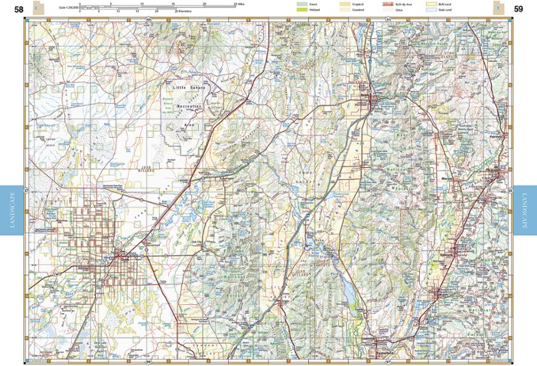
Explore the Beehive State with the Benchmark Maps Utah Road and Recreation Atlas as your navigator. Its filled with easy-to-read, shade-relief maps and loads of recreation activities to stop off for.
- Comprehensive guide highlights parks, monuments, historic sites, campgrounds, RV parks and boat launches with an index to locate attractions and destinations quickly
- Atlas pages feature generous page-to-page overlaps, GPS grids and easy-to-read symbols, along with climate graphs for selected cities to choose the best time to visit
- Also includes essential recreation information and road classes for the entire state, as well as land-use classes
- Details on the maps include rest areas, exit numbers, point-to-point roadway mileages, campgrounds, RV parks, road surface, cities and elevations
- Metro-area maps of large cities are scaled to enhance detail and make navigation easier within the city
- Regional maps show mileages and mileage charts
Imported.
View all Benchmark Maps Mountain West Maps| Best Use | Travel |
|---|---|
| State / Province | Utah |
| Folded Dimensions | 15 x 11 x 0.5 inches |
| Map Scale | 1:250,000 & 1:730,000 |
| Double Sided | Yes |
| Publisher | Benchmark Maps |
| Copyright Year | 2022 |
| Map Number | BE0BENUTAT |