
Getting out into the wilderness, or even just your neighborhood park, offers a great excuse to leave tech at home. After all, depending on where you’re heading, there might not be service available anyway.
On the other hand(held device), it can be useful, not to mention convenient, to carry our cellphones in lieu of an atlas, bird book and star charts—and these days, there’s an app version of these and more. Many even work offline for times when you’re far beyond cell towers. (But remember: There are no apps on the Ten Essentials list. It’s always best to bring navigation and emergency communication tools as backup.)
Here, find our top nine apps to take with you on your next adventure.
1. AllTrails
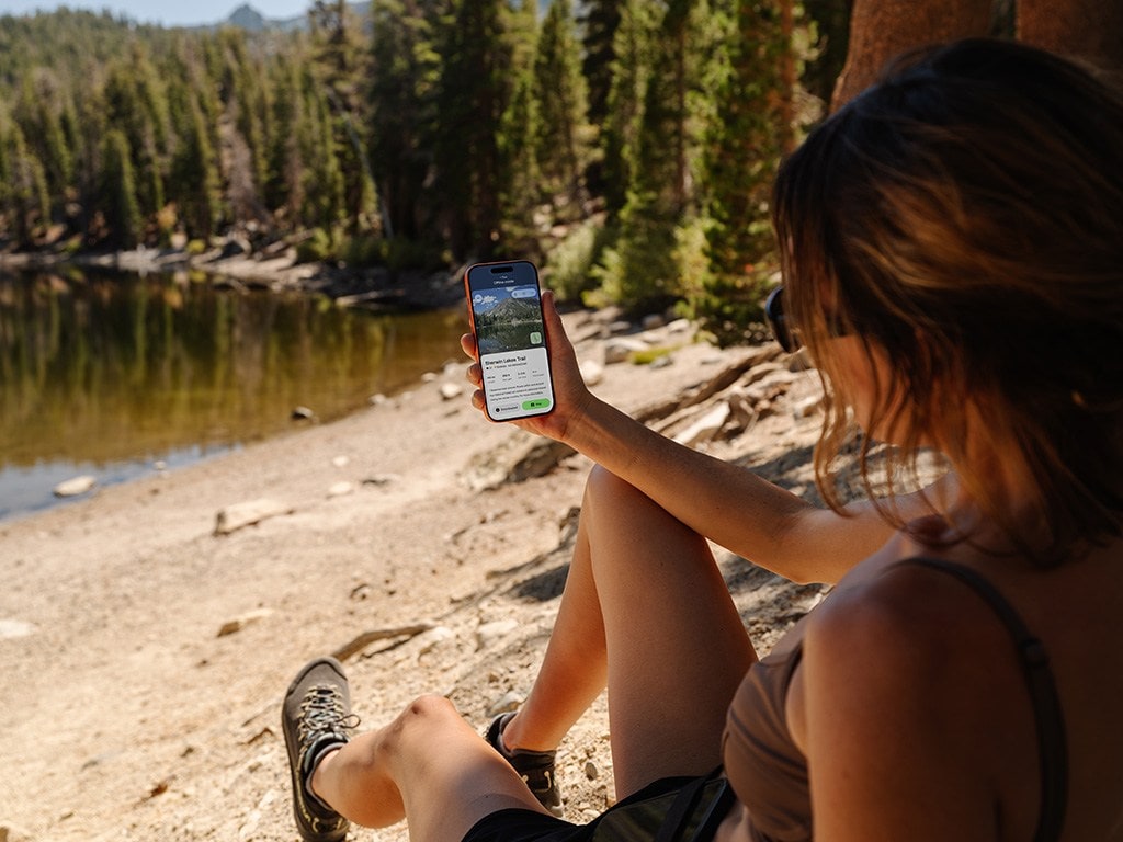
With a database of more than 500,000 curated trails across all seven continents, AllTrails comes by its name honestly. More than 95 million users turn to this mega collection to find trails near and far, read route descriptions, peruse crowd-sourced trail photos, and get trail condition updates. AllTrails also provides helpful deets about possible closures and entrance fees, along with driving directions to the trailhead from your current location. Stay within cell service, and you’ll be able to record your hike using GPS and leave details for future hikers.
Now, REI Co-op members can enjoy lifetime discounted subscriptions to AllTrails Plus for offline maps, trail conditions, wrong-turn alerts and more; and AllTrails Peak, a premium subscription with route customization, weather alerts and a trail heatmap.
Cost: Free for basic features. AllTrails Plus subscription $35.99/year; $25/year for REI Co-op Members. AllTrails Peak subscription $79.99/year; $50/year for REI Co-op Members
2. Strava
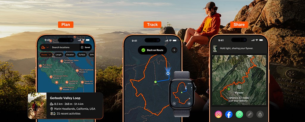
For over a decade, Strava has been one of the top free platforms for cyclists and runners to log their activity and share it with in-app friends. With a subscription, you can also track goals, create challenges and compete against each other—complete with leaderboards. There’s even a global heatmap highlighting where more than 195 million Strava users recreate most frequently. But the app is not just for speed demons anymore: New features offer more benefits to the hiking crowd. In addition to route discovery, search and builder tools, hikers can download routes for use in low- or no-connectivity areas, and create cinematic, 3D aerial animation of a completed route.
Want more? Subscribe to receive off-route alerts, see richer trail surface data (including water sources) and post-activity replays that auto-animate in your feed. “We know our community loves to get out on the trail together,” says Alev Canoglu, Strava director of product management, pointing out that hiking has become one of the app’s most popular activities. “A trail is a different experience from a road, so this year we’ve designed the map and the tools around how people actually explore the outdoors.”
Cost: Free for basic features. Strava subscription $11.99 per month or $79.99 per year plus applicable taxes
3. Gaia GPS

Although there’s nothing like a stand-alone GPS (and, of course, paper maps—the OG trail tool), Gaia GPS allows you to find your next hiking trail, plot a new route, and generate elevation profiles and distances for your adventure. Refer to the app’s easy-to-read, modern topo maps— downloadable for offline navigation—to stay on course; rely on its weather, wildfire and avalanche forecasts to help you stay safe. (But always check outside conditions beforehand so you can plan accordingly.) Those hoping to overnight in the backcountry can scout trustworthy camping options using public and private land boundaries. Record your adventures, too, and see your stats in real time. Take a photo using the in-app camera, and Gaia GPS will automatically create a “waypoint” on your map with the photo; access these photos later to identify landmarks and further streamline navigation on your next adventure.
Cost: $4.99/month
4. Recreation.gov
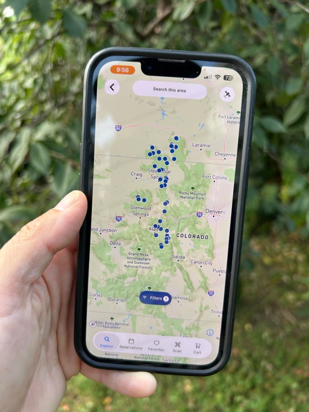
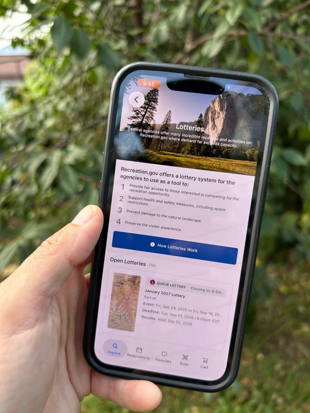
Planning an outing at a federally managed recreation destination? You’ll want quick access to the smartphone optimized version of Recreation.gov, a free, easy-to-use centralized travel planning and reservation app. Book campsites, secure timed-entry reservations, and score permits for overnight and backcountry experiences in national parks, Bureau of Land Management acreage, U.S. Forest Service land and more. It’s also your home for entering highly sought-after permit lotteries like the one to hike Half Dome. If you’re simply looking for trip inspiration, you’ll appreciate the robust search functionality for destinations and activities. Later, access your purchase details or make changes to your trip under the “reservations” tab.
Cost: Free with in-app purchases
5. Native Land Digital
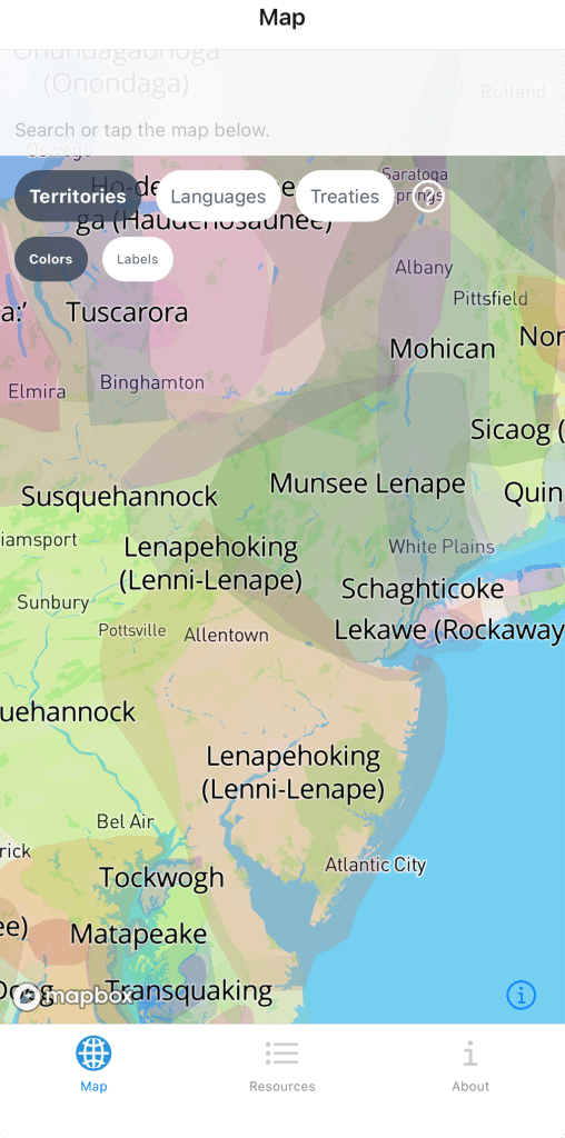
It’s essential to recognize those who have called lands we hike and the waters we explore home long before us. Native Land Digital helps us honor their histories, cultures and stewardship by allowing users to learn whose ancestral land they’re standing on. The Indigenous-led organization behind the project seeks to “uplift Indigenous ways of knowing and build understanding between Indigenous and non-Indigenous peoples” in large part through “map[ping] Indigenous lands in a way that changes, challenges and improves the way people see history and the present day.” Download the free app to see a nuanced overlay of Indigenous territories, treaties and languages. (Learn more about land acknowledgments and recreating on Indigenous land with We Are All on Native Land.)
Cost: Free
6. Merlin Bird ID by Cornell Lab of Ornithology
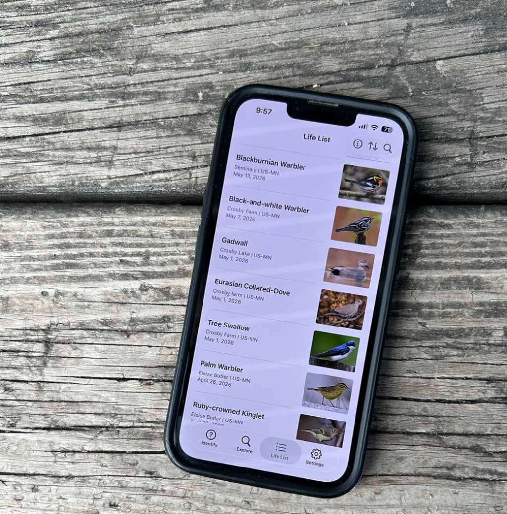
Hikers with birds on the brain no doubt already have the Cornell Lab of Ornithology’s Merlin Bird ID nested handily on their phone’s home screen, poised to name that (bird)song. Co-op staff certainly do. “I never go on a hike without my Merlin app open,” says REI hike editor Ever Meister, who’s been using Merlin for more than five years. “Heck, I never go outside without firing it up! Now that I recognize most of the common birds in the state, I use it most thrillingly during migration seasons and have started using the ‘Nearby Places’ option to seek out less commonly seen or transitory species that have been spotted nearby.”
Merlin isn’t just for more seasoned avian oglers. The free app’s collection of step-by-step queries about the bird’s appearance and behavior, along with date and location data, will have even fledgling birders soaring to successful identifications in no time.
Cost: Free
7. Pl@ntNet
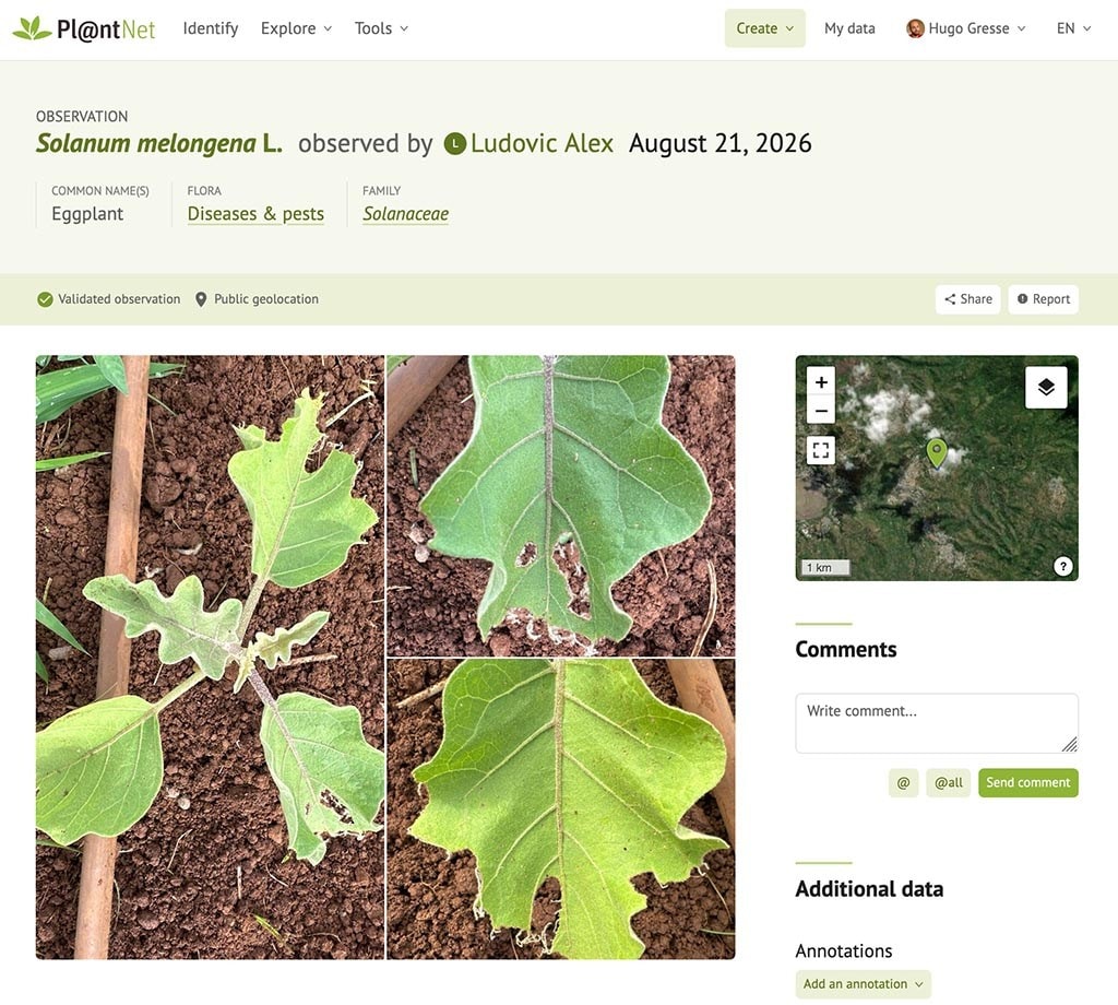
A rose by any other name would smell as sweet—but referring to said flower as a “palm tree” will likely earn you derisive looks from anyone within earshot. Be sure about the botanical moniker—or even go one step further and toss out the Latin binomial nomenclature—with citizen science project and identification app Pl@ntNet. The no-cost app helps users identify more than 1.3 billion different plants covering 77,700 plant species simply by snapping a flora pic and selecting which characteristic you plan to identify it by (fruit, bark or flowers, for example). Voilà! A list of possible identifications (and the probability that they’re correct) will appear.
Cost: Free
8. PeakFinder
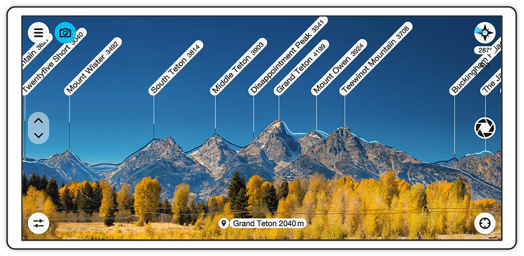
We all have that friend, partner or in-law who confidently points to a distant peak and rattles off the name. And, if you’re like us, you’re just a teensy bit jealous. With PeakFinder, you become the geography rockstar. Simply point your phone at the mountain range in question, and the app will generate a digital diagram complete with peak names and elevations—even offline. PeakFinder’s database of more than one million features promises to correctly ID everything from Everest to the hill in your neighborhood park. Users can also snap high-res photos (edit your pic later and export it with the peak names), access more detailed peak info like coordinates, and mark favorites for future reference—or exploration.
Cost: $4.99 on iPhone and $5.99 on Android
9. Star Walk 2 Plus
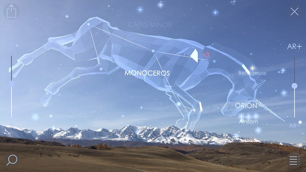
With Star Walk 2 Plus, you can identify the night sky’s wonderments when out on an evening hike or backpacking trip. The app allows you to pick out celestial objects, study 3D models of constellations and see how it all moves throughout the night using a real-time map of up above. Keen to spot Betelgeuse, Jupiter or the International Space Station? Star Walk can also provide instructions on where and when to look for any stars, planets or human-made fliers—not to mention asteroids, comets and nebulae—you want to scope. Sections for astronomical news (think upcoming meteor showers and solar eclipses) can help you time your next trip to an International Dark Sky destination. The latest version offers an enhanced planet-viewing experience in the planet walk feature.
Cost: Free with in-app purchases