
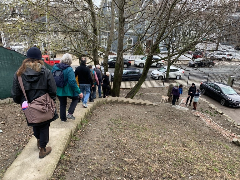
Picture a wild canyon. Eucalyptus trees, craggy rock formations and a twisted trail including wooden stairs. You’ve been hiking for hours and have the sweat-soaked shirt to show for it. But your soles could use a reprieve, and that GORP in the bottom of your backpack just doesn’t sound appealing anymore.
Suddenly, you emerge from the canyon into Glen Park, a residential neighborhood on San Francisco’s southern portion. There’s public transportation within sight, offering you the choice to call it a day. Or you could walk down Diamond Street for a sustenance break before finishing your hike: There’s fresh banh mi and spicy fish tostadas nearby. Not far from here, there are redwood trees and hidden staircases waiting to be explored.
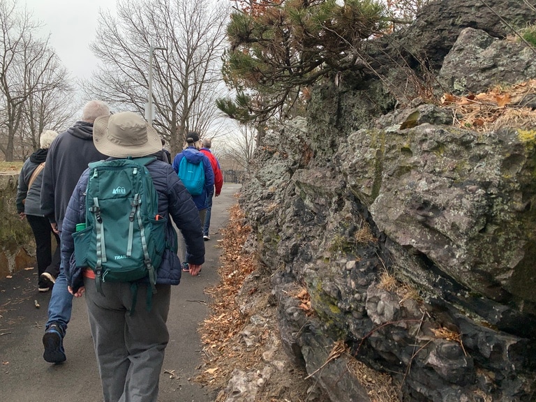
This is the San Francisco Crosstown Trail, a 18-mile urban hiking trail that meanders through some of the city’s most immersive green spaces and frequently stretches into neighborhoods that don’t pop up on the average tourist’s itinerary. And its centrality to the city is helping us reimagine hiking.
Historically, hiking is associated with backcountry trails and destinations like Yosemite National Park or the Blue Ridge Mountains. Throughout the U.S., even closer-to-home hikes tend to be in areas that feel or seem “wild,” forested or secluded. Most of us, however, live in and around cities. With hiking becoming increasingly popular, urban explorers are bringing hiking home by scouting and mapping scenic, publicly accessible hiking trails across the places they live.
In upper Manhattan, you can follow the Giraffe Path (named for its giraffe-like shape) from Central Park’s northern entrance to Fort Tryon Park’s lookout ledges. In Scotland, Glasgow’s Magnificent 11 packs woods, waterfalls and fields into a robust 11-mile circuit. The Denver Orbital Trail and Chicago’s Outerbelt total 177 miles and 210 miles, respectively. They boast forests, wetlands and city vistas, as well as grittier, manmade city infrastructure. These types of trails are often called Instant Urban Trails because they can be created quickly: They don’t take much physical or manual labor to construct and don’t require municipal permits. This is because Instant Urban Trails are a curation of pre-existing walkable spaces, like park paths, sidewalks or staircases.
I know, because I created one: the Walking City Trail, a 27-mile route across my hometown of Boston, linking 30 green spaces and 17 neighborhoods. It now exists as a searchable trail on AllTrails and has been hiked by thousands of people, becoming a destination trail. The idea came to me in 2021, after my first ramble on the San Francisco Crosstown Trail. I spent the flight back to Boston poring over city maps, imagining how to hike through a constellation of parks, gardens and forests leading to the Bunker Hill Monument. As late winter faded into spring’s soggy beauty, I spent every weekend clomping into the field and taking lots of notes and photos. The Walking City Trail debuted three months later.
“There are hundreds of trails out there,” Bob Siegel, co-creator of the San Francisco Crosstown Trail, said by phone shortly after I launched the Walking City Trail. “They’re hidden under the dirt and pavement, waiting for someone to bring them to the surface.”
Here's how you can join the Instant Urban Trails movement and create a walkable trail across your city or town—all you need is an idea, an appetite for exploring your home turf and a gregarious spirit. While there are no standard rules or blueprints for making your own urban trail, here are five field-tested tips gleaned from my own experience as well as the other trail-makers I spoke with.
How to Make a Trail Where You Live
- Decide what you want your trail to say or do
- Recruit a team of helpers
- Assemble your maps
- Begin prepping for launch
- Encourage people to find and visit your trail

Find Your Trail's Story
Every trail—backcountry or urban, big or small—has a unique narrative. Once you’ve decided that you want to create a city trail, you can discover its story by asking a few primary questions.
Where should your trail take people?
A landmark destination like a monument or an iconic lookout point? A recreational zone like a shopping district or a food hub? Or a true hidden gem? Knowing the destination is the inaugural step. But, as the old chestnut tells us, the journey is just as significant. So, consider the kind of scenic elements that you want your trail to showcase: the greener sides of your city or town, cool architecture, historic oddities, etc.
“I had started spending a ton of time in the forest preserves [around west Chicago], discovering trails that were just enchanting,” says Jay Readey one of the architects of the Chicago Outerbelt Trail. “I looked at a map and said, 'I bet I can get to Lake Michigan and Chicago’s lakefront from here without stepping out of green spaces.’ And it proved almost true.”
How long should the trail be?
Begin your project with an ideal trail scale, or length, in mind. Readey and the Outerbelt community envisioned their route as an epic hike around Chicago’s woodlands and waters, which justified its gargantuan mileage. But all Instant Urban Trail makers will have to make some compromises between scenery and efficiency.
Maybe you want to create something that people of many abilities could walk in a day. Or perhaps you envision a more epic trail covering swaths of your community, a trail that could be section-hiked.
Considering these questions early on will sharpen your focus as you start to tell people about your trail dreams, gauge their thoughts and—potentially—bring them aboard to help.
Recruit Your Trail Crew
While you can create an Instant Urban Trail solo, assembling a team makes the work more fun. It also yields a richer trail, shaped by a wider range of local knowledge. You can recruit teammates while you’re still cooking up your route, or after establishing the trails you want to include. Here are some tips for building a trail crew.
Friends and family: One of the quickest ways to gather extra hands (or hiking shoes) is to rally your personal network. A group text or an email asking for route suggestions, local insights and testers might be just what you need to rally a support system. This approach can also help get folks excited, though you may want to expand your reach outside your close familial and social circles to drum up more attention.
Nonprofit and governmental organizations: Historically, trails are built by public agencies and nonprofits, with input from planners and builders along the way from inception to construction. Community members may weigh in during town-hall-style meetings, which allow people who live in the vicinity of a proposed trail to share ideas and concerns.
On the plus side, you might have more access to resources with an organization’s backing, as well as help with planning, execution and marketing. On the other hand, pitching your trail to local government or an outdoor recreation organization can mean months, even years of waiting. Town hall meetings, while sometimes helpful for building community support for a proposed trail project, can devolve into a less-productive forum where skepticism and apprehension dominate the room.
Local affinity groups: You might consider recruiting your trail crew from spaces adjacent to outdoor exploration. After REI Co-op Member Justin Boyan hiked the San Francisco Crosstown Trail, he flew home to Providence, Rhode Island, inspired to create a similar urban hiking trail across the state’s capital city: what’s now the Providence Crosstown Trail. He sought input from fellow locals who were already involved with celebrating their cityscape’s history and unique charms. He sketched and tested a route, then brought the idea to “an ‘unconference’” sponsored by the Providence Preservation Society,” Boyan says. “There was an enthusiastic response, and this helped me transition my trail concept from an individual effort to a communal effort.” Not only that, he says, but the Preservation Society also organized an inaugural Crosstown walk, introducing more than 30 people to the trail on day one.
How big should your trail crew be?
There’s no “correct” size for an Instant Urban Trail crew. It could be a group of 3 or 30. A smaller group usually allows for easier decision-making, while a large group could enhance the trail by bringing in more ideas and perspectives. However, keep in mind that there’s such a thing as too many choices, and tough calls will have to be made about the route. In addition to keeping the meetings and deliberations simpler, going forward with a small team can help you segue more easily into the third and most creative stage of creating an Instant Urban Trail.
Assemble the "Trilogy" of Maps
Maps are the backbone of Instant Urban Trail navigation, and they’re just as integral to the trail building process. Once you’ve found your trail’s story and assembled your team, it’s time to start scouting the actual route by sketching out a trilogy of trail maps.
Dream map: First comes the speculative exercise, making a theoretical map of where your trail should run. Using whatever mapping tool you prefer (Google Maps, AllTrails, Gaia GPS, etc.). identify your trail’s origin and destination. Then, look closely at what’s between these two points. For instance, if you want your trail to feature public gardens, search for gardens located near each other. If you encounter sizable distances between two gardens, look for walkable greenways, leafy streets, or other pathways that could bridge the gap.
Field test: Once you build your theoretical Instant Urban Trail map, it’s time to slather on sunblock and run a field test. This is when you really get to venture into the weeds and find the bones of the route. Suppose your trail is going to run through a park. Which park paths should the trail utilize?
Mike Tormey came up with some guiding principles when he set out to find the Denver Orbital Trail’s precise route. “Generally, accessible trails were better than really treacherous ones,” Tormey says. “I’d prefer a formal and paved path down from one elevation to another, rather than a goat path created from desire lines cutting down from a slope.” Additionally, Tormey took advantage of most opportunities to have the Denver Orbital Trail pass close to water features, but he also left room for spontaneous inspiration.
“If I was out surveying and found an interesting trail, I picked it based on vibes,” he recalls.
Guiding principles can also help you determine what streets your trail should follow, when connecting green spaces. The only way to find out is to vet the options on foot—while being mindful of your trail’s story and what elements the trail should include. If it’s supposed to be a user-friendly trail, maybe avoid a long and winding staircase to a hilltop—but if adventurous, built infrastructure is part of the story, add those stairs to your route!
GPS map: Once you have a sharper, more defined map of your trail, it’s time to make a GPS map. Using a GPS tracking app, like Strava, head back out and walk your honed route, taking notes on the trail’s turns, elevation gain, distance and duration. This final map will be very important as you move from trail scouting to trail launch countdown.
Initiate Trail Launch Sequence
Before launching your trail, consider setting a launch date that coincides with a seasonal or civic event that could help draw attention to your trail. For example: If the route winds through maple or aspen groves, a fall-foliage-timed launch might be the ticket. If your route features lots of local monuments, launching just before Memorial Day weekend could be effective.
Once you’ve scheduled the trail launch, it’s time to create the trail’s digital infrastructure, such as a simple, dedicated website. A low-cost basic package from website building platforms like Squarespace or Wix work fine, and the trail site should contain three things.
A map of the whole trail, or a series of more detailed maps outlining the trail, is essential. You can create them by uploading your GPS map to Google Maps, AllTrails and similar platforms, and linking them to your trail website.
Information about trail features—a teaser, if you will. Don’t give away all the secrets, but including alluring photos and descriptions can inspire website visitors to reach for their trekking poles.
Turn-by-turn directions, since digital maps aren’t 100% confusion-proof. This also offers hikers guidance on trail junctions to look out for. Remember those notes that you took when you made your GPS map? Use those to write the turn-by-turn directions.
How to Get the Word Out
Once the trail infrastructure is ready, it’s time to prime your audience, including local media. Editors and reporters often jump on uplifting stories, like the launch of a cool new urban trail— especially these days, with hiking’s increasing popularity. One such news story in The New York Times introduced me and many others to the San Francisco Crosstown Trail, and there were others too.
“Before we opened the Crosstown Trail on National Trails Day, I sent out an email to all of the reporters I knew, describing what we were doing,” co-creator Siegel says. He ended up connecting with a reporter for The San Francisco Chronicle that way. “He and I hit the trail together, and he wrote a great article that came out on opening day.”
A few weeks before your trail goes live, write a simple press release email describing the trail to local writers, editors, and producers. Include information such as the trail’s launch date, your contact information and pertinent details about the route. What makes it special? You can find pitch instructions for most media outlets on their websites or in the masthead of their publications. (Tip: Send the email individually to each media contact, rather than as a mass email to many addresses.)
Use social media to prep people for the trail launch by offering a few tantalizing glimpses of special sites along the route. Post your best photos to Instagram or Facebook—locally based Facebook groups are a great way to get more attention—and share text about what features and locations they’ll be able to visit on your soon-to-launch trail across town.
Once everyone’s excited about the launch, you’ll want to do one more big thing to make sure your new trail flourishes …
Activate, Activate, Activate
In parks departments, the word “activation” often describes sparking human activity in recreational green spaces—and it’s something you can do to make your newly launched trail even more visible and attractive to the wider public.
Many hikers—especially newer ones—are drawn to group adventures, where there’s safety (or at least comfort) in numbers. Organizing or encouraging group walks can create social cross-pollination and put your trail on more. To accommodate a wider range of hikers, consider making the group hikes shorter, no more than 4 miles in length. (Created a long trail? You can section-hike it as a group!)
Pittsburgh has more than 700 staircases nestled in its surrounding woods, and an annual urban step-hiking adventure called StepTrek celebrates them. (It doubles as a fundraiser for the South Side Slopes Neighborhood Association, which helps preserve many of these public stairways.) Each event yields two curated hiking routes that participants can complete with the aid of maps. While the StepTrek routes aren’t branded as “trails,” they offer the same outdoor experience as an Instant Urban Trail.
“StepTrek is like chutes and ladders,” says Joe Balaban, an organizer for the event. “And it also helps to keep the city focused on the steps. One hundred years ago, steps were how workers made it down from their homes on the hillsides to the steel mills at the bottom. Now, they need maintenance.”
If organizing an Instant Urban Trail event of your own feels overwhelming, try co-hosting a group walk with a local partner organization or elected official with an interest in recreation and bringing people together. In Boston, for example, I collaborated with former city councilor Kendra Lara, and the Boston chapter of climate advocacy group Mothers Out Front to offer a series of free community walks on the new trail.
A couple months later, the Appalachian Mountain Club—a premier outdoor education nonprofit in the northeast—wanted to host public walks along the Walking City Trail. It was a thrilling development in which I played more of an advisory role, and demonstrated trail activation’s powerful ripple effects. At some point, how people use the trail may be out of your hands, allowing you to put up your feet, watch, and grin.
“We don’t do much Crosstown Trail publicity anymore,” Siegel says. “Word of mouth bubbles along. People are now using the trail for walkathons and other events. Some people do it on their birthdays. The other day I saw 60 people on part of the trail! A young entrepreneurs group.”
Perhaps the most profound perk of getting more people onto your trail is the community that these efforts can yield. The Walking City Trail began a solo project; now it’s a collective endeavor. Through the early group hikes along the route, I met fellow Boston explorers who wanted to help the trail flourish. In spring of 2025, 3 years after Walking City’s launch, we created a new 31-mile companion route across Boston called the City on the Hills Trail, which runs perpendicular to the Walking City Trail.
Of course, you don’t have to broadcast your trail: It could be a little secret, shared among your friends and family. But, if you see your trail as an offering to your community and the wider hiking community, the time you spend getting people onto the trail will be worth it. At the very least, you’ll meet some memorable characters, and some of them may become friends.
Which, in my book, is one of the finest outcomes of hiking any trail, cross-country or cross-town.