Anyone learning navigation soon hears the somewhat confounding words "magnetic declination." You'll also find out that before you can go anywhere (with accuracy anyway), you have to understand what it means and how to set the declination on your compass properly. This article guides you through that process and tells you:
- What magnetic declination is
- How to find the declination you need to set
- How to set declination on most Brunton and Suunto compasses
- How to account for declination on compasses without adjustable declination
A Brief Explanation of Magnetic Declination
As a kid you learned that north is at the top of the globe. As a grown-up navigator, though, you now realize that the world isn't quite that simple. What we think of as the top of the globe is referred to as "true north." Magnetic north (where your compass needle actually points) is a function of Earth's magnetic fields and its core elements, which fluctuate in complicated ways. Currently, magnetic north is roughly north of Hudson Bay in Canada.
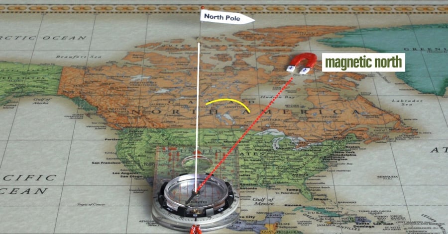
The difference between magnetic north and true north is "magnetic declination."
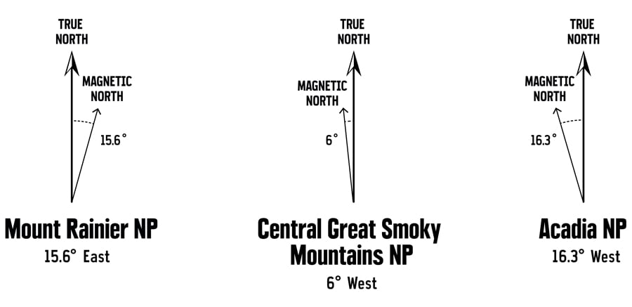
In the continental U.S., declination can vary from nearly 20 degrees east in places on the West Coast to nearly 20 degrees west in places on the East Coast. When you're navigating in the wilds, degrees matter. A 15 degree error, for example, on a mile-long hike puts you a quarter-mile away from your destination.
Finding the Declination You Need to Set
Because declination varies depending on where you are on the globe, your first step is to find the declination value for your trip area. And whenever you head to a new area, you'll need to check, and likely reset, your compass declination for that area.
Topographic maps list declination in the legend, but an added complication is that declination in a given location also changes slowly over time. So check your map's revision date or, better yet, check the National Oceanic and Atmospheric Administration (NOAA) website for magnetic declination. The site should have the most up-to-date data.
Setting the Declination on Your Compass
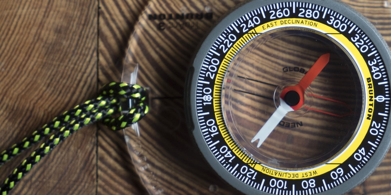
Brunton and Suunto, two of the biggest navigation brands, differ in the way declination is adjusted on most of their compass models. The steps presented below for each brand are for a magnetic declination of 15.6° West.
Declination Adjustment on a Brunton Compass
Brunton's tool-free adjustment system spares you the concern about losing the adjustment tool, but it can take a little time to get the hang of it.
- Place your thumb on the center hub of the compass, then pinch—very tightly—with your forefinger located on the bottom of the compass, exactly opposite of your thumb's position.
- Hold the rotating bezel outside that center hub firmly (and perfectly still) with your other hand as you twist your pinched thumb and forefinger clockwise.
- Pay close attention to the declination scale (yellow in this example), which is inside of the rotating bezel. The declination indicator (a red tick mark in this example) will start to rotate as you twist. Note: If your model has no separate declination scale, use the orienting arrow and the degree scale on the rotating bezel.
- Stop when the declination indicator is centered over your declination value (15.6° West in this example). Now your declination is set and can be left as is for the duration of your current trip.
Declination Adjustment on a Suunto Compass
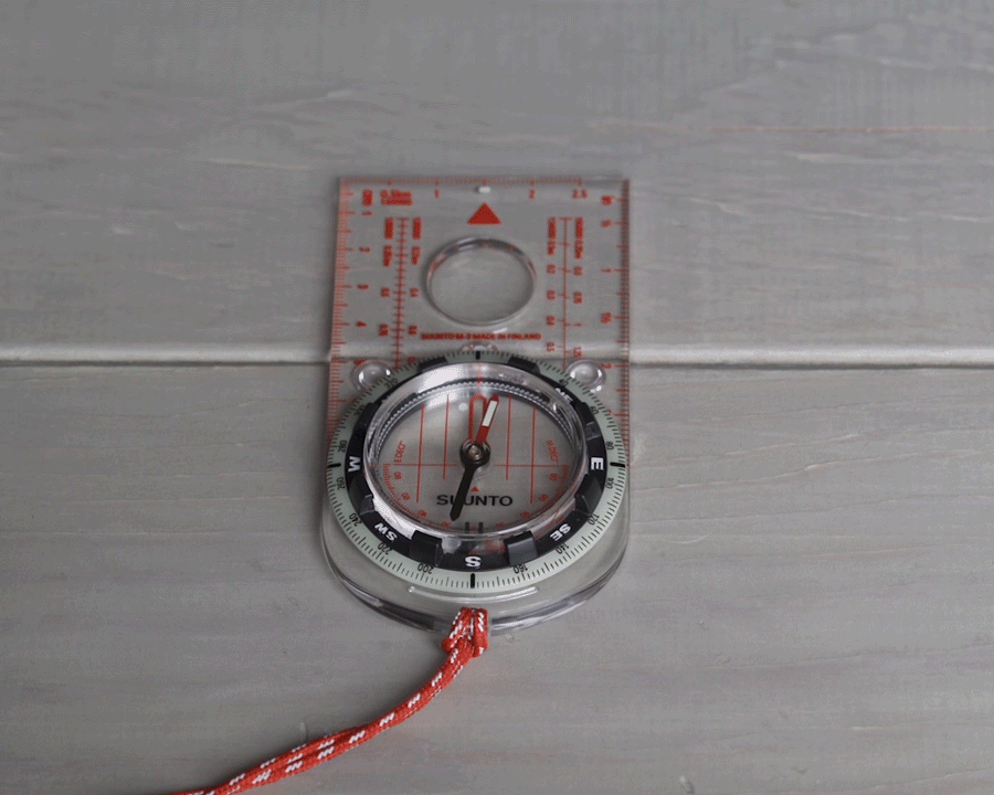
Suunto's adjustment is easy, but you need to keep track of the adjustment key that does the trick. The adjustment key comes looped on the lanyard included with the compass in the package. (Inventive folks who lose the key may be able to do the adjustment using a tiny blade-end on one of the tools in a multi-tool.)
- Turn the compass over.
- Insert the metal key (provided with your compass) into the adjustment screw.
- Turn the key until the declination indicator is the correct number of degrees east or west of 0° (15.6 degrees West in this example).
What to Do If Your Compass Doesn't Have Adjustable Declination
If you plan to do any navigation more advanced than getting a general impression of north, south, east and west, then you really should invest in a compass with adjustable declination. It's not an expensive feature and it will make navigation simpler and far less prone to mental errors.
If you're in a situation where you need to navigate precisely and have a compass that lacks declination adjustment (but that has a declination scale printed inside the bezel), these are the steps:
- Find the declination for your area, using exactly the same steps (above) as you would for a compass with adjustable declination.
- After that, you make declination adjustments by adding or subtracting that declination each time you work with a bearing.
- Note that, for all calculations, an east declination is a positive number and a west declination is a negative number.
- Read How to Use a Compass for a refresher on how to take a bearing in the field and from a map.
- Whenever you transfer a magnetic bearing taken in the field to your map, you add the magnetic declination to get the true bearing. (Note that a west declination is, in essence, subtracted because you are adding a negative number.)
- Whenever you transfer a bearing taken from your map to the field, you subtract the magnetic declination to get the magnetic bearing to follow. (Now a west declination is, in essence, added because you are subtracting a negative number.)